4
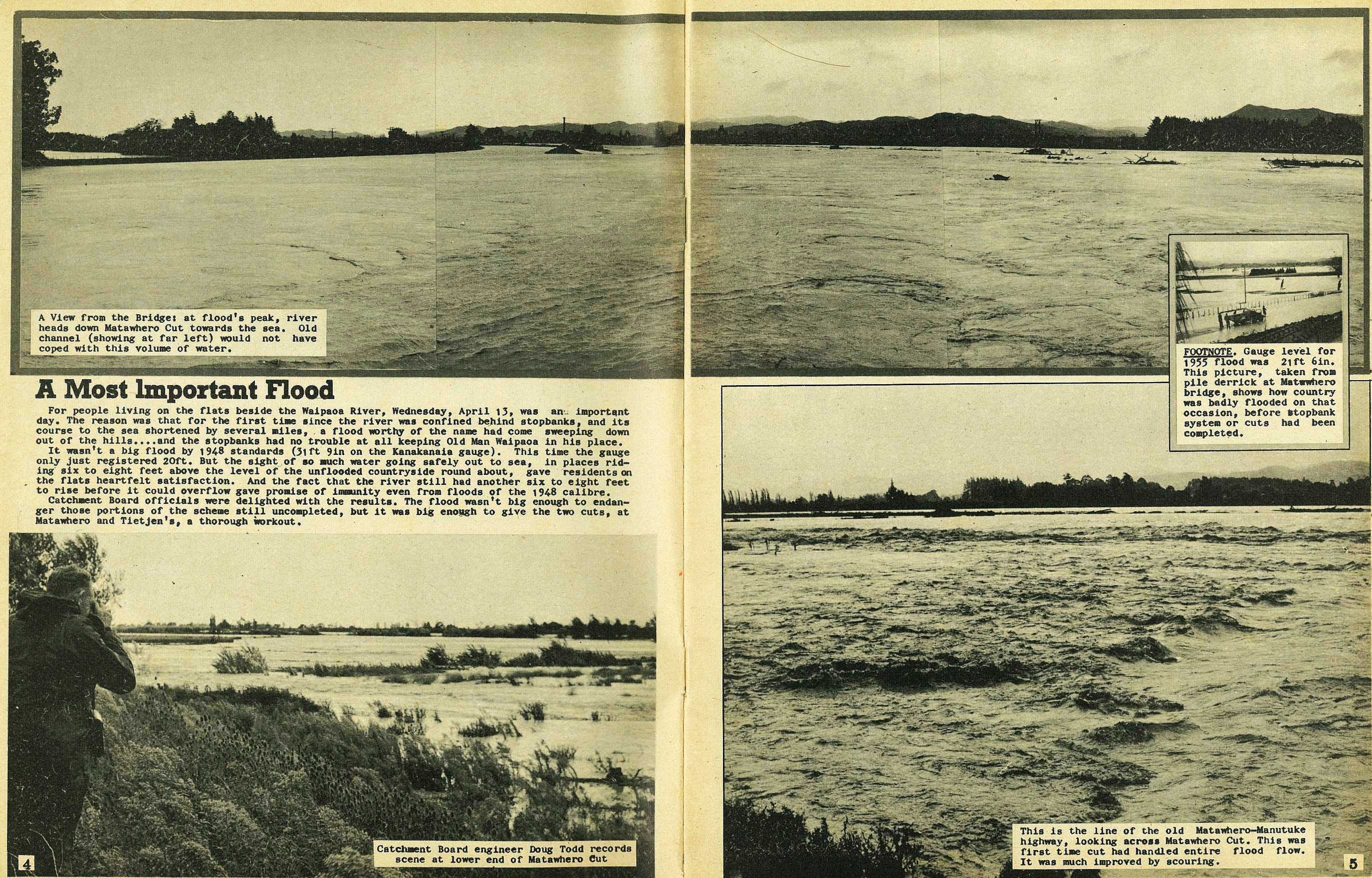
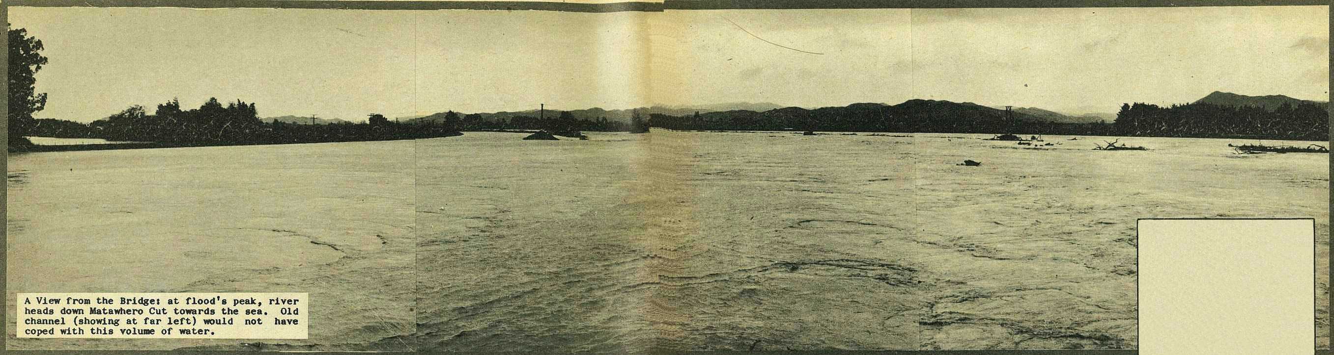
A Most Important Flood
For people living on the flats beside the Waipaoa River, Wednesday, April 13, was an important day. The reason was that for the first time since the river was confined behind stopbanks, and its course to the sea shortened by several miles, a flood worthy of the name had come sweeping down out of the hills....and the stopbanks had no trouble at all keeping Old Man Waipaoa in his place.
It wasn't a big flood by 1948 standards (3lft 9in on the Kanakanaia gauge). This time the gauge only just registered 20ft. But the sight of so much water going safely out to sea, in places riding six to eight feet above the level of the unflooded countryside round about, gave residents on the flats heartfelt satisfaction. And the fact that the river still had another six to eight feet to rise before it could overflow gave promise of immunity even from floods of the 1948 calibre.
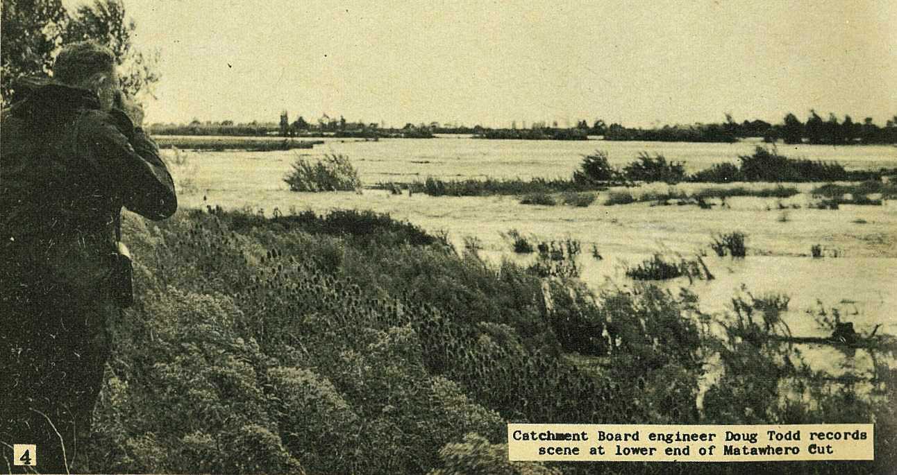
Catchment Board officials were delighted with the results. The flood wasn't big enough to endanger those portions of the scheme still uncompleted, but it was big enough to give the two cuts, at Matawhero and Tietjen's, a thorough workout.
5
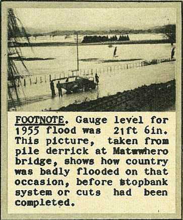
Footnote. Gauge level for 1955 flood was 21ft 6in. This picture, taken from pile derrick at Matawhero bridge, shows how country was badly flooded on that occasion, before stopbank system or cuts had been completed.
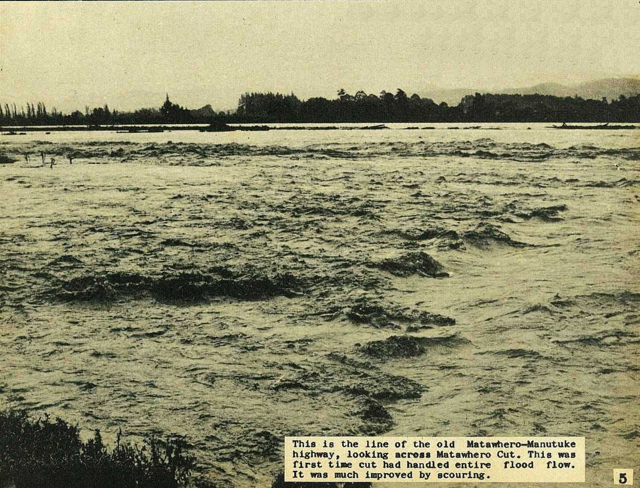
This is the line of the old Matawhero-Manutuke highway, looking across Matawhero Cut. This was first time cut had handled entire flood flow. It was much improved by scouring.
6
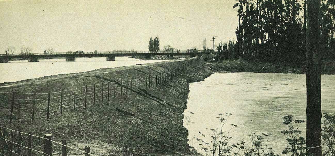
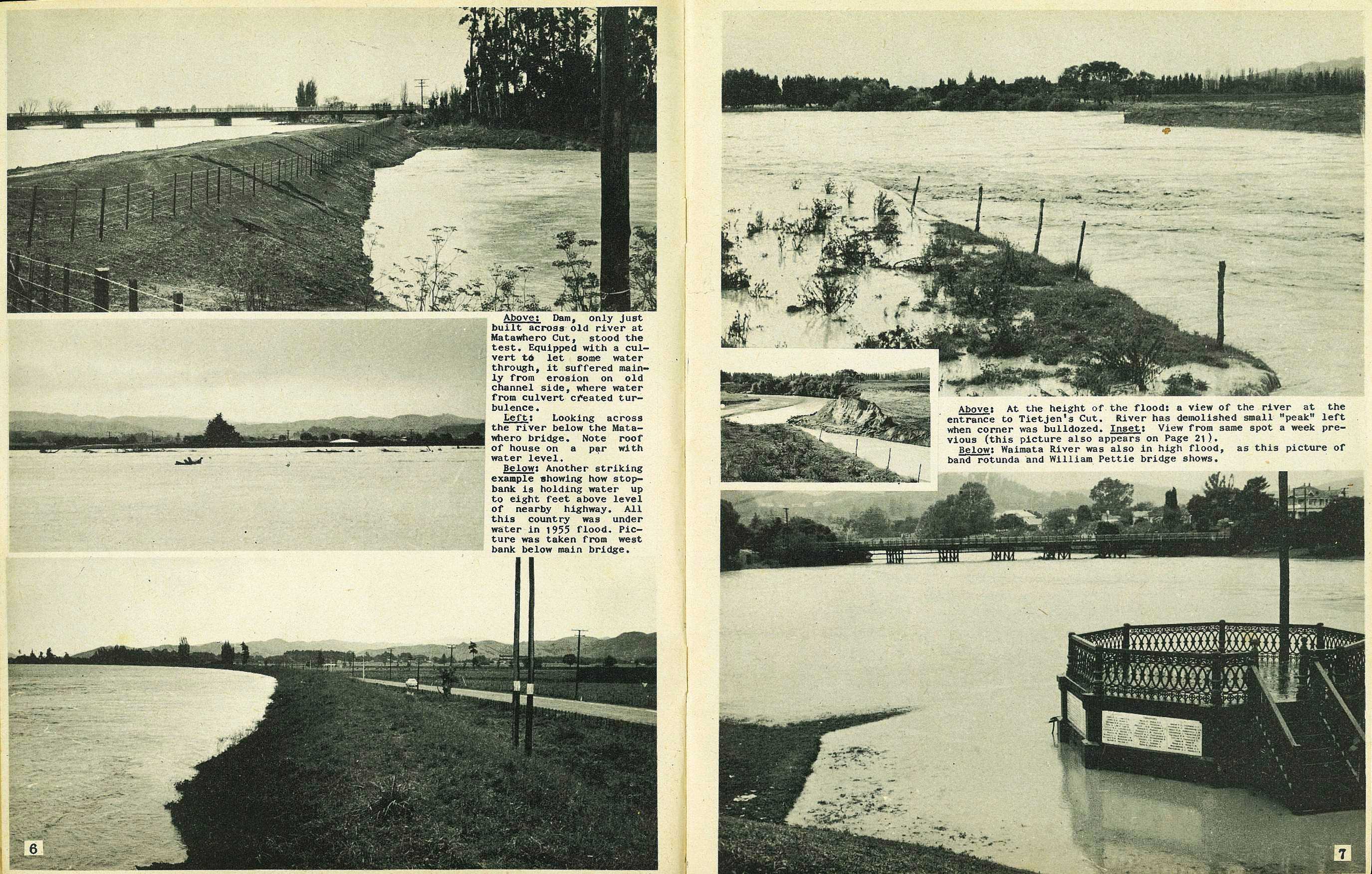
Dam, only just built across old river at Matawhero Cut, stood the test. Equipped with a culvert to let some water through, it suffered mainly from erosion on old channel side, where water from culvert created turbulence.
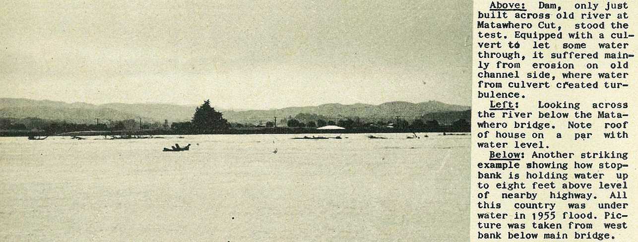
Looking across the river below the Matawhero bridge. Note roof of house on a par with water level.
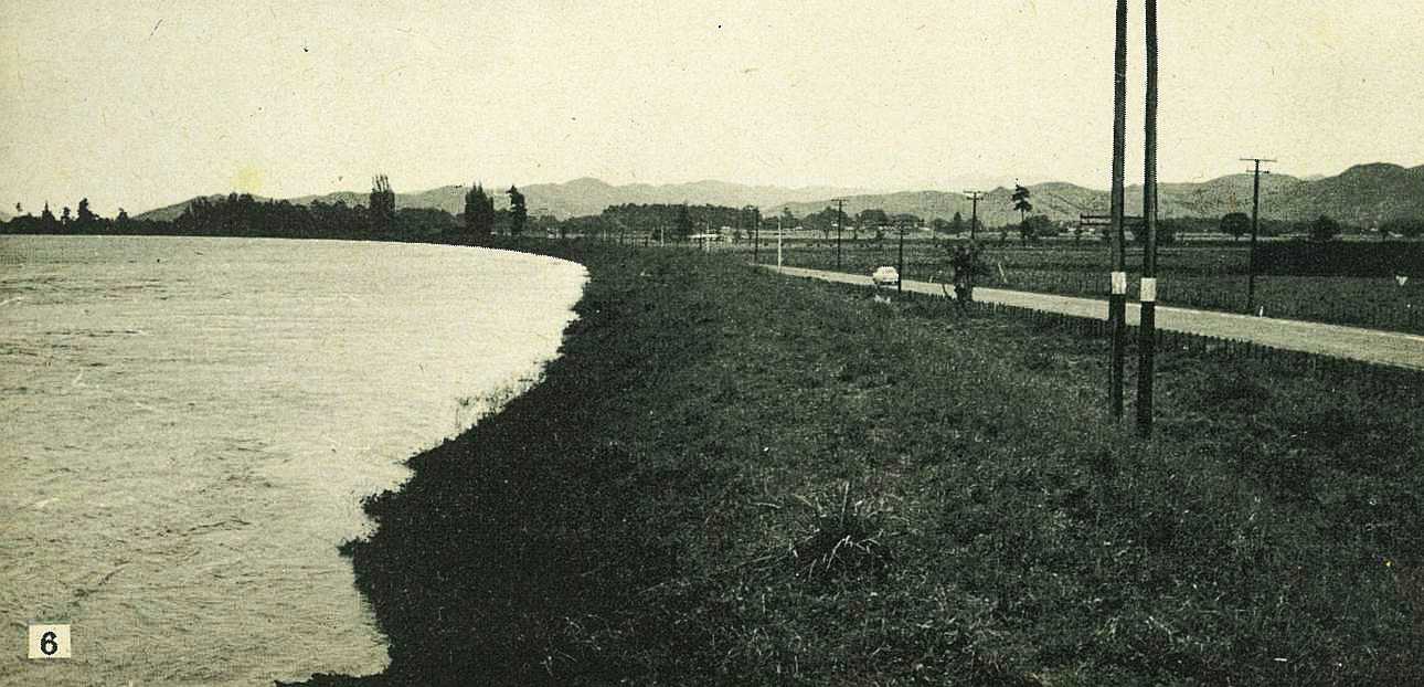
Another striking example showing how stopbank is holding water up to eight feet above level of nearby highway. All this country was under water in 1955 flood. Picture was taken from west bank below main bridge.
7
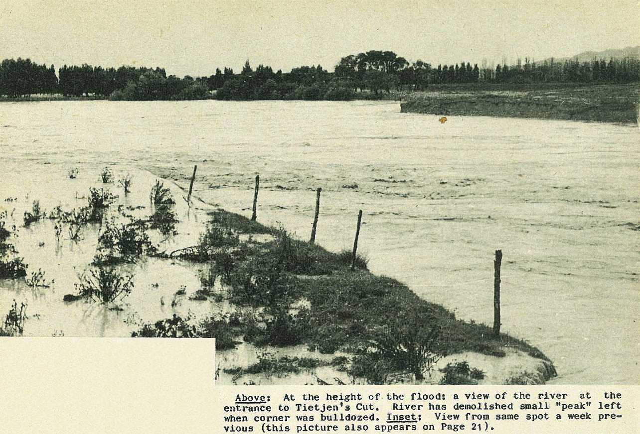
At the height of the flood: a view of the river at the entrance to Tietjen's Cut. River has demolished small "peak" left when corner was bulldozed.
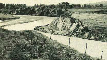
View from same spot a week previous (this picture also appears on Page 21).
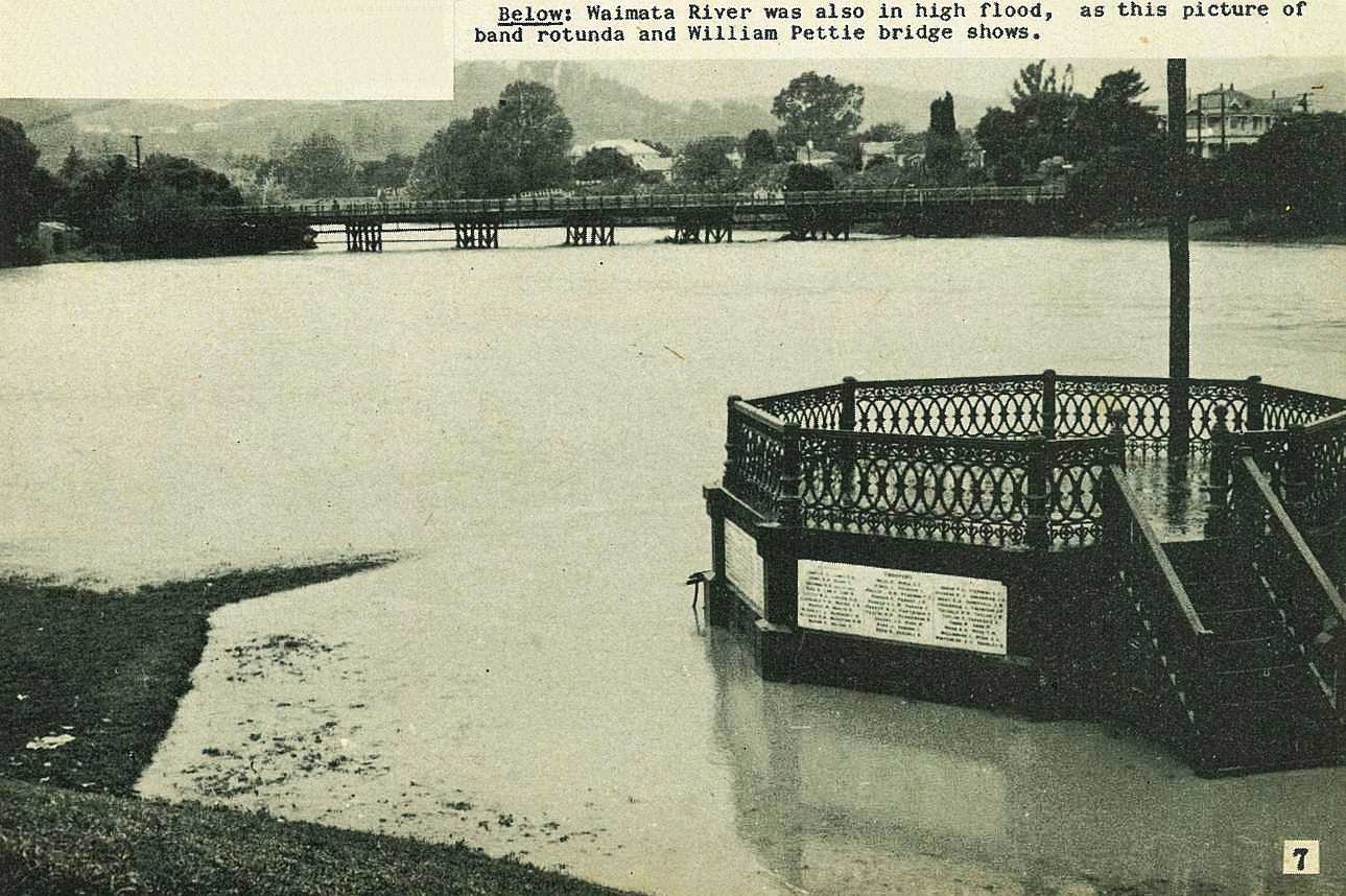
Waimata River was also in high flood, as this picture of band rotunda and William Pettie bridge shows.

 would not have coped with this volume of water.\r\n\r\nGisborne Photo News - No 70 : April 21, 1960'); void 0)
 would not have coped with this volume of water.\r\n\r\nGisborne Photo News - No 70 : April 21, 1960'); void 0)
 would not have coped with this volume of water.\r\n\r\nGisborne Photo News - No 70 : April 21, 1960'); void 0)
; void 0)
; void 0)
; void 0)
; void 0)
; void 0)
; void 0)
; void 0)
; void 0)
; void 0)
; void 0)
; void 0)
; void 0)
; void 0)
; void 0)
; void 0)
; void 0)
; void 0)
; void 0)
; void 0)
; void 0)
; void 0)
.\r\n\r\nGisborne Photo News - No 70 : April 21, 1960'); void 0)
.\r\n\r\nGisborne Photo News - No 70 : April 21, 1960'); void 0)
.\r\n\r\nGisborne Photo News - No 70 : April 21, 1960'); void 0)
; void 0)
; void 0)
; void 0)