
19
Gisborne the golden

From thousands of feet up in the air. the camera looks down and records, in one breathtaking sweep, almost the whole panorama of Gisborne, sun-kissed centre of the prosperous East Coast, with the bay and Young Nick's Head, Captain Cook's first landfall in New Zealand, in the background. This and the photographs which follow, have been gathered together by "Photo News" to mark the occasion, announced on August 10, of Gisborne's accession to city status.

20
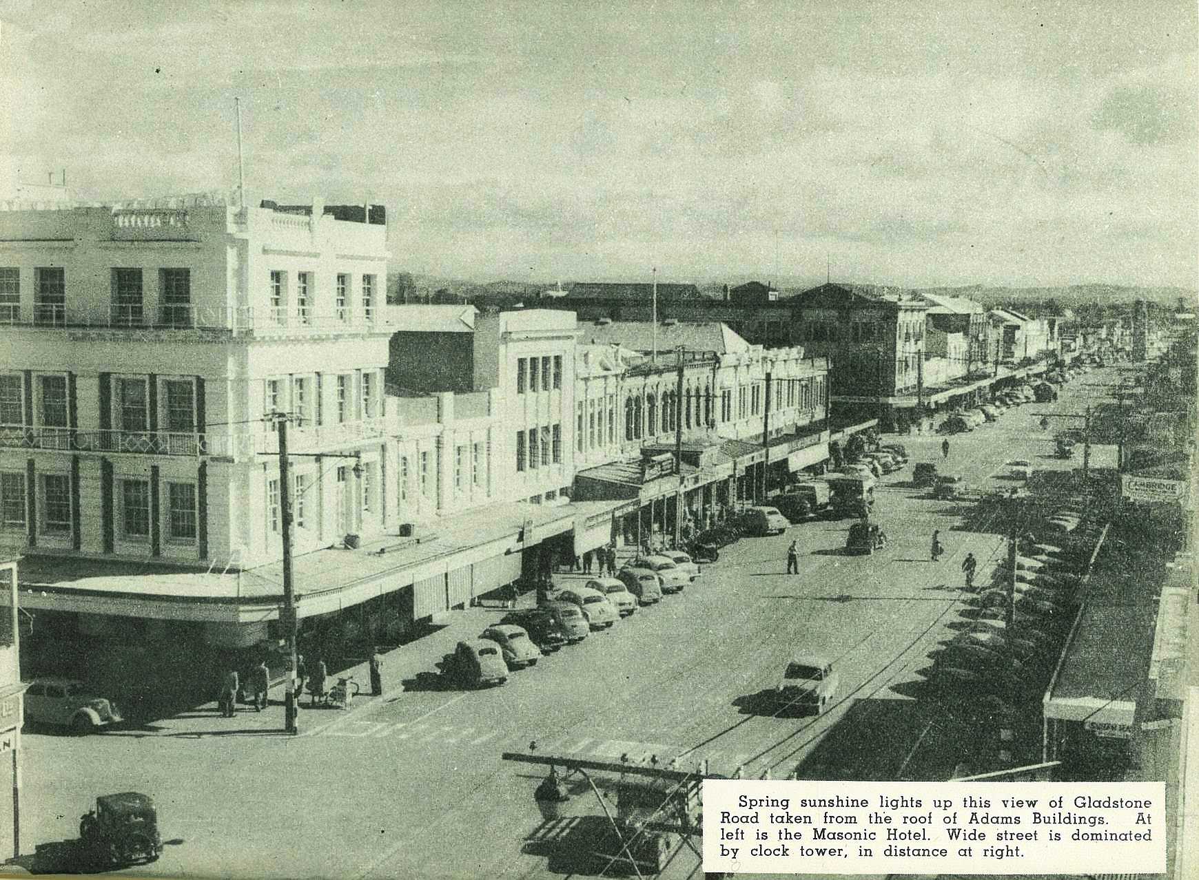
Spring sunshine lights up this view of Gladstone Road taken from the roof of Adams Building. At left is the Masonic Hotel. Wide street is dominated by clock tower, in distance at right.
21

A view from the hills, looking across the suburb of Whataupoko and the Taruheru River to the commercial centre ot the city, the freezing works and Kaiti Hill at left, and the sea beyond.

22

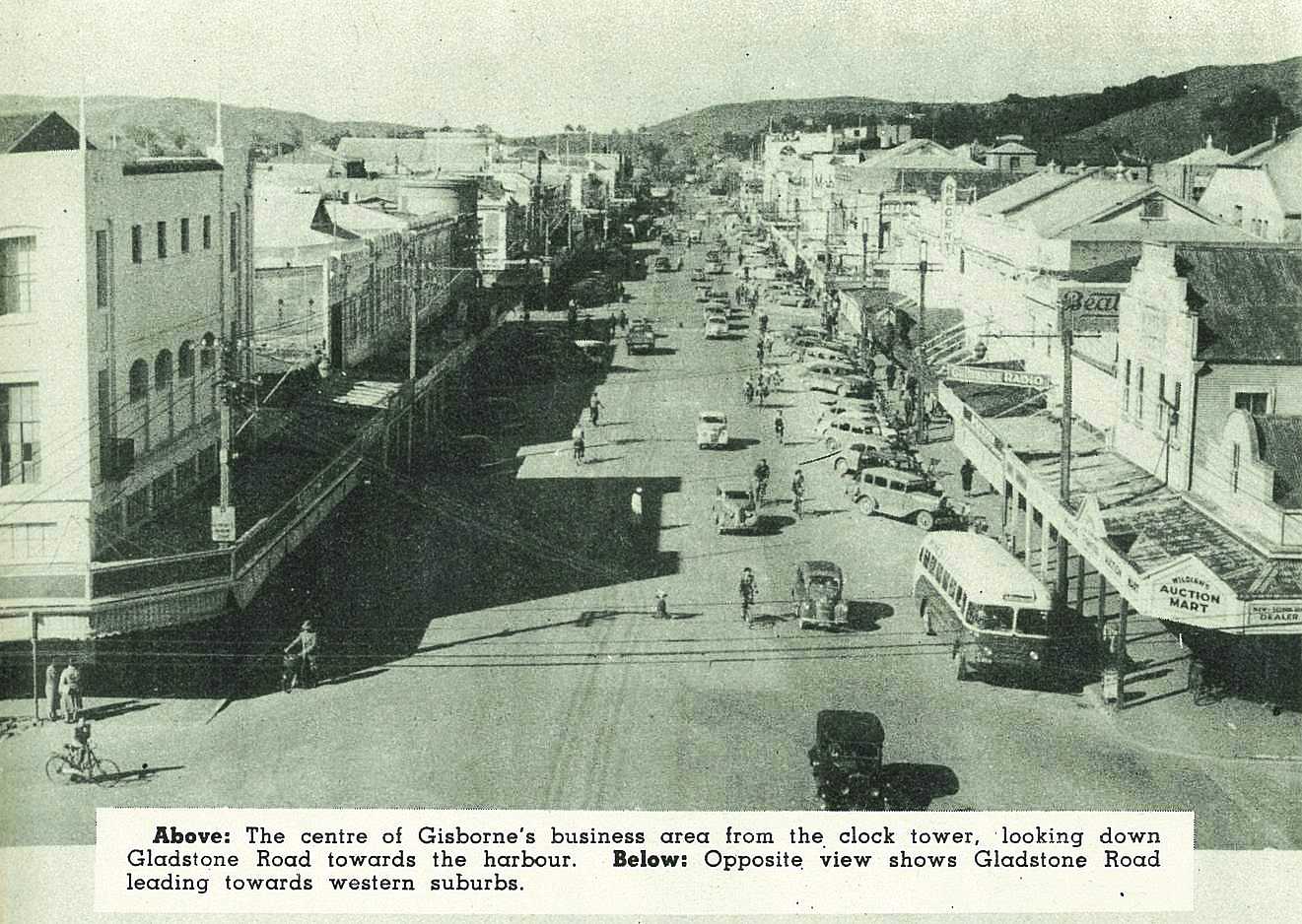
Childers Road, Gladstone Road, and Palmerston Road are the three highways in this aerial picture, leading from the heart of the city towards the western suburbs.
23


24

An aerial view across the heart of the city to the rivers and the suburb of Kaiti in the distance. Wainui Road, at top of picture, leads through low hills to Wainui Beach.
25

The thriving suburb of Mangapapa, looking down Ormond Road and Stout Street towards the town area. Mangapapa school is at left, and the Taruheru River at right, spanned successively by the Roebuck Road bridge, the Gardens bridge, the Derby Street bridge, and the Peel Street bridge.

26

View from hills shows cross-section of Gisborne landscape, with Botanical Gardens in centre of picture. Across the bay is Young Nick's Head and the Mahia Peninsula.
27
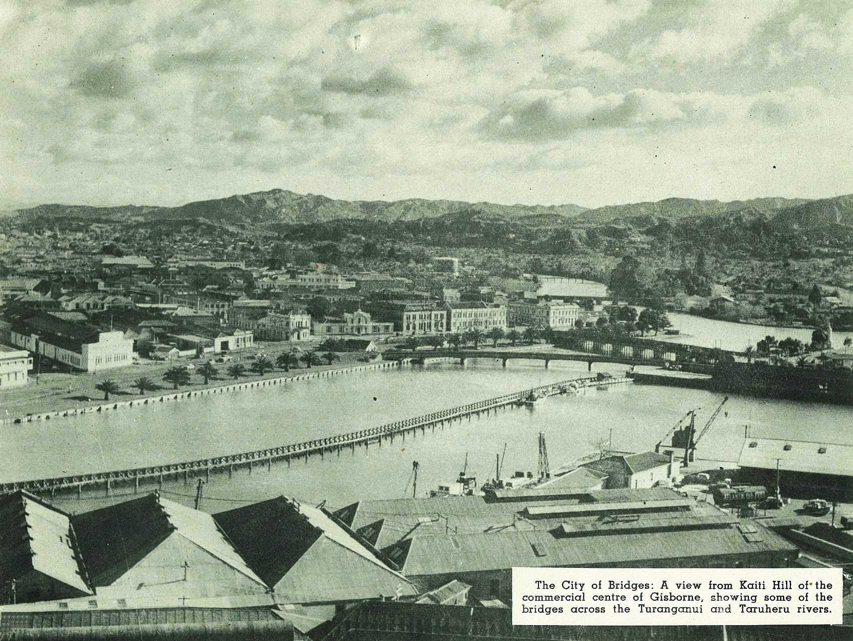
The City of Bridges: A view from Kaiti Hill of the commercial centre of Gisborne, showing some of the bridges across the Turanganui and Taruheru rivers.

28
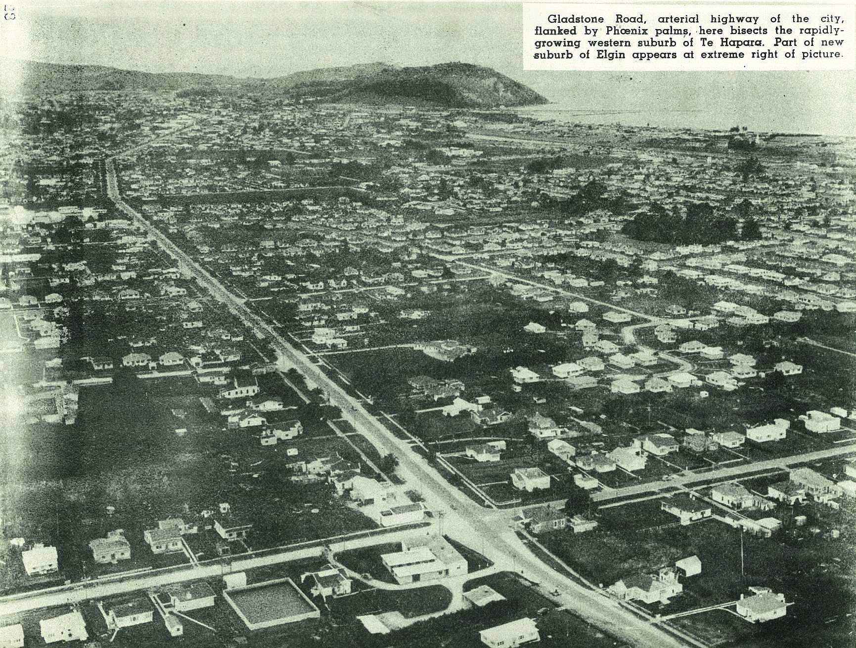
Gladstone Road, arterial highway of the city, flanked by Phoenix palms, here bisects the rapidly-growing western suburb of Te Hapara. Part of new suburb of Elgin appears at extreme right of picture.
29

Where Captain Cook first landed in New Zealand: A view of the bay and Young Nick's Head beyond the monument erected in memory of the great navigator.

30

Cook Hospital from the air. A new view of the "Hospital on the Hill." Note additions to Nurse′s Home at right still in course of construction. Beyond, at top of picture, is new State Hydro Electric distributing centre.
31
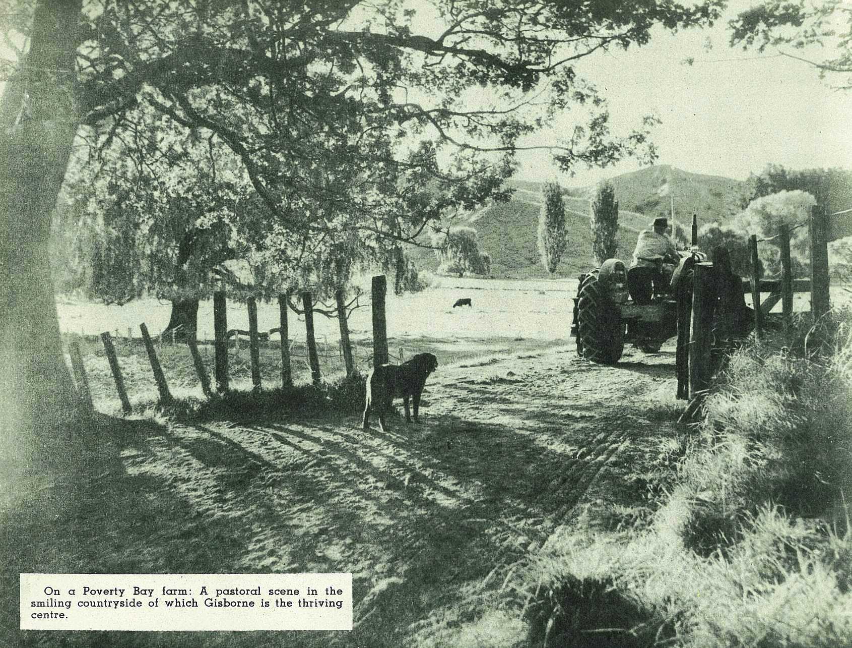
On a Poverty Bay farm: A pastoral scene in the smiling countryside of which Gisborne is the thriving centre.
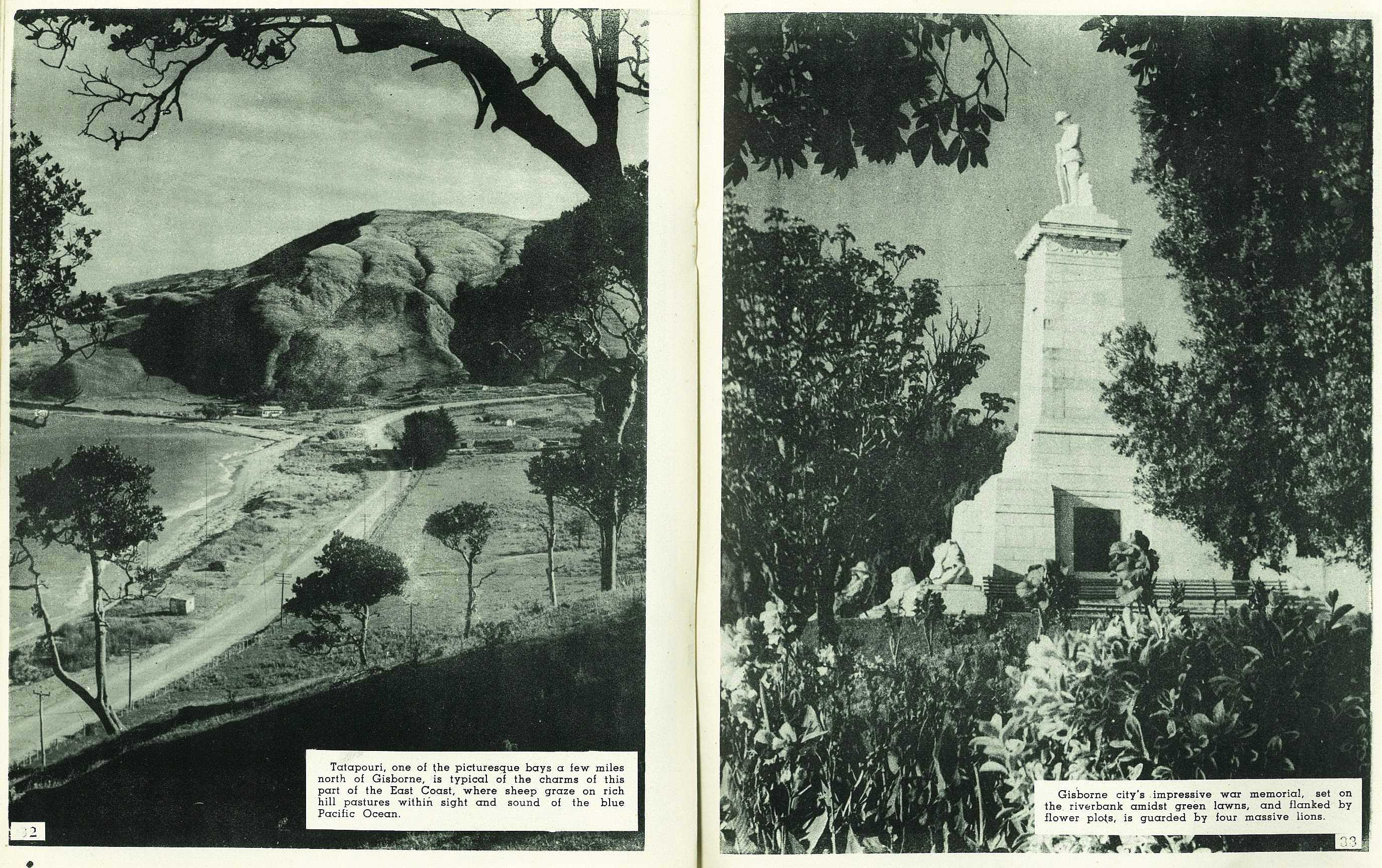
32

Tatapouri, one of the picturesque bays a few miles north of Gisborne, is typical of the charms of this part of the East Coast, where sheep graze on rich hill pastures within sight and sound of the blue Pacific Ocean.
33

Gisborne city's impressive war memorial, set on the riverbank amidst green lawns, and flanked by flower plots, is guarded by four massive lions.
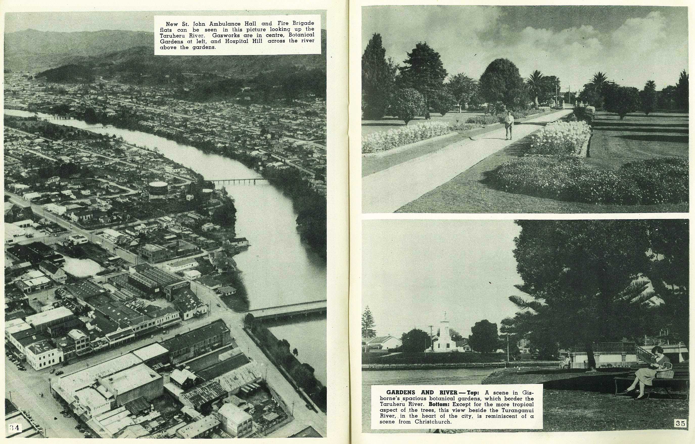
34

New St. John Ambulance Hall and Fire Brigade flats can be seen in this picture looking up the Taruheru River. Gasworks are in centre, Botanical Gardens at left, and Hospital Hill across the river above the gardens.
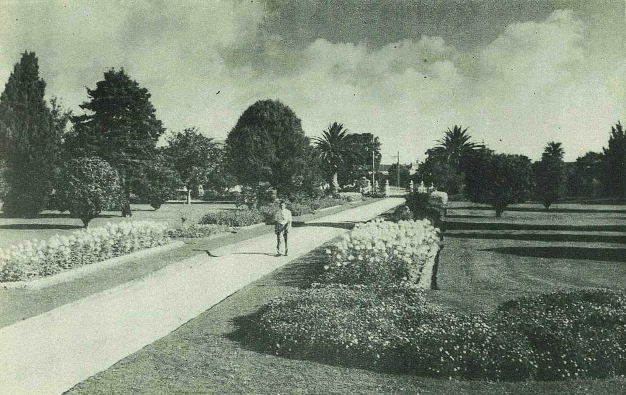
35

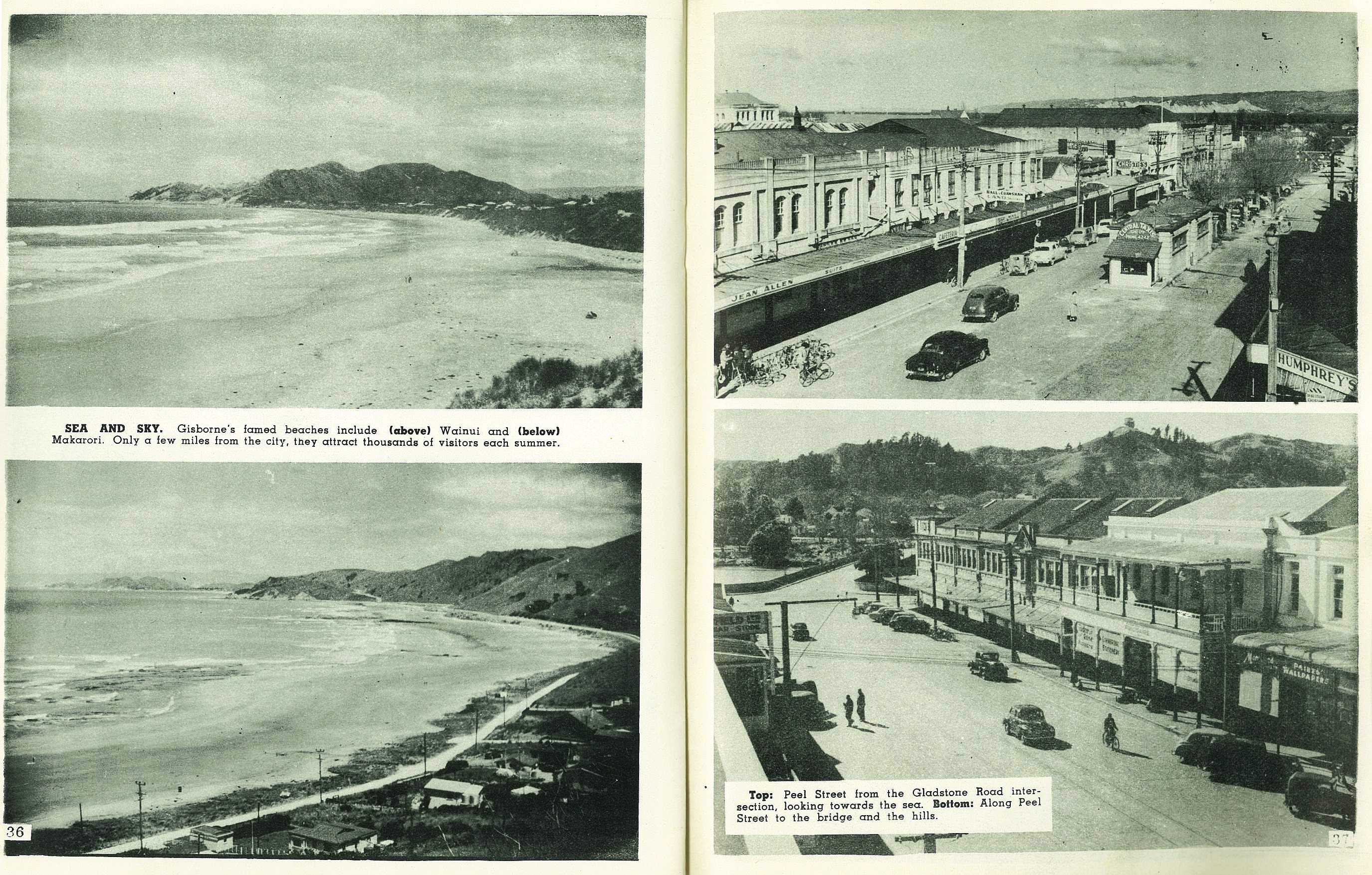
36


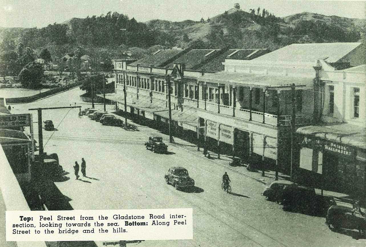
37


38

Gisborne′s new Girls High School, nearing completion, is seen at left in this aerial view. In centre is High School playing Fields, beyond that is the High School, and beyond that again is the Intermediate School.
39
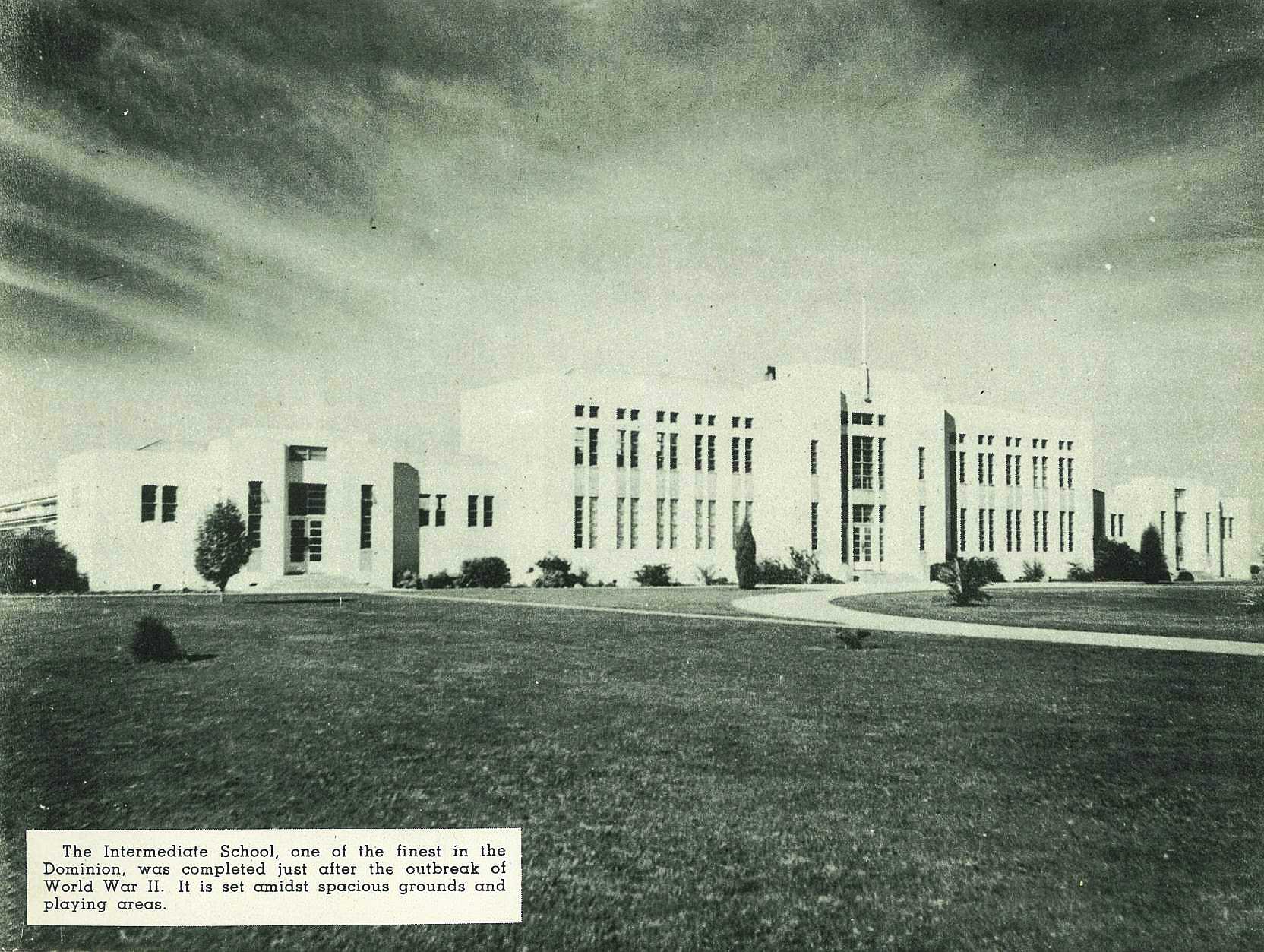
The Intermediate School, one of the finest is the dominion, was completed just after the outbreak of World War II. It is set amidst spacious grounds and playing areas.
40

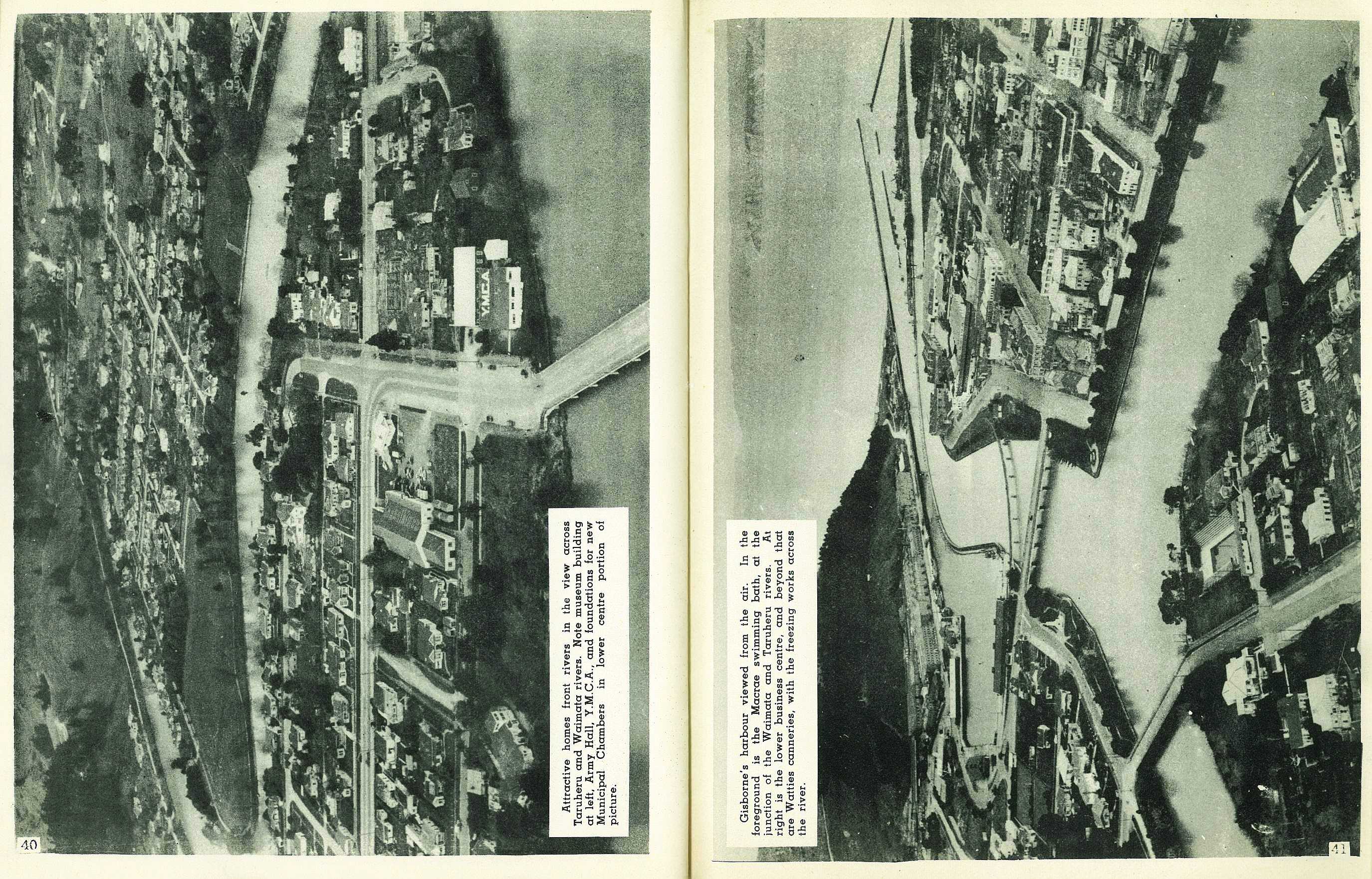
Attractive homes front rivers in the view across Taruheru and Waimata rivers. Note museum building at left, Army Hall Y.M.C.A., and foundations for new Municipal Chambers in lower centre portion of picture.
41

Gisborne′s harbour viewed from the air.In the foreground is the Macrea swimming bath, at the junction of the lower business centre, and beyond that are Watties countries, with the freezing words across the river.

42

Popular rendezvous for summer holiday-makers: Part of the camping grounds at Waikance Beach, only a few hundred yards from the centre of the city, with the new beach pavilion in the foreground.

; void 0)
; void 0)
; void 0)
; void 0)
; void 0)
; void 0)
; void 0)
; void 0)
; void 0)
; void 0)
; void 0)
; void 0)
; void 0)
; void 0)
; void 0)
; void 0)
; void 0)
; void 0)
; void 0)
; void 0)
; void 0)
; void 0)
; void 0)
; void 0)
; void 0)
; void 0)
; void 0)
; void 0)
; void 0)
; void 0)
; void 0)
; void 0)
; void 0)
; void 0)
; void 0)
; void 0)
; void 0)
; void 0)
; void 0)
; void 0)
; void 0)
; void 0)
; void 0)
; void 0)
; void 0)
; void 0)
; void 0)
; void 0)
; void 0)
; void 0)
; void 0)
; void 0)
; void 0)
; void 0)
; void 0)
; void 0)
; void 0)
; void 0)
; void 0)
; void 0)
; void 0)
; void 0)
; void 0)
; void 0)
; void 0)
; void 0)
; void 0)
; void 0)
; void 0)
; void 0)
; void 0)
; void 0)
; void 0)
; void 0)
; void 0)
; void 0)
; void 0)
; void 0)
; void 0)
; void 0)
; void 0)
; void 0)
; void 0)
; void 0)