
34
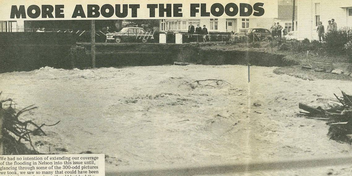
More About the Floods
We had no intention of extending our coverage of the flooding in Nelson into this issue until, glancing through some of the 300-odd pictures we took, we saw so many that could have been used in the previous issue if we'd but had the time and space to use them. And so, since interest in the end-of-August flooding has been so intense, we reproduce in this issue a few more of the best pictures we took on that weekend and as Nelson cleaned up. Also, we have included one or two pictures taken during the very high winds of last month, when the gales backed up a 16ft. tide and sent the sea into properties at Monaco.
Much has happened since the weekend of August 29-31. "Operation Goodwill", launched by Nelson Jaycees, was an unqualified success and many home owners had the worst on the rubble and silt removed from their sections by hundreds of volunteers. The National Roads Board has offered a $5 for $1 subsidy to help in the restoration of the city's damaged streets (a very generous gesture) and the city has approached Government for assistance to repair the ravages of the flooding. It has been estimated that total damage to civic amenities is in the region of $400,000. As yet (at the time we went to press) the city council has received no firm assurance from the Government that financial aid will be forthcoming. The council, however, is still hoping.
The picture Above shows the Brook Stream leaving the culvert under Tasman Street, and surging into properties on the northern bank of the stream.
35
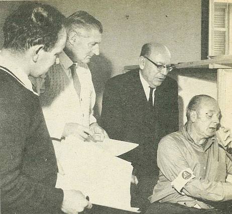
The Minister in Charge of the Earthquake and War Damage Commission (Mr Rae) visited Nelson to see for himself the extent of the damage. We got this photograph of him (standing right) as Mr Allen McKinstry (controller of Nelson Civil Defence welfare), and the then assistant Town Clerk (Mr H. A. Levestam) awaited the latest developments coming over the radio telephone to Mr Geoff Gould.

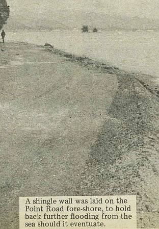
The back lawn and garden of Mr E. W. R. Burden, inundated by sea water when gale-force winds forced high seas into his property. Mr Burden, and other Monaco property owners, feel that a sea wall should be built to prevent further flooding.
36
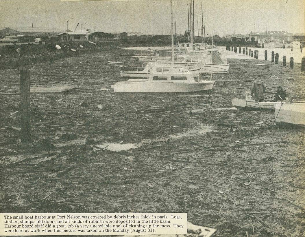
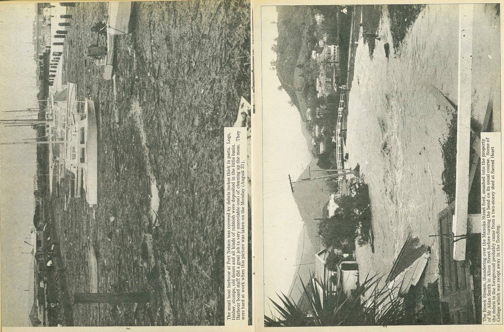
The small boat harbour at Port Nelson was covered by debris inches thick in parts. Logs, timber, stumps, old doors and all kinds of rubbish were deposited in the little basin. Harbour board staff did a great job (a very unenviable one) of cleaning up the mess. They were hard at work when this picture was taken on the Monday (August 31).
37
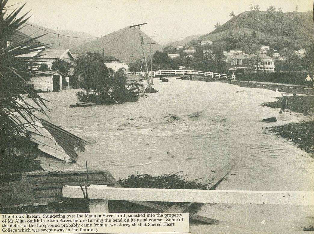
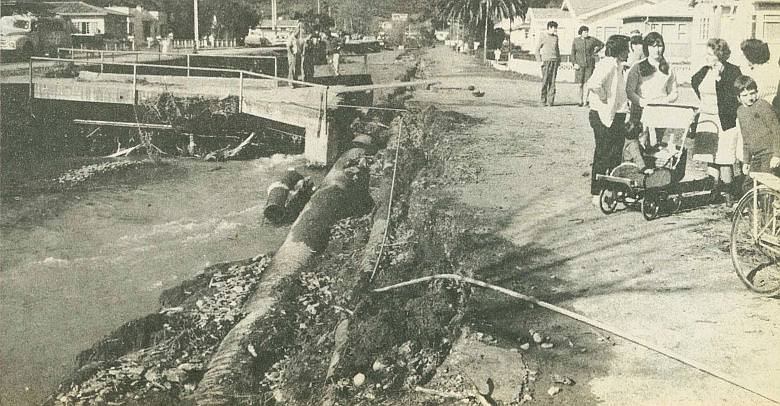
The Brook Stream, thundering over the Manuka Street ford, smashed into the property of Mr Allan Smith in Alton Street before turning the bend on its usual course. Some of the debris in the foreground probably came from a two-storey shed at Sacred Heart College which was swept away in the flooding.
38
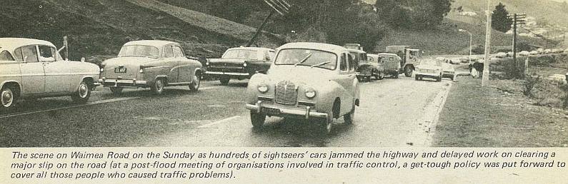
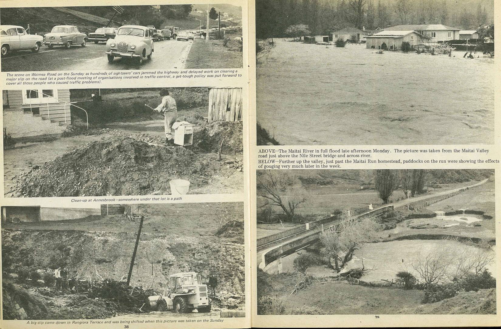
The scene on Waimea Road on the Sunday as hundreds of sightseers' cars jammed the highway and delayed work on clearing a major slip on the road (at a post-flood meeting of organisations involved in traffic control, a get-tough policy was put forward to cover all those people who caused traffic problems).
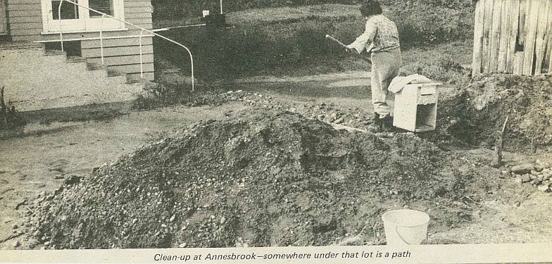
Clean-up at Annesbrook - somewhere under that lot is a path
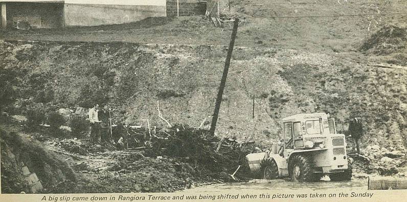
A big slip came down in Rangiora Terrace and was being shifted when this picture was taken on the Sunday
39

The Maitai River in full flood late afternoon Monday. The picture was taken from the Maitai Valley road just above the Nile Street bridge and across river.

Further up the valley, just past the Maitai Run homestead, paddocks on the run were showing the effects of gouging very much later in the week.
40
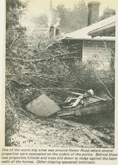
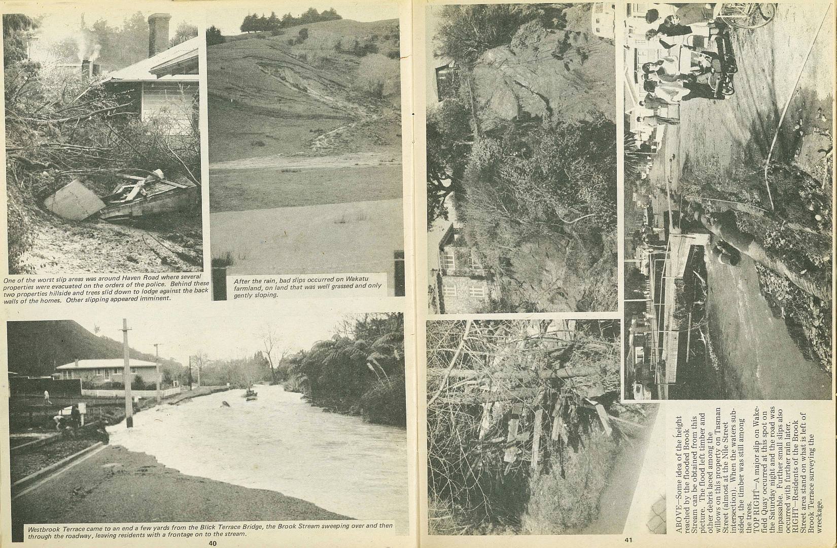
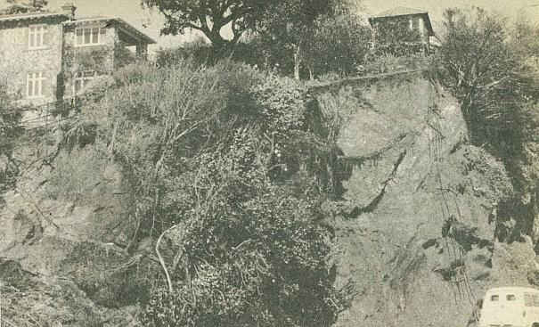
One of the worst slip areas was around Haven Road where several properties were evacuated on the orders of the police. Behind these two properties hillside and trees slid down to lodge against the back walls of the homes. Other slipping appeared imminent.
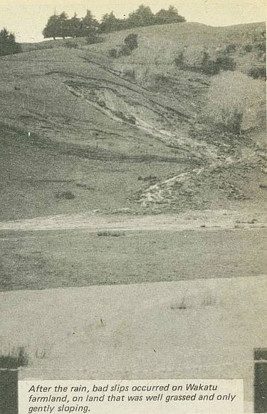
After the rain, bad slips occurred on Wakatu farmland, on land that was well grassed and only gently sloping.
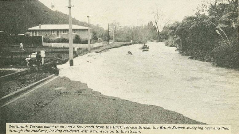
Westbrook Terrace came to an end a few yards from the Blick Terrace Bridge, the Brook Stream sweeping over and then through the roadway, leaving residents with a frontage on to the stream.
41
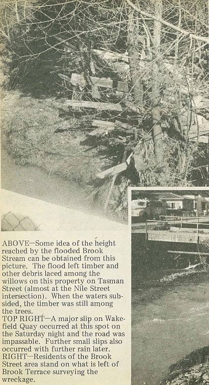
Some idea of the height reached by the flooded Brook Stream can be obtained from this picture. The flood left timber and other debris laced among the willows on this property on Tasman Street (almost at the Nile Street intersection). When the waters subsided, the timber was still among the trees.
A major slip on Wakefield Quay occurred at this spot on the Saturday night and the road was impassable. Further small slips also occurred with further rain later.
Residents of the Brook Street area stand on what is left of Brook Terrace surveying the wreckage.

; void 0)
; void 0)
; void 0)
; void 0)
; void 0)
; void 0)
 visited Nelson to see for himself the extent of the damage. We got this photograph of him (standing right) as Mr Allen McKinstry (controller of Nelson Civil Defence welfare), and the then assistant Town Clerk (Mr H. A. Levestam) awaited the latest developments coming over the radio telephone to Mr Geoff Gould. - Nelson Photo News - No 120 : October 17, 1970'); void 0)
 visited Nelson to see for himself the extent of the damage. We got this photograph of him (standing right) as Mr Allen McKinstry (controller of Nelson Civil Defence welfare), and the then assistant Town Clerk (Mr H. A. Levestam) awaited the latest developments coming over the radio telephone to Mr Geoff Gould. - Nelson Photo News - No 120 : October 17, 1970'); void 0)
 visited Nelson to see for himself the extent of the damage. We got this photograph of him (standing right) as Mr Allen McKinstry (controller of Nelson Civil Defence welfare), and the then assistant Town Clerk (Mr H. A. Levestam) awaited the latest developments coming over the radio telephone to Mr Geoff Gould. - Nelson Photo News - No 120 : October 17, 1970'); void 0)
; void 0)
; void 0)
; void 0)
 of cleaning up the mess. They were hard at work when this picture was taken on the Monday (August 31). - Nelson Photo News - No 120 : October 17, 1970'); void 0)
 of cleaning up the mess. They were hard at work when this picture was taken on the Monday (August 31). - Nelson Photo News - No 120 : October 17, 1970'); void 0)
 of cleaning up the mess. They were hard at work when this picture was taken on the Monday (August 31). - Nelson Photo News - No 120 : October 17, 1970'); void 0)
; void 0)
; void 0)
; void 0)
. - Nelson Photo News - No 120 : October 17, 1970'); void 0)
. - Nelson Photo News - No 120 : October 17, 1970'); void 0)
. - Nelson Photo News - No 120 : October 17, 1970'); void 0)
; void 0)
; void 0)
; void 0)
; void 0)
; void 0)
; void 0)
; void 0)
; void 0)
; void 0)
; void 0)
; void 0)
; void 0)
; void 0)
; void 0)
; void 0)
; void 0)
; void 0)
; void 0)
; void 0)
; void 0)
; void 0)
. When the waters subsided, the timber was still among the trees. - Nelson Photo News - No 120 : October 17, 1970'); void 0)
. When the waters subsided, the timber was still among the trees. - Nelson Photo News - No 120 : October 17, 1970'); void 0)
. When the waters subsided, the timber was still among the trees. - Nelson Photo News - No 120 : October 17, 1970'); void 0)
; void 0)
; void 0)
; void 0)
; void 0)
; void 0)
; void 0)