6
The Motorway
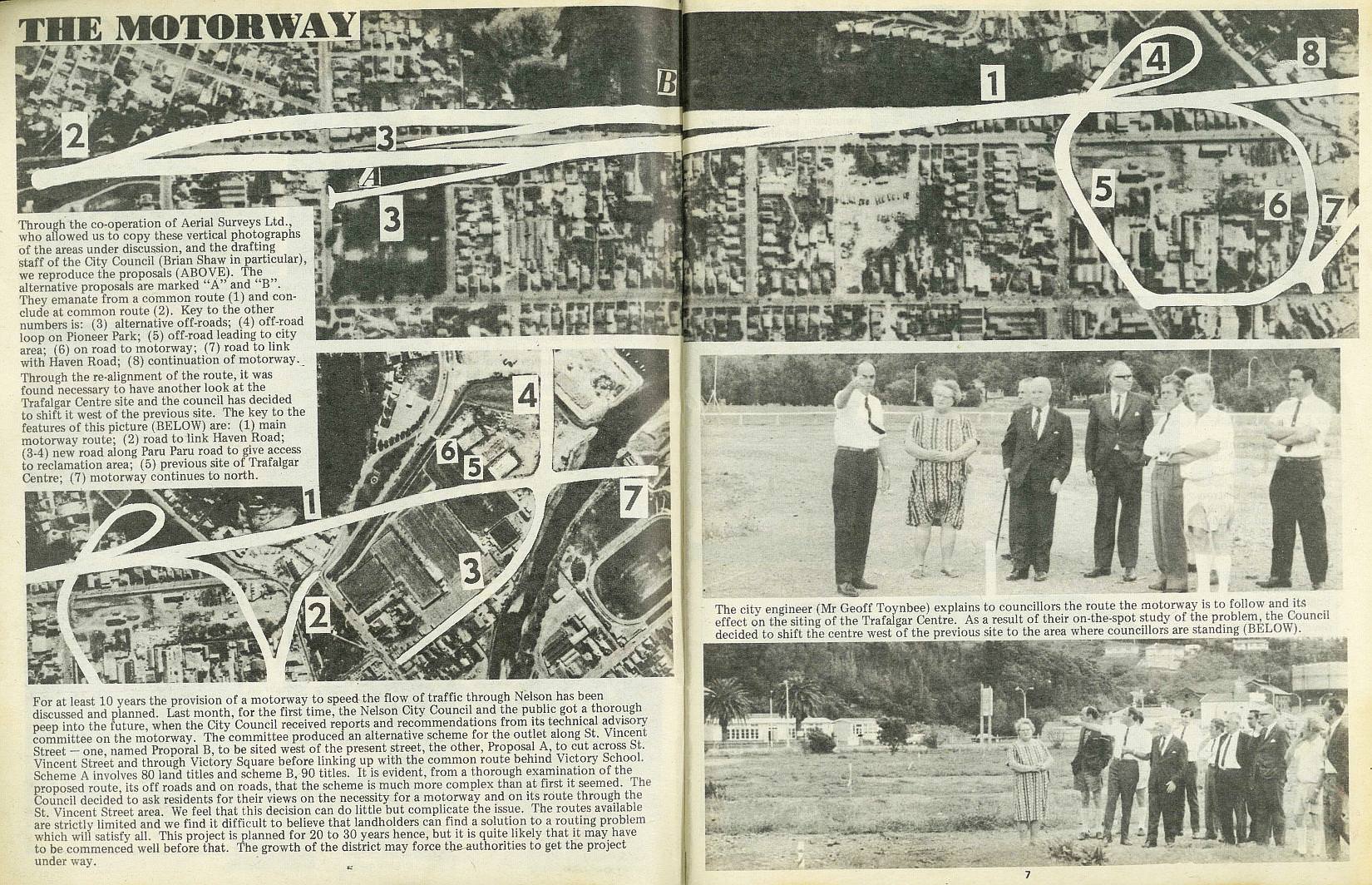
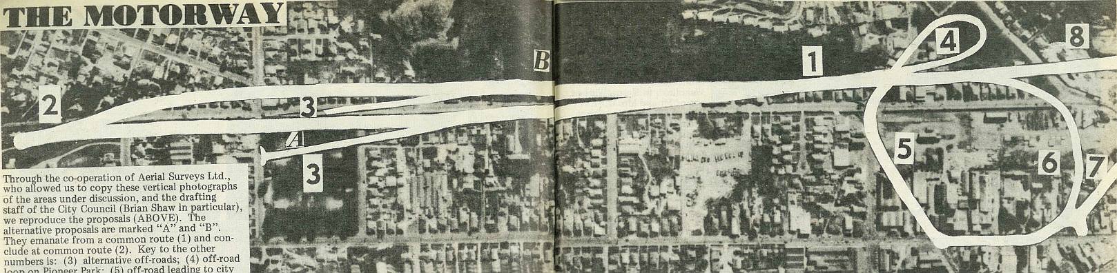
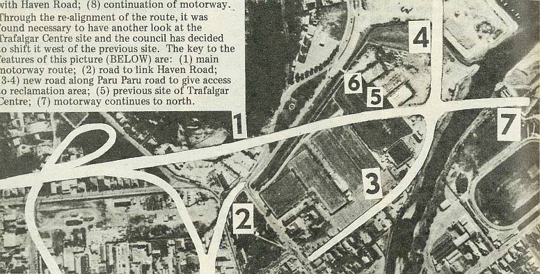
Through the co-operation of Aerial Surveys Ltd., who allowed us to copy these vertical photographs of the areas under discussion, and the drafting staff of the City Council (Brian Shaw in particular), we reproduce the proposals (Above). The alternative proposals are marked "A" and "B". They emanate from a common route (1) and conclude Fat common route (2). Key to the other numbers is: (3) alternative off-roads; (4) off-road loop on Pioneer Park; (5) off-road leading to city area; (6) on road to motorway; (7) road to link with Haven Road; (8) continuation of motorway. Through the re-alignment of the route, it was found necessary to have another look at the Trafalgar Centre site and the council has decided to shift it west of the previous site. The key to the features of this picture (Below) are: (1) main motorway route; (2) road to link Haven Road; (3-4) new road along Paru Paru road to give access to reclamation area; (5) previous site of Trafalgar Centre; (7) motorway continues to north.
For at least 10 years the provision of a motorway to speed the flow of traffic through Nelson has been discussed and planned. Last month, for the first time, the Nelson City Council and the public got a thorough peep into the future, when the City Council received reports and recommendations from its technical advisory committee on the motorway. The committee produced an alternative scheme for the outlet along St. Vincent Street - one, named Proporal B, to be sited west of the present street, the other, Proposal A, to cut across St. Vincent Street and through Victory Square before linking up with the common route behind Victory School. Scheme A involves 80 land titles and scheme B, 90 titles. It is evident, from a thorough examination of the proposed route, its off roads and on roads, that the scheme is much more complex than at first it seemed. The Council decided to ask residents for their views on the necessity for a motorway and on its route through the St. Vincent Street area. We feel that this decision can do little but complicate the issue. The routes available are strictly limited and we find it difficult to believe that landholders can find a solution to a routing problem which will satisfy all. This project is planned for 20 to 30 years hence, but it is quite likely that it may have to be commenced well before that. The growth of the district may force the authorities to get the project under way.
7
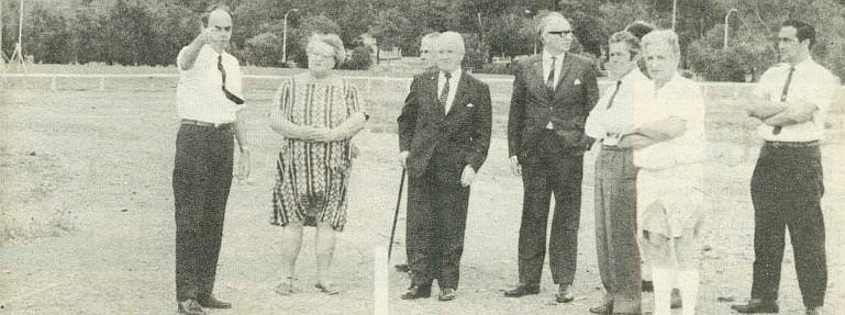
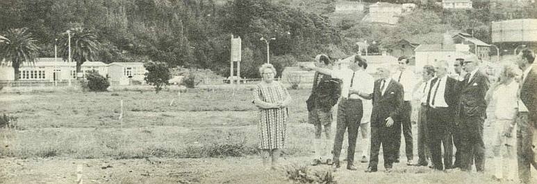
The city engineer (Mr Geoff Toynbee) explains to councillors the route the motorway is to follow and its effect on the siting of the Trafalgar Centre. As a result of their on-the-spot study of the problem, the Council decided to shift the centre west of the previous site to the area where councillors are standing (Below).

; void 0)
; void 0)
; void 0)
; void 0)
; void 0)
; void 0)
; void 0)
; void 0)
; void 0)
; void 0)
; void 0)
; void 0)