12
The Waikokopu Slip
Disaster Strikes at Gisborne's Rail Link
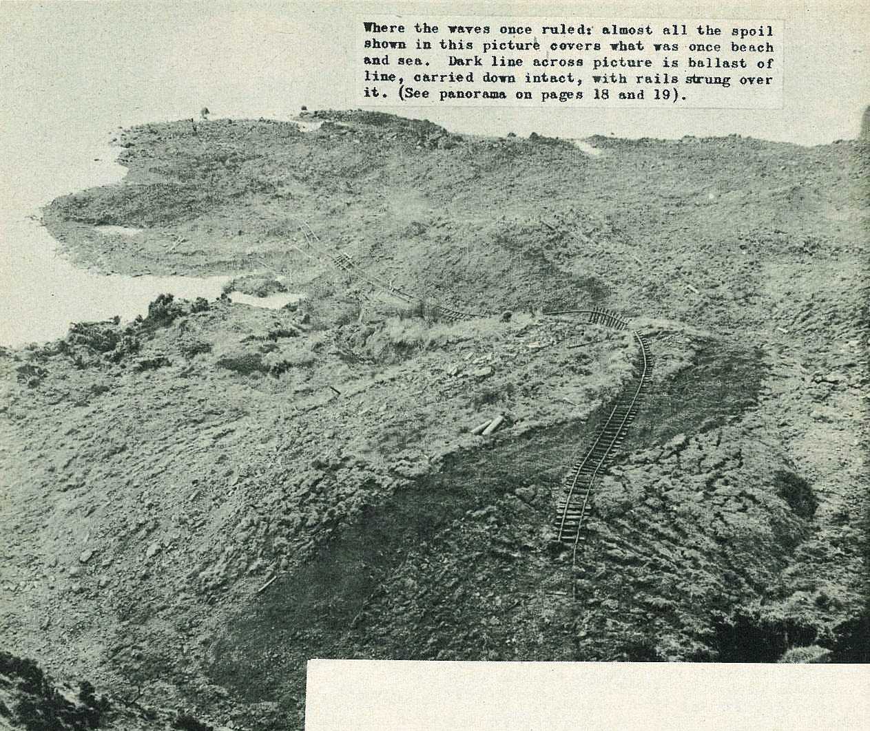
For weeks, as unremitting wet weather softened the surrounding hills, railwaymen kept watch at Waikokopu. Where the line weaves a precarious course across a steep, greasy face, high above the sea, measuring instruments showed occasional earth movements.
The morning of August 12 dawned wet and grey. At first light a ganger was on the scene, checking the troublespot before the first trains were due.
He called in railway consultants to confirm his diagnosis that the worst was about to happen. From the Nuhaka end they watched and waited. On the Opoutama side, passengers in a bus, halted by railwaymen, also kept vigil.
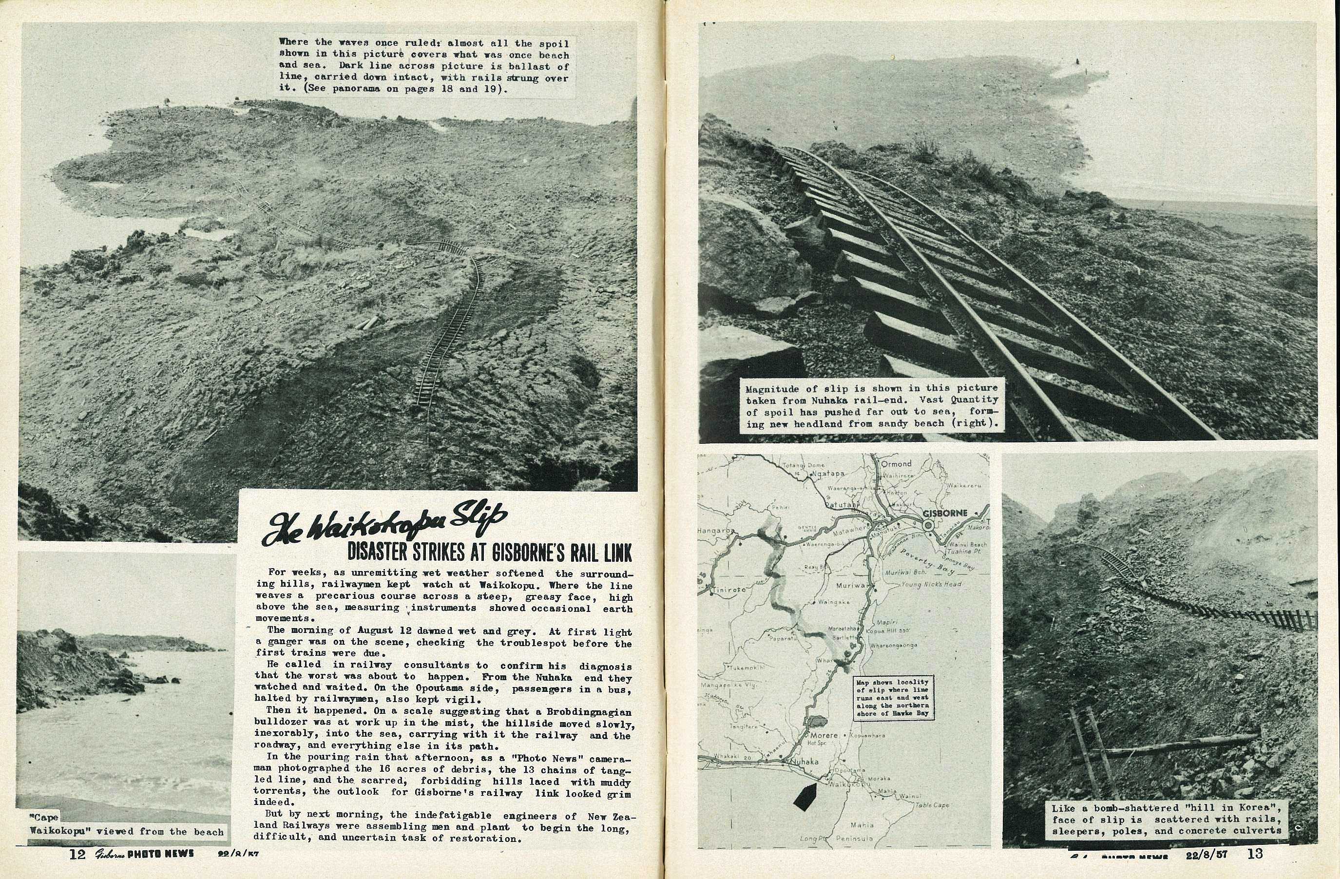
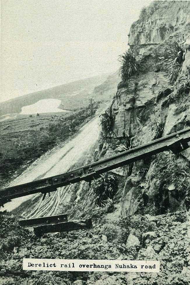
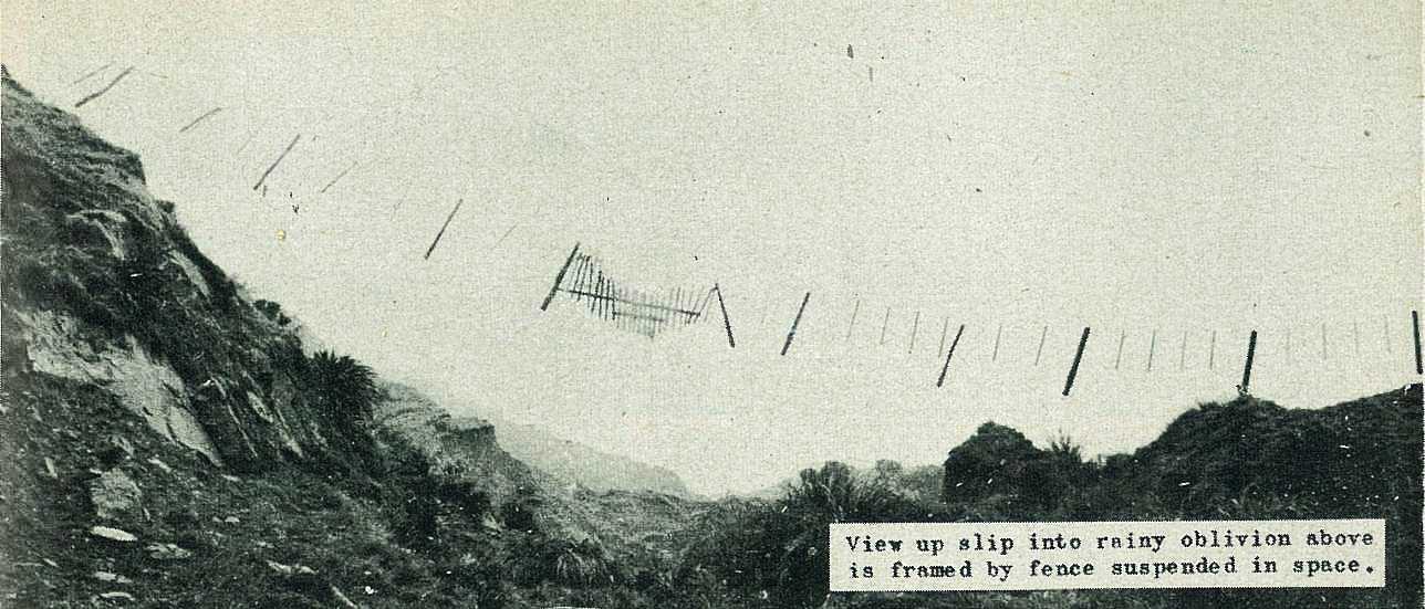
Then it happened. On a scale suggesting that a Brobdingnagian bulldozer was at work up in the mist, the hillside moved slowly, inexorably, into the sea, carrying with it the railway and the roadway, and everything else in its path.
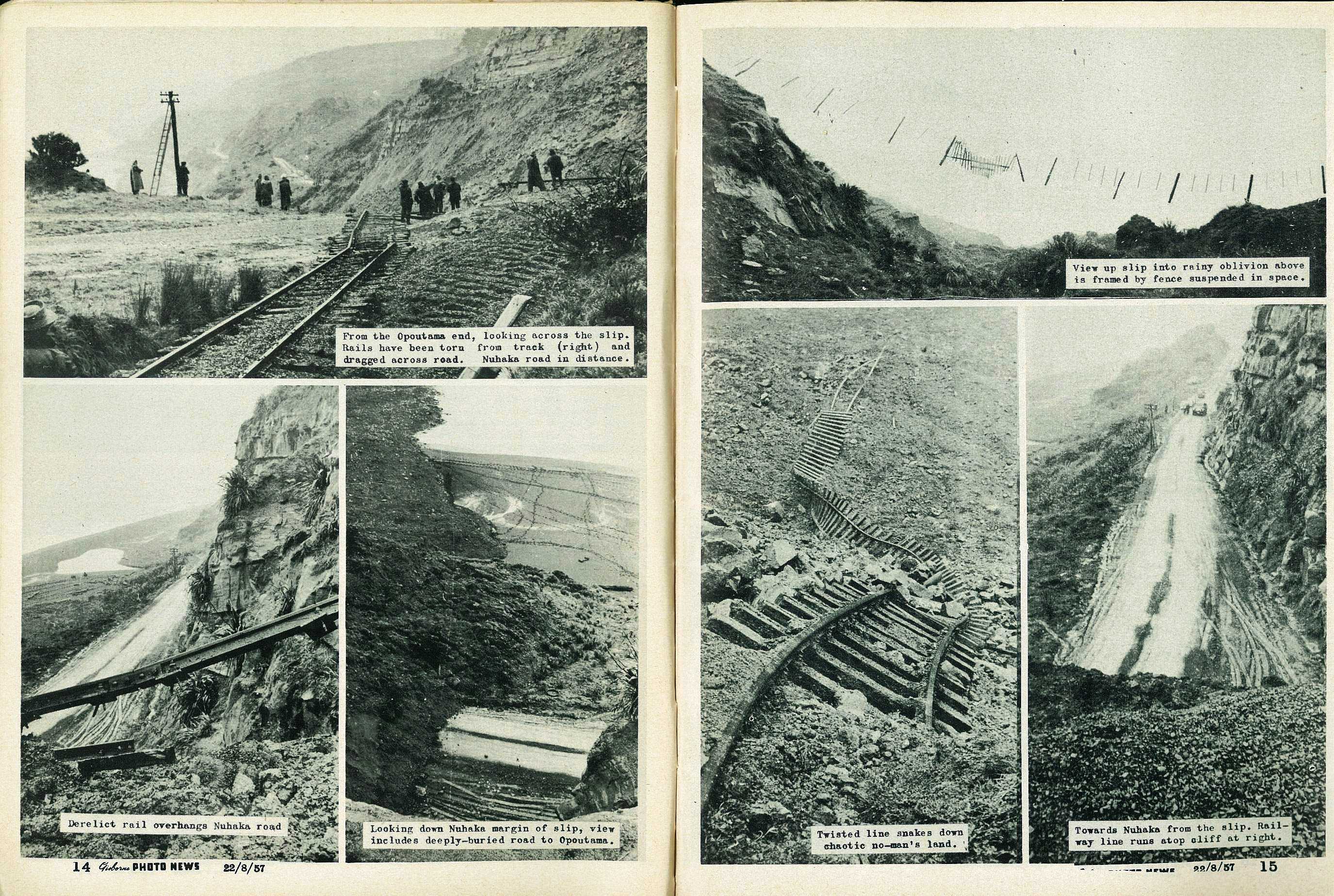
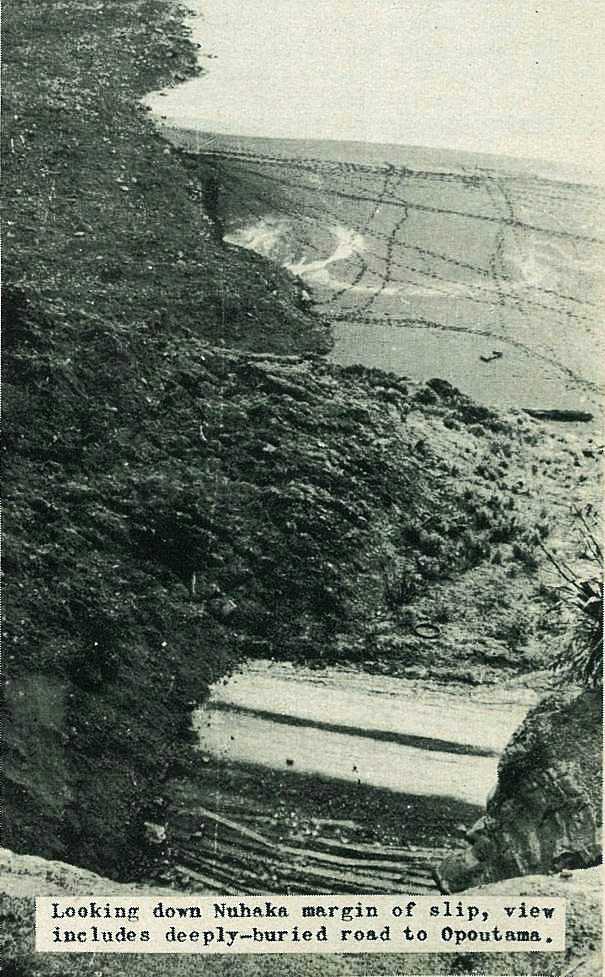
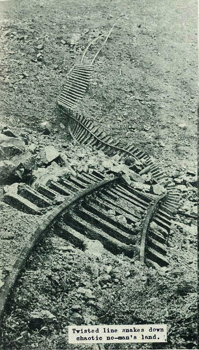
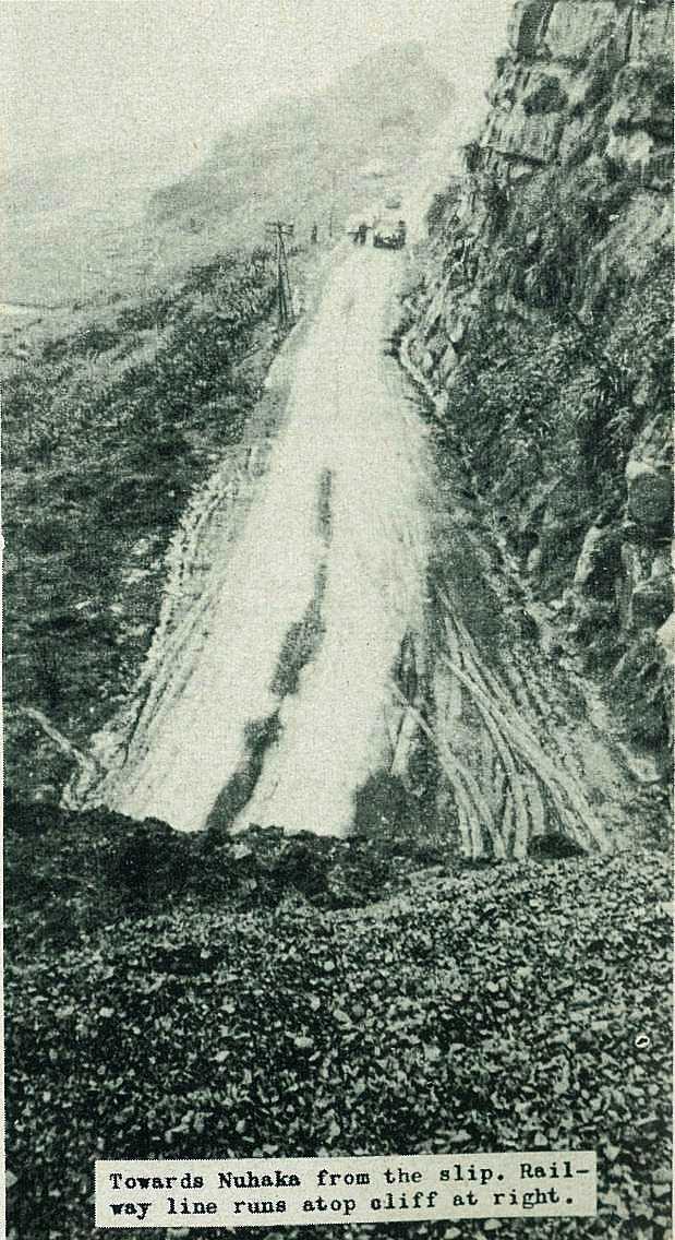
In the pouring rain that afternoon, as a "Photo News" cameraman photographed the 16 acres of debris, the 13 chains of tangled line, and the scarred, forbidding hills laced with muddy torrents, the outlook for Gisborne's railway link looked grim indeed.
But by next morning, the indefatigable engineers of New Zealand Railways were assembling men and plant to begin the long, difficult, and uncertain task of restoration.
13
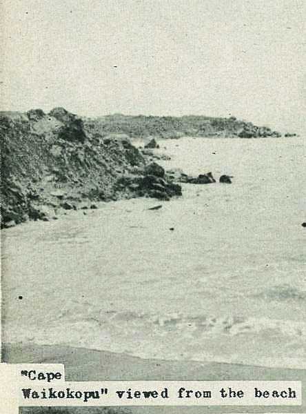
Magnitude of slip is shown in this picture taken from Nuhaka rail-end. Vast Quantity of spoil has pushed far out to sea, forming new headland from sandy beach (right).
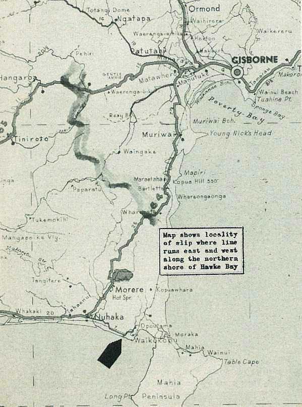
Map shows locality of slip where line runs east and west along the northern shore of Hawke Bay
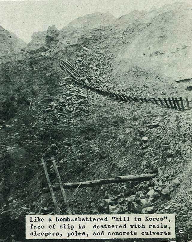
Like a bomb-shattered "hill in Korea", face of slip is scattered with rails, sleepers, poles, and concrete culverts
14
15

.\r\n\r\nGisborne Photo News - No 38 : August 22, 1957'); void 0)
.\r\n\r\nGisborne Photo News - No 38 : August 22, 1957'); void 0)
.\r\n\r\nGisborne Photo News - No 38 : August 22, 1957'); void 0)
; void 0)
; void 0)
; void 0)
.\r\n\r\nGisborne Photo News - No 38 : August 22, 1957'); void 0)
.\r\n\r\nGisborne Photo News - No 38 : August 22, 1957'); void 0)
.\r\n\r\nGisborne Photo News - No 38 : August 22, 1957'); void 0)
; void 0)
; void 0)
; void 0)
; void 0)
; void 0)
; void 0)
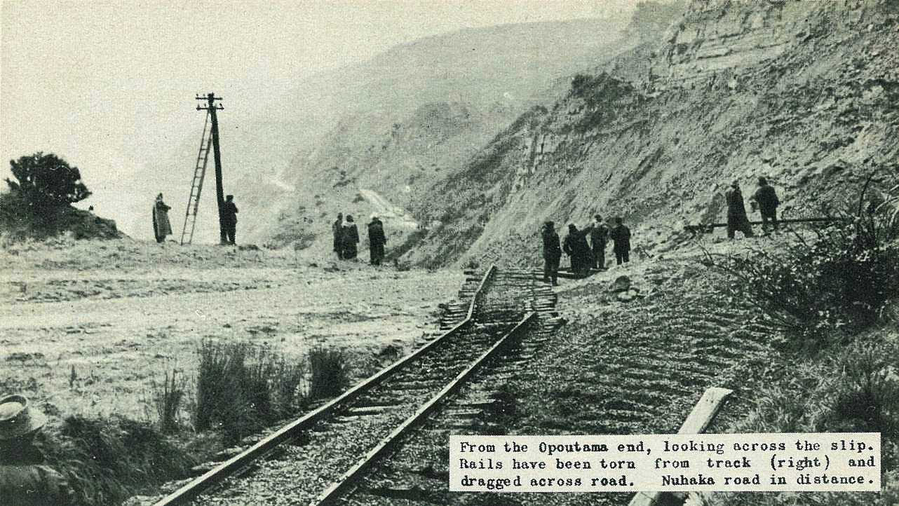
 and dragged across road. Nuhaka road in distance.\r\n\r\nGisborne Photo News - No 38 : August 22, 1957'); void 0)
 and dragged across road. Nuhaka road in distance.\r\n\r\nGisborne Photo News - No 38 : August 22, 1957'); void 0)
 and dragged across road. Nuhaka road in distance.\r\n\r\nGisborne Photo News - No 38 : August 22, 1957'); void 0)
; void 0)
; void 0)
; void 0)
; void 0)
; void 0)
; void 0)
; void 0)
; void 0)
; void 0)
; void 0)
; void 0)
; void 0)
; void 0)
; void 0)
; void 0)