
29
Gisborne'S Water
Gisborne's water supply has reached a very interesting stage with the virtual completion of the new dam, which is project No.2 in the Mangapoike Scheme. The new 70' high dam will hold 508 million gallons of water (top picture, front cover). A decisive link, now, is for more storage in the city area in the form of storage reservoirs, and this stage is being surveyed at present. When completed these two parts of the scheme should see Gisborne's water supply at a very adequate stage for some years. However, this supply system is not expected to last the city's requirements for ever and the next stage will be the spectacular Puninga Development (bottom picture, front cover) which is, at present, planned for completion in approximately ten years. This stage is expected to supply over 4000 million gallons of water and, when completed, will take the city well into the next century. This development could also give Gisborne an aquatic area which would be ideal for water skiing, power boat races and rowing, as well as providing important fire protection sources for the Wharerata State Forests.
The local branch of the National Travel Association organised a visit to the water works area recently and a tour and explanation of the whole system was given by.Deputy Mayor Seton Clare.

The view from the top of the dam shows the area that will hold the 508 million gallons of water. Visitors walk down to inspect the control and supply tower, at right, which will be reached by the steel bridge from the left bank. Note the cleared area up to the eventual water line.

The width of the work is more impressive from the top and gives some idea of the immensity of the dam. The wire netted rocks on top, the black plastic net, the metal facing at right, and the rock surrounded squares on the far bank are all sections of the wave protection part of the works. With the large expanse of water to come waves can be much higher than one would think.

30

This aerial shows how the pipeline follows the natural fall of the hills to the point marked Smith's Creek. Discoloured water will be a thing of the past. A new pipeline section (continous white line) is being installed by helicopter and buried underground It will join the lower valley pipeline just below the point marked intake. Previously the water flowed down Smith's Creek (over open ground) before re-entering the lower pipeline. Heavy rain stirred up this particular area thus giving the resultant discolouration.


Under this track is buried the lower end of the new pipeline section which descends to join the valley pipeline seen in the centre
31
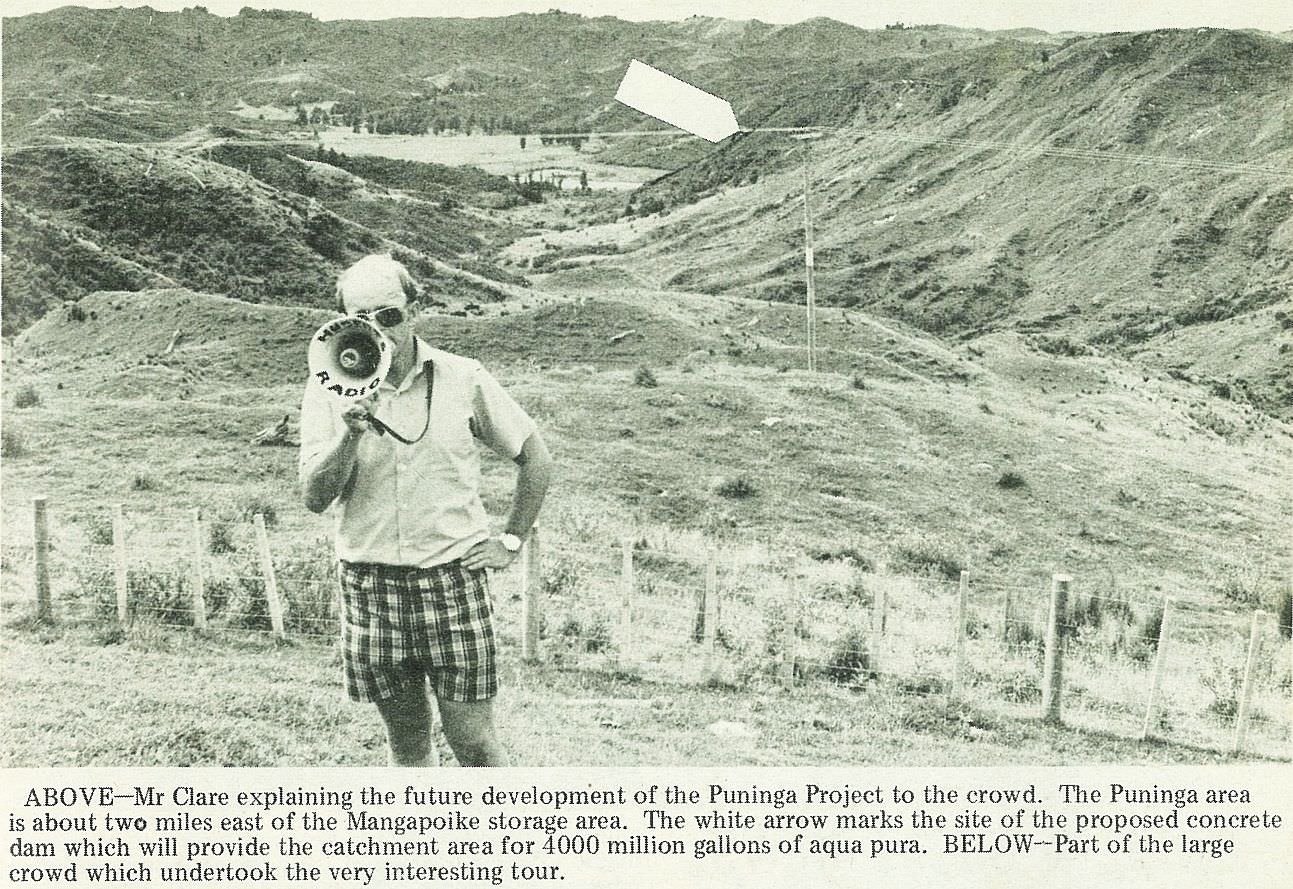
Mr Clare explaining the future development of the Puninga Project to the crowd. The Puninga area is about two miles east of the Mangapoike storage area. The white arrow marks the site of the proposed concrete dam which will provide the catchment area for 4000 million gallons of aqua pura.

Part of the large crowd which undertook the very interesting tour.

; void 0)
; void 0)
; void 0)
; void 0)
; void 0)
; void 0)
 is being installed by helicopter and buried underground It will join the lower valley pipeline just below the point marked intake. Previously the water flowed down Smiths Creek (over open ground) before re-entering the lower pipeline. Heavy rain stirred up this particular area thus giving the resultant discolouration.\r\n\r\nGisborne Photo News - No 249 : March 26, 1975'); void 0)
 is being installed by helicopter and buried underground It will join the lower valley pipeline just below the point marked intake. Previously the water flowed down Smiths Creek (over open ground) before re-entering the lower pipeline. Heavy rain stirred up this particular area thus giving the resultant discolouration.\r\n\r\nGisborne Photo News - No 249 : March 26, 1975'); void 0)
 is being installed by helicopter and buried underground It will join the lower valley pipeline just below the point marked intake. Previously the water flowed down Smiths Creek (over open ground) before re-entering the lower pipeline. Heavy rain stirred up this particular area thus giving the resultant discolouration.\r\n\r\nGisborne Photo News - No 249 : March 26, 1975'); void 0)
; void 0)
; void 0)
; void 0)
; void 0)
; void 0)
; void 0)
; void 0)
; void 0)
; void 0)
; void 0)
; void 0)
; void 0)