68
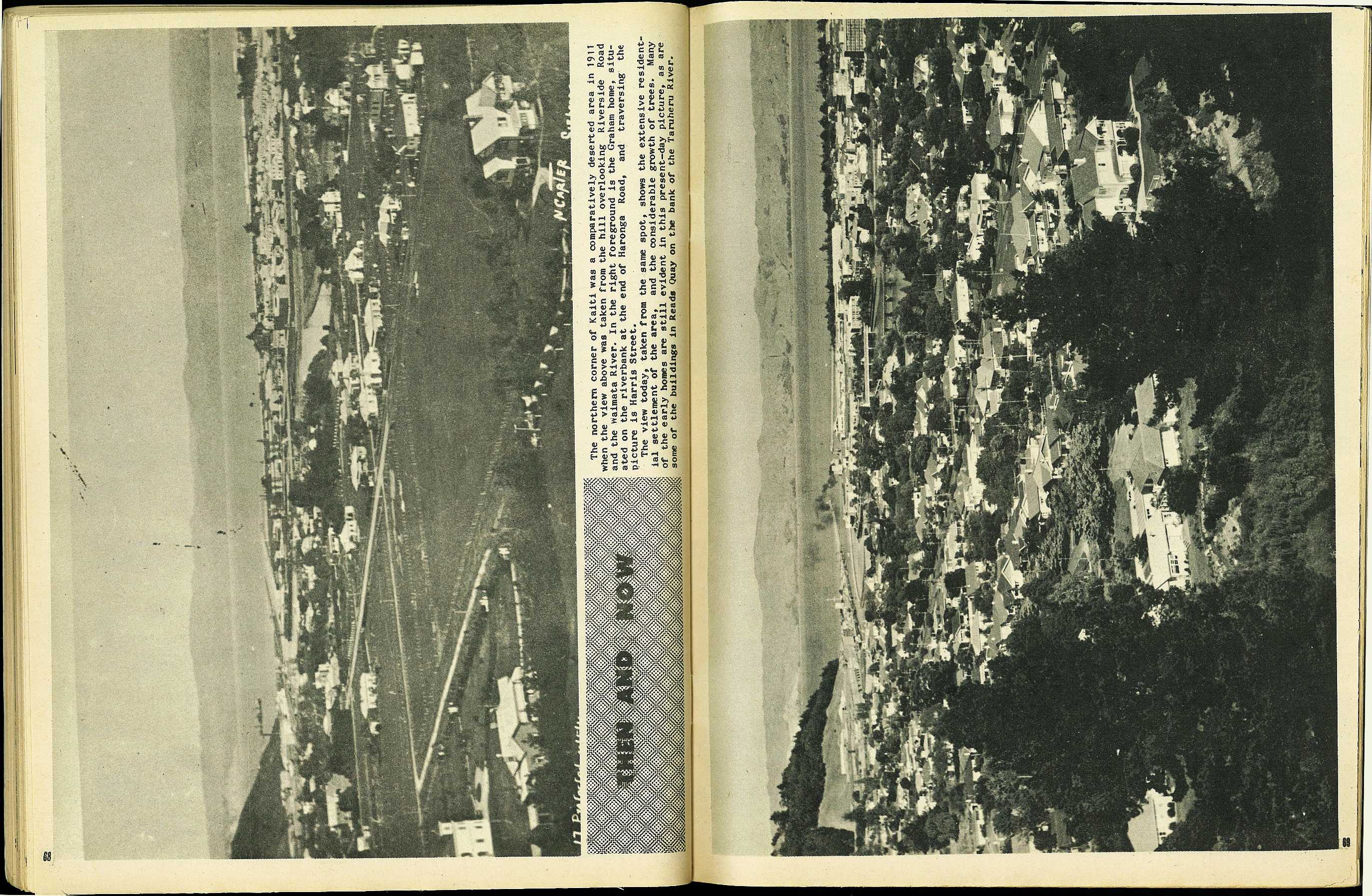
Then And Now
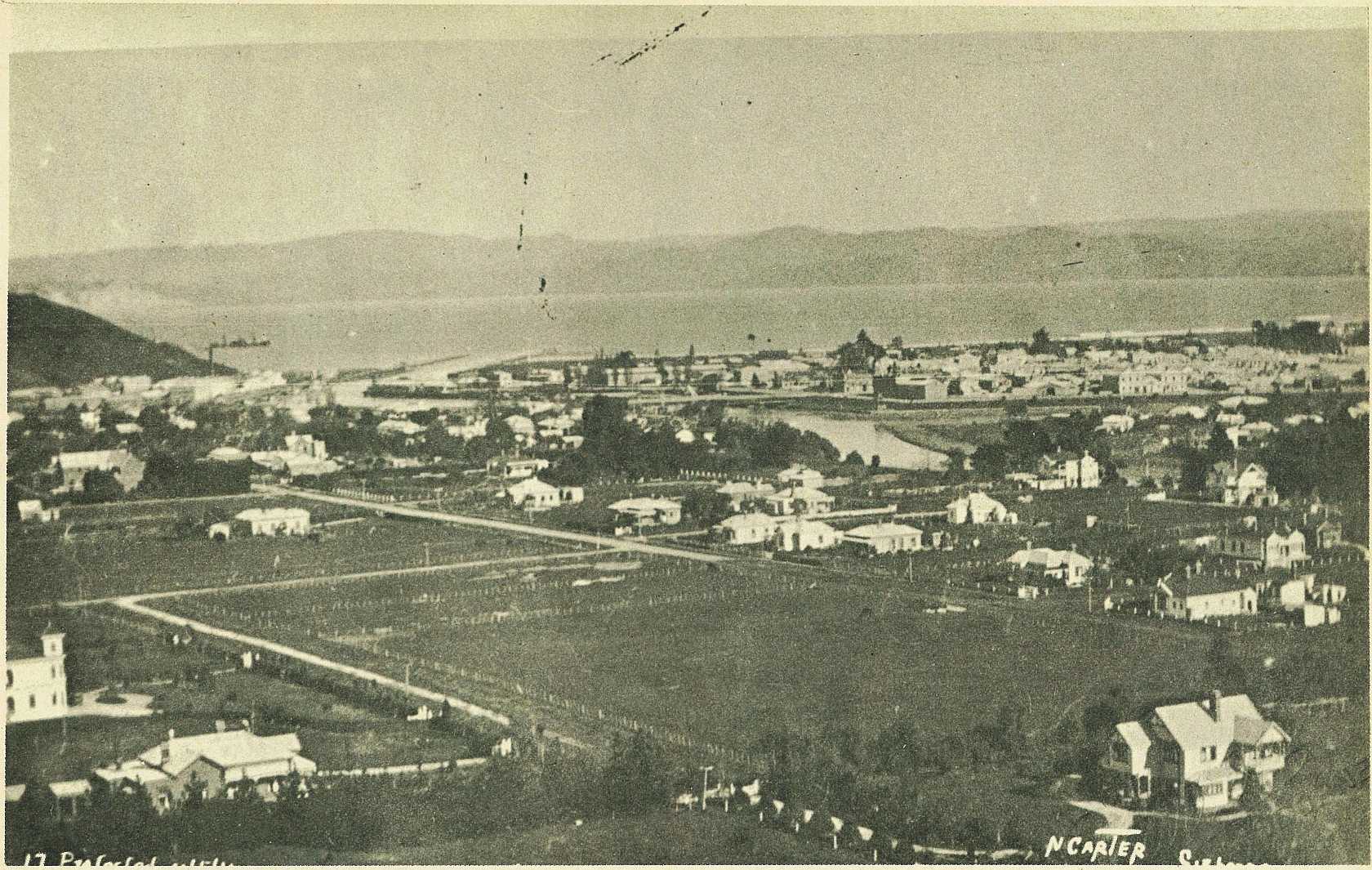
The northern corner of Kaiti was a comparatively deserted area in 1911 when the view above was taken from the hill overlooking Riverside Road and the waimata River. In the right foreground is the Graham home, situated on the riverbank at the end of Haronga road, and traversing the picture is Harris street.
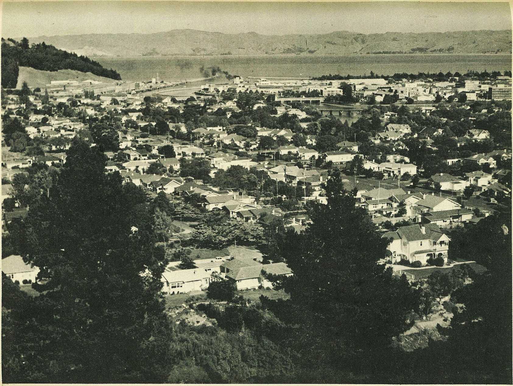
The view today, taken from the same spot, shows the extensive residential settlement of the area, and the considerable growth of trees. Many of the early homes are still evident in this present-day picture, as are some of the buildings in Reads Quay on the bank of the Taruheru River.
69

; void 0)
; void 0)
; void 0)
; void 0)
; void 0)
; void 0)