47
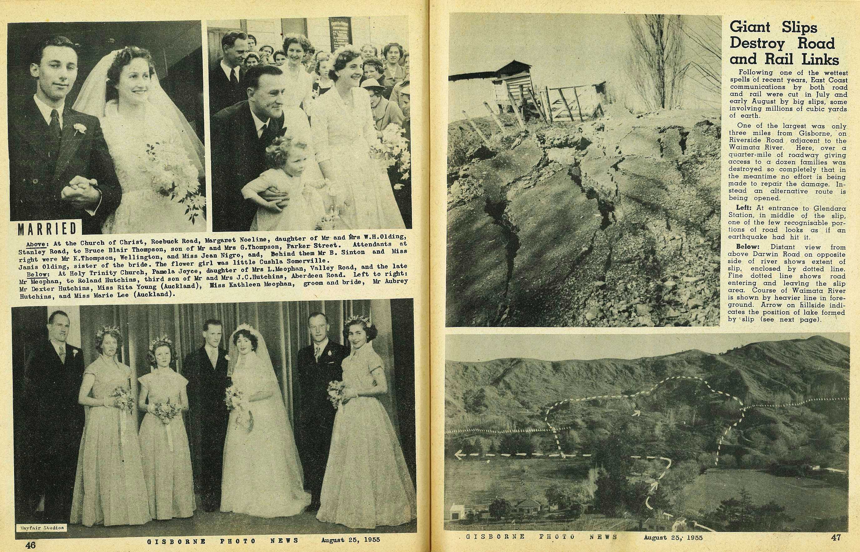
Giant Slips Destroy Road and Rail Links
Following one of the wettest spells of recent years. East Coast communications by both road and rail were cut in July and early August by big slips, some involving millions of cubic yards of earth.
One of the largest was only three miles from Gisborne, on Riverside Road adjacent to the Waimata River. Here, over a quarter-mile of roadway giving access to a dozen families was destroyed so completely that in the meantime no effort is being made to repair the damage. Instead an alternative route is being opened.
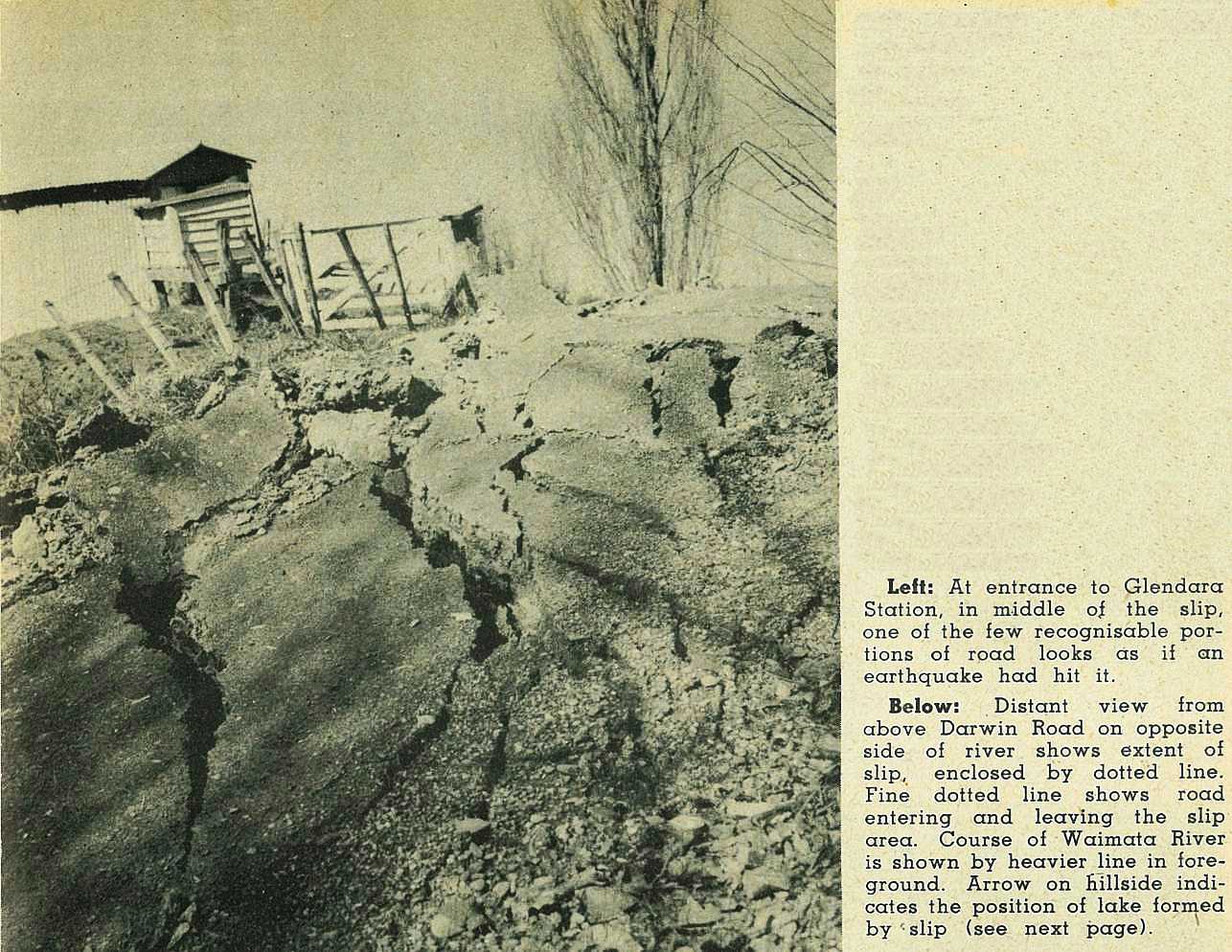
At entrance to Glendara Station, in middle of the slip, one of the few recognisable portions of road looks as if an earthquake had hit it.
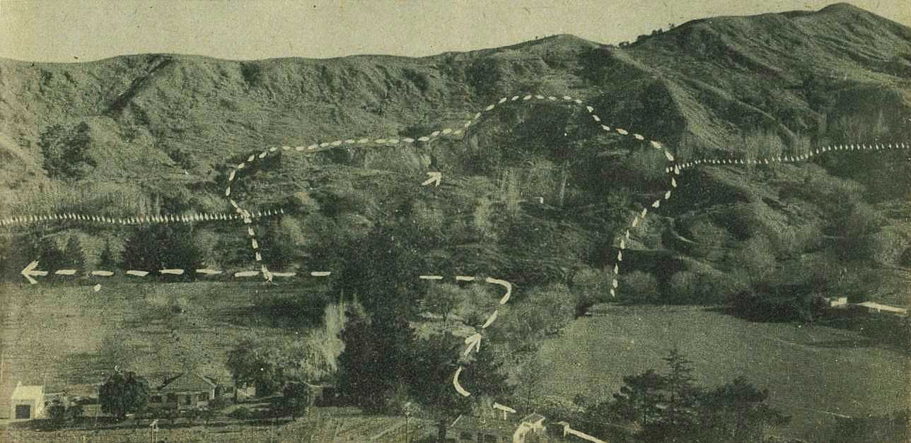
Distant view from above Darwin Road on opposite side of river shows extent of slip, enclosed by dotted line. Fine dotted line shows road entering and leaving the slip area. Course of Waimata River is shown by heavier line in foreground. Arrow on hillside indicates the position of lake formed by slip (see next page).

; void 0)
; void 0)
; void 0)
.\r\n\r\nGisborne Photo News - No 14 : August 25, 1955'); void 0)
.\r\n\r\nGisborne Photo News - No 14 : August 25, 1955'); void 0)
.\r\n\r\nGisborne Photo News - No 14 : August 25, 1955'); void 0)