6
In Wake of Snow, Flooded Rivers Spill Over Flats
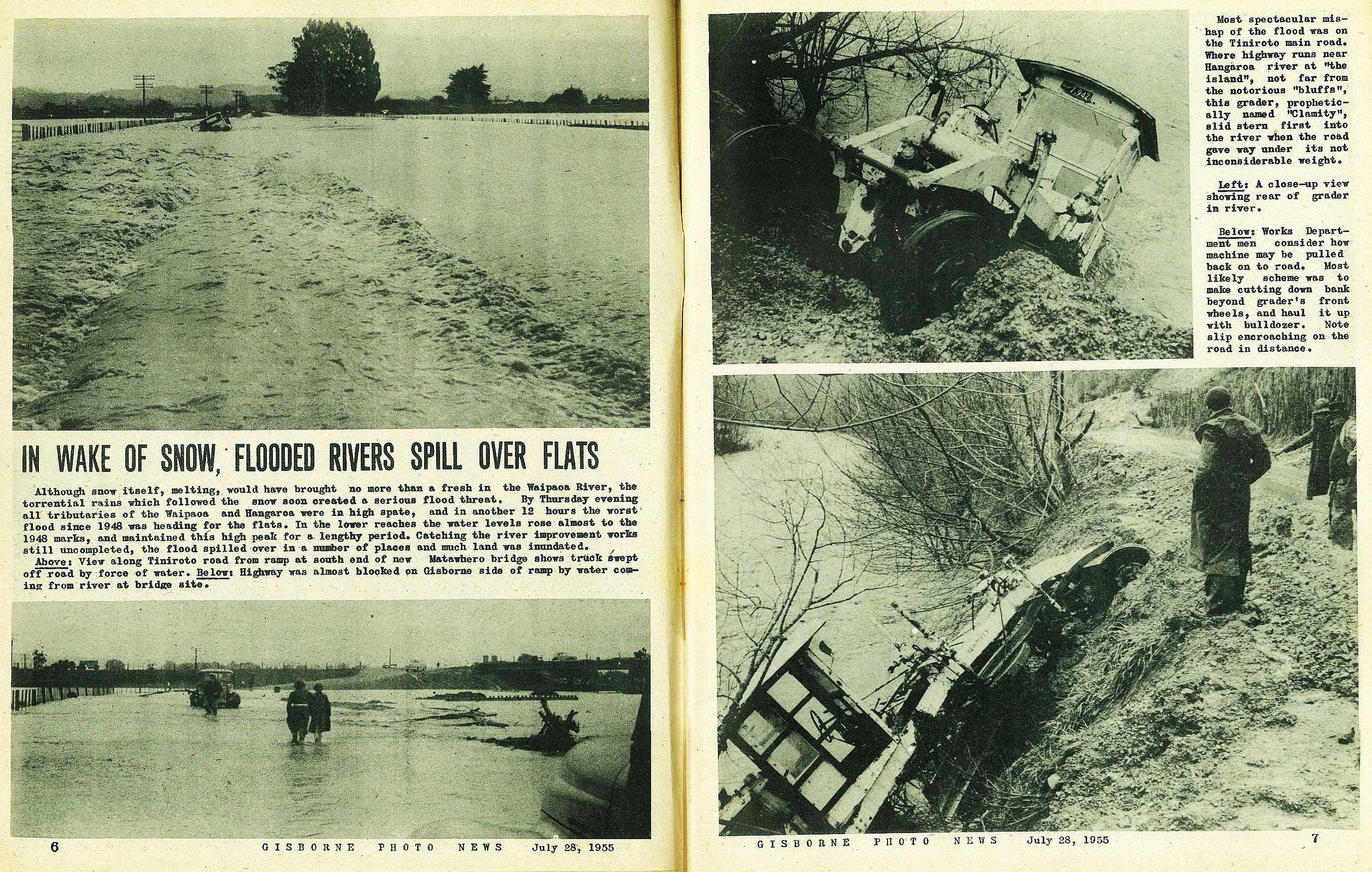
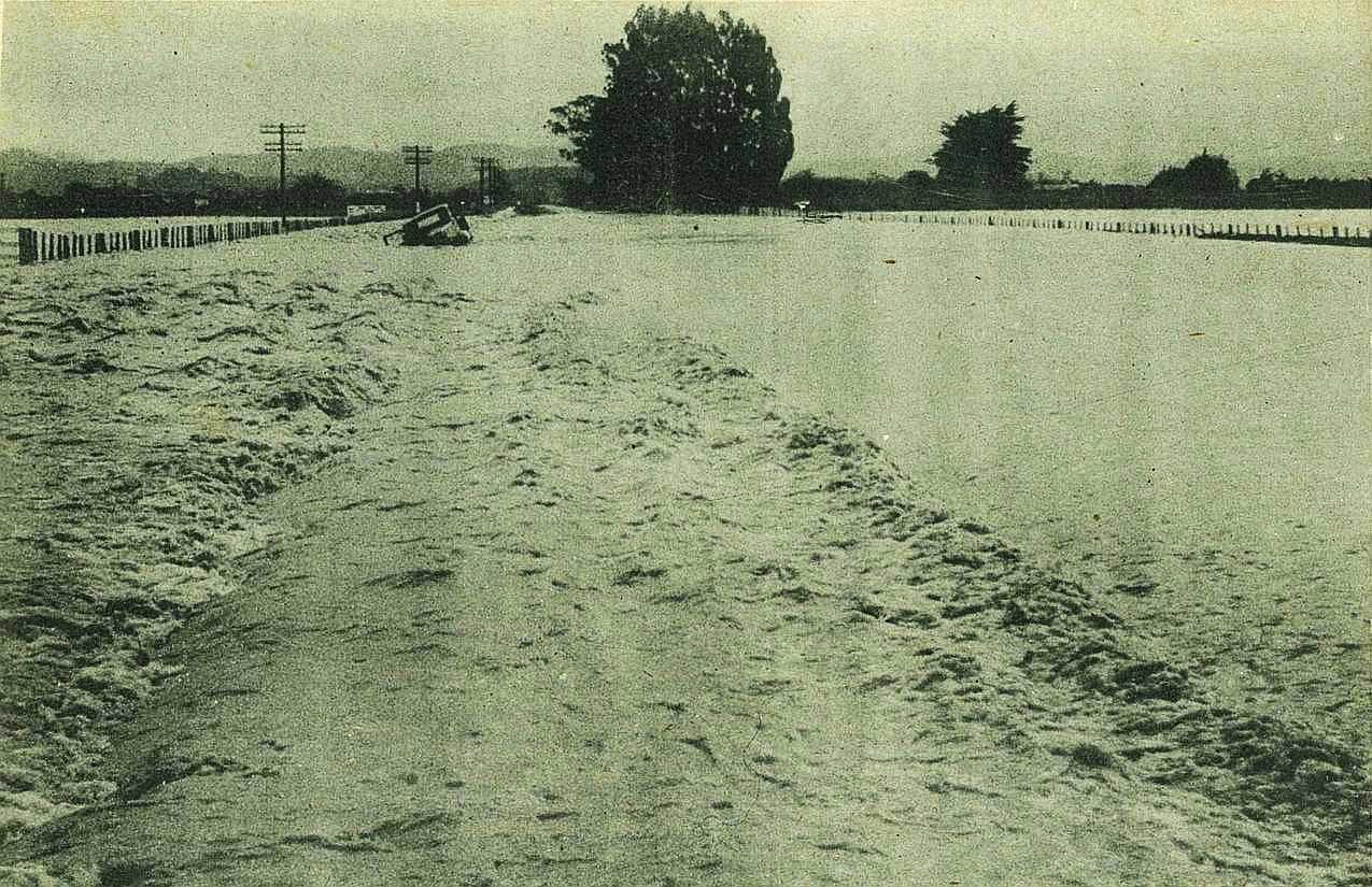
Although snow itself, melting, would have brought no more than a fresh in the Waipaoa River, the torrential rains which followed the snow soon created a serious flood threat. By Thursday evening all tributaries of the Waipaoa and Hangaroa were in high spate, and in another 12 hours the worst' flood since 1948 was heading for the flats. In the lower reaches the water levels rose almost to the 1948 marks, and maintained this high peak for a lengthy period. Catching the river improvement works still uncompleted, the flood spilled over in a number of places and much land was inundated.
7
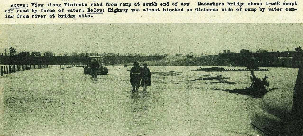
Most spectacular mishap of the flood was on the Tiniroto main road. Where highway runs near Hangaroa river at "the island", not far from the notorious "bluffs", this grader, prophetically named "Clamity", slid stern first into the river when the road gave way under its not inconsiderable weight.

8
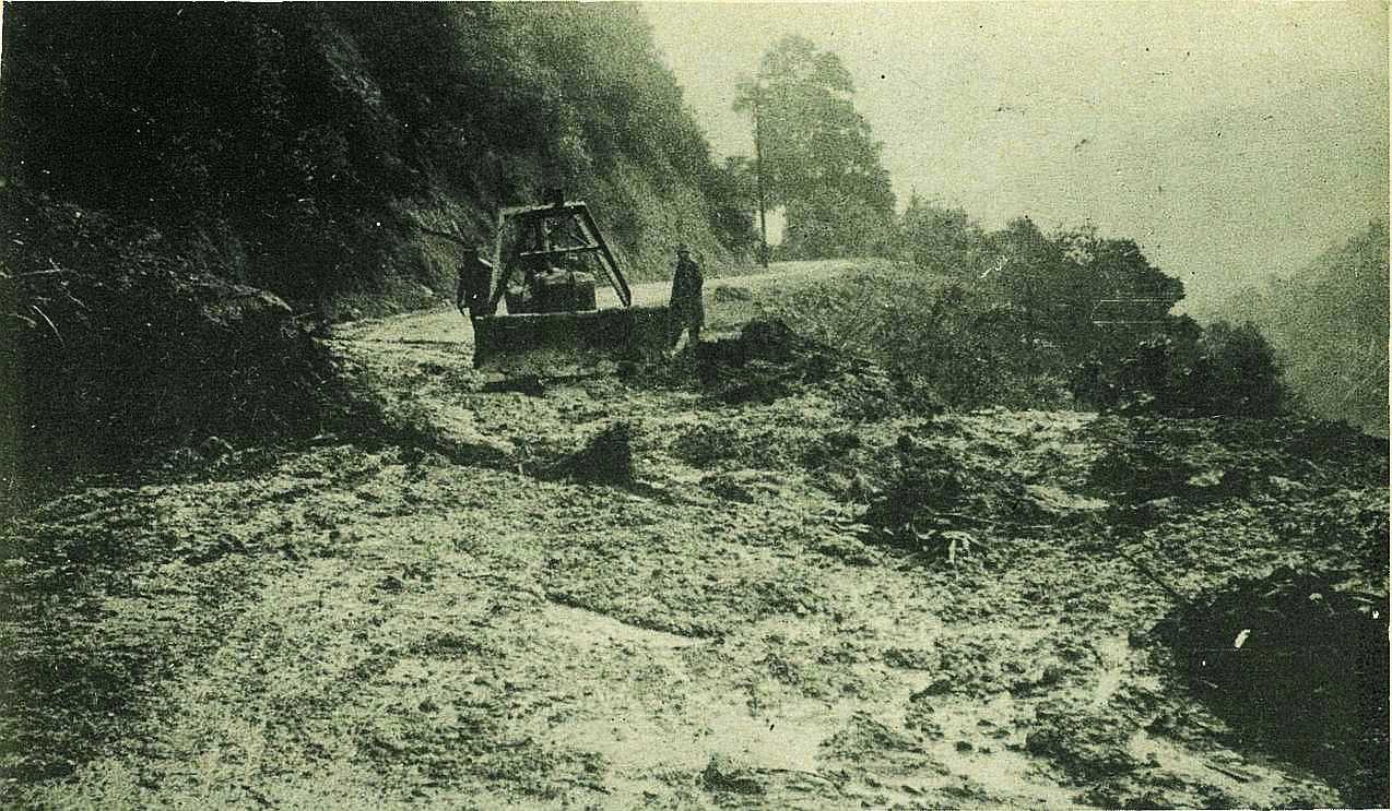
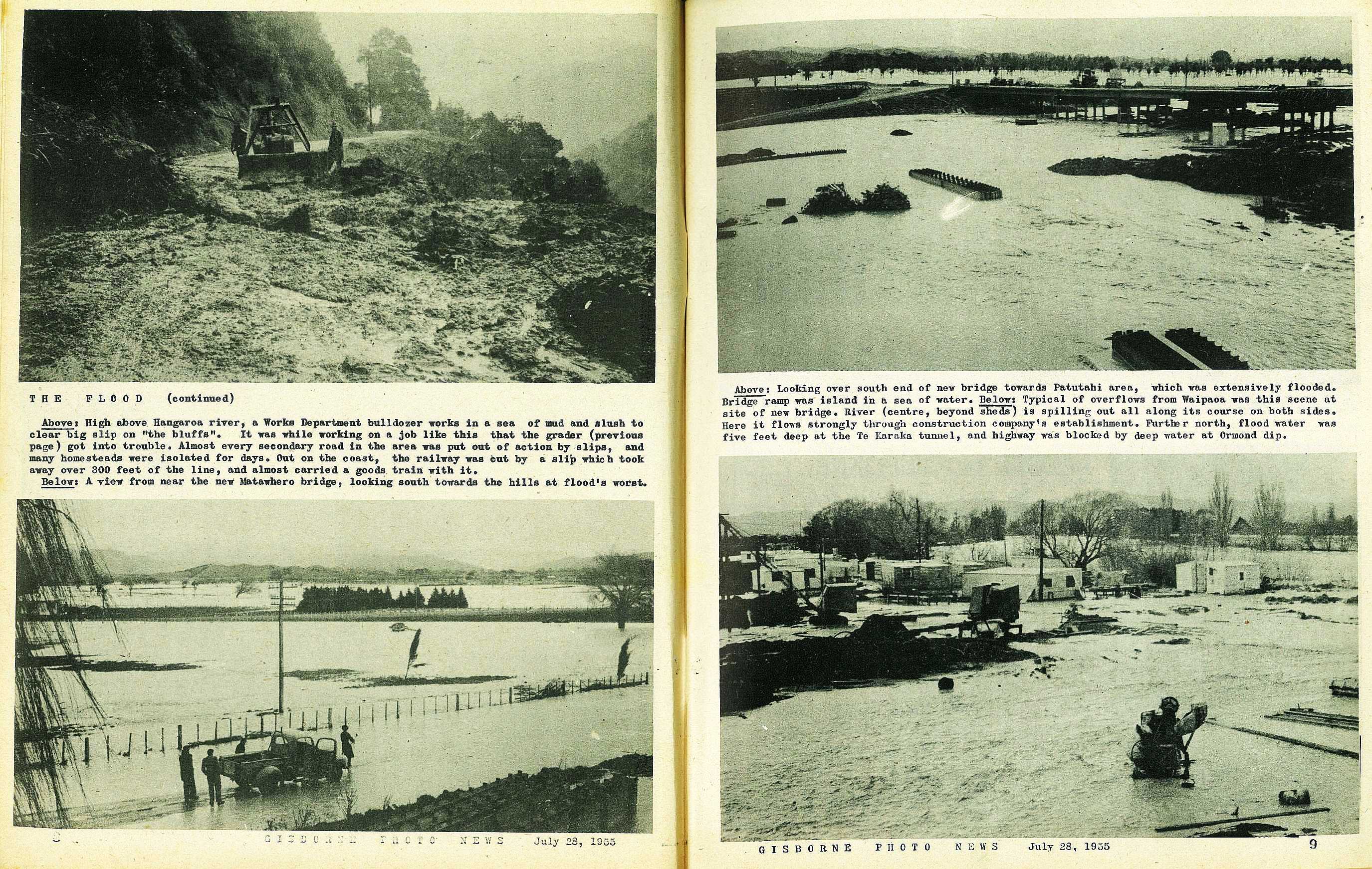
High above Hangaroa river, a Works Department bulldozer works in a sea of mud and slush to clear big slip on "the bluffs". It was while working on a job like this that the grader (previous page) got into trouble. Almost every secondary road in the area was put out of action by slips, and many homesteads were isolated for days. Out on the coast, the railway was cut by a slip which took away over 300 feet of the line, and almost carried a goods train with it.
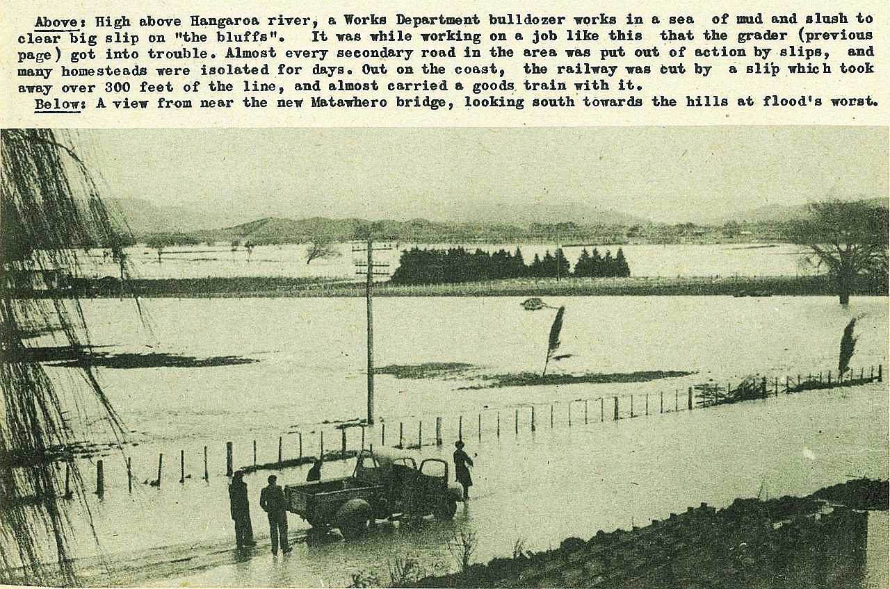
A view from near the new Matawhero bridge, looking south towards the hills at flood's worst.
9
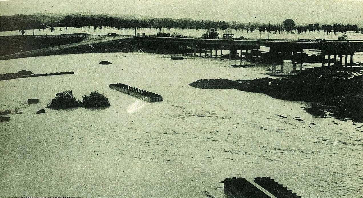
Looking over south end of new bridge towards Patutahi area, which was extensively flooded. Bridge ramp was island in a sea of water.
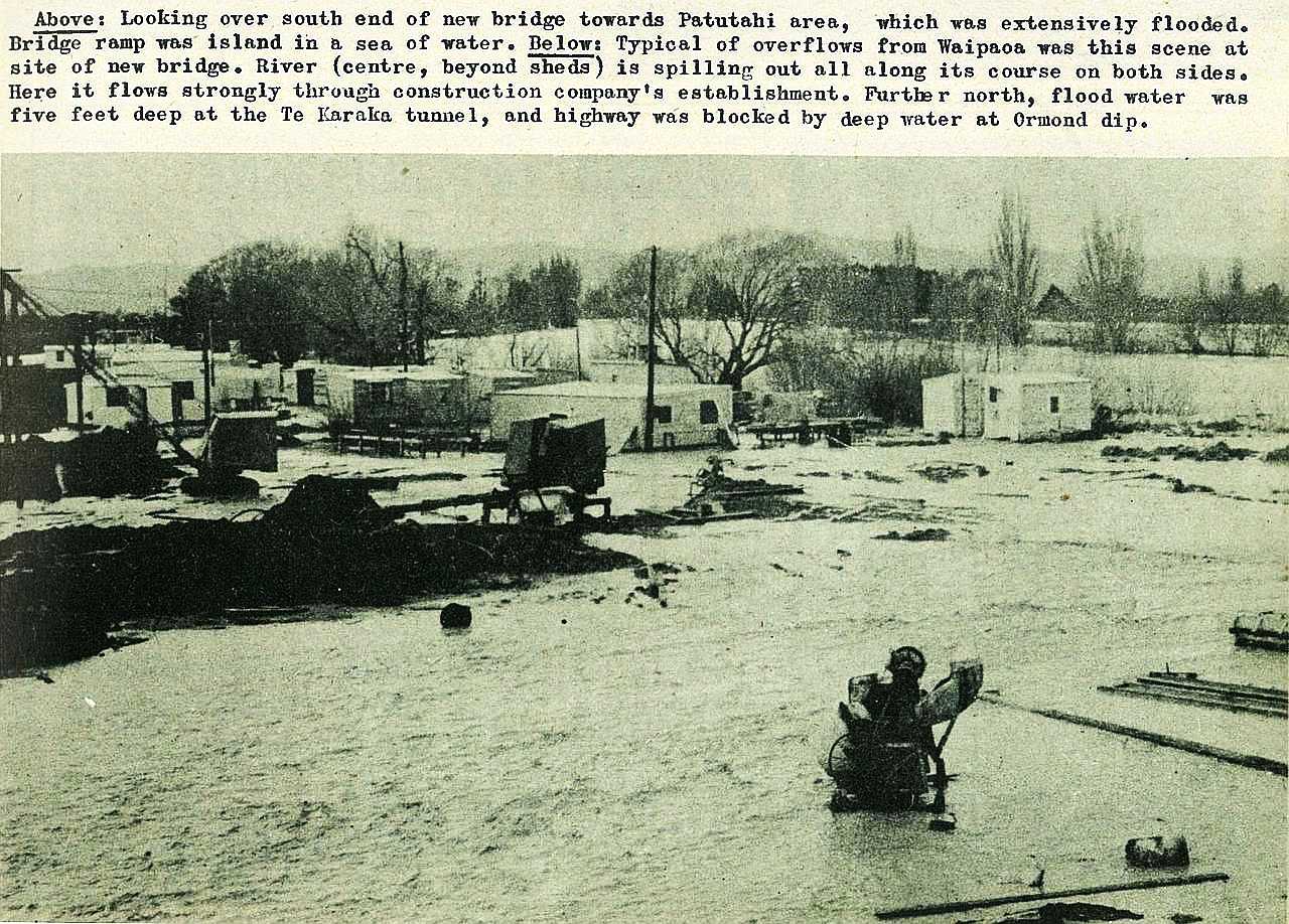
Typical of overflows from Waipaoa was this scene at site of new bridge. River (centre, beyond sheds) is spilling out all along its course on both sides. Here it flows strongly through construction company's establishment. Further north, flood water was five feet deep at the Te Karaka tunnel, and highway was blocked by deep water at Ormond dip.

; void 0)
; void 0)
; void 0)
; void 0)
; void 0)
; void 0)
; void 0)
; void 0)
; void 0)
; void 0)
; void 0)
; void 0)
 got into trouble. Almost every secondary road in the area was put out of action by slips, and many homesteads were isolated for days. Out on the coast, the railway was cut by a slip which took away over 300 feet of the line, and almost carried a goods train with it.\r\n\r\n - No 13 : July 28, 1955'); void 0)
 got into trouble. Almost every secondary road in the area was put out of action by slips, and many homesteads were isolated for days. Out on the coast, the railway was cut by a slip which took away over 300 feet of the line, and almost carried a goods train with it.\r\n\r\n - No 13 : July 28, 1955'); void 0)
 got into trouble. Almost every secondary road in the area was put out of action by slips, and many homesteads were isolated for days. Out on the coast, the railway was cut by a slip which took away over 300 feet of the line, and almost carried a goods train with it.\r\n\r\n - No 13 : July 28, 1955'); void 0)
; void 0)
; void 0)
; void 0)
; void 0)
; void 0)
; void 0)
 is spilling out all along its course on both sides. Here it flows strongly through construction companys establishment. Further north, flood water was five feet deep at the Te Karaka tunnel, and highway was blocked by deep water at Ormond dip.\r\n\r\n - No 13 : July 28, 1955'); void 0)
 is spilling out all along its course on both sides. Here it flows strongly through construction companys establishment. Further north, flood water was five feet deep at the Te Karaka tunnel, and highway was blocked by deep water at Ormond dip.\r\n\r\n - No 13 : July 28, 1955'); void 0)
 is spilling out all along its course on both sides. Here it flows strongly through construction companys establishment. Further north, flood water was five feet deep at the Te Karaka tunnel, and highway was blocked by deep water at Ormond dip.\r\n\r\n - No 13 : July 28, 1955'); void 0)