15
It Follows a Tortuous Route for Thirty Miles
Some fortunate towns get their water easy. Some, like Gisborne, get it the hard way. Behind the jet of water which issues from the kitchen tap of a Gisborne household, there lies a long story of searching and scheming, planning and building over the years. It might be said that Gisborne will never have a first-class water supply, but with the latest development in that long story, the laying of the 21-inch pipeline to Waingake, the town can reasonably expect to have an ample supply of good water for many years to come.
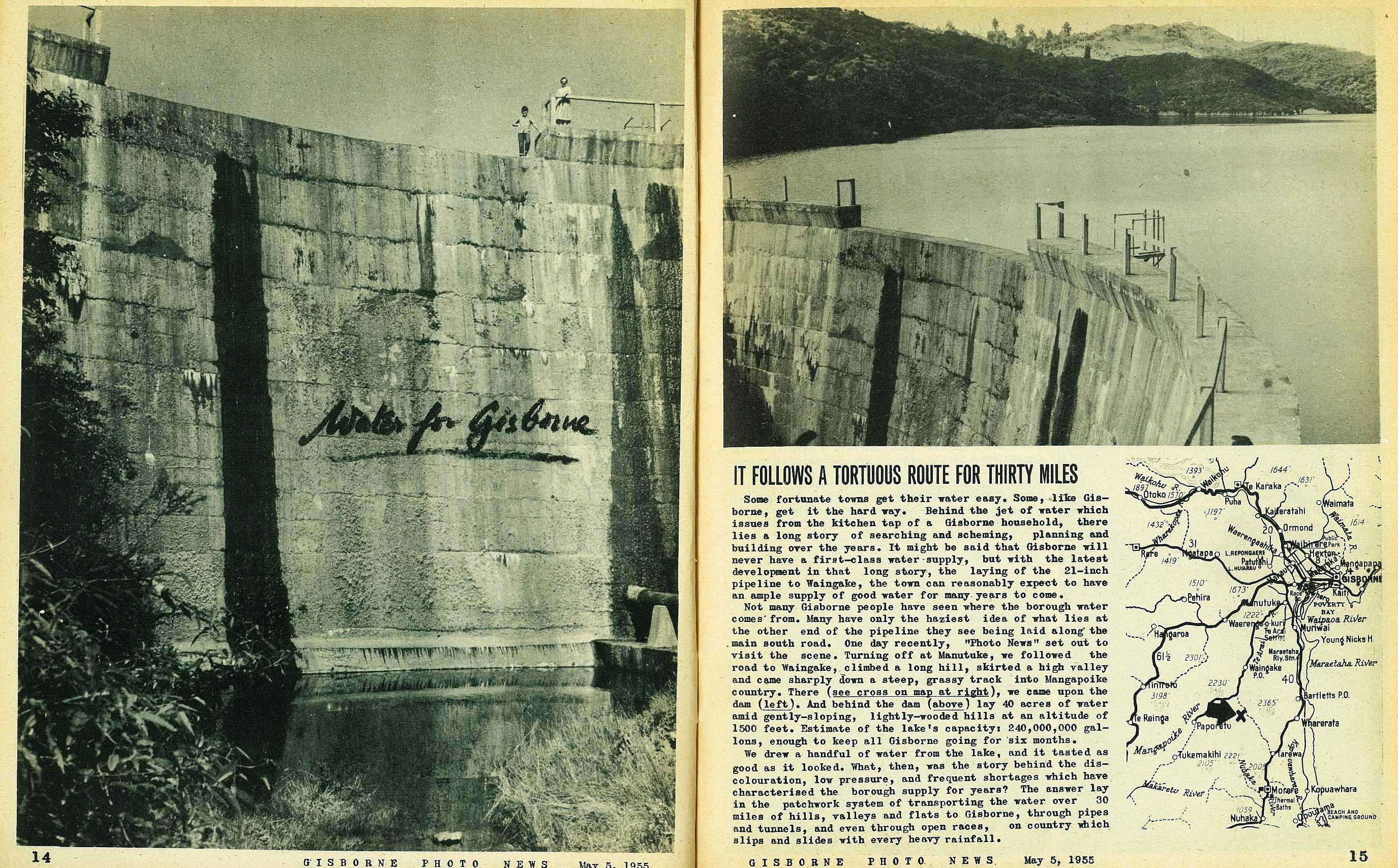
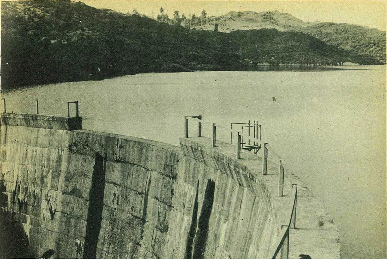
Not many Gisborne people have seen where the borough water comes from. Many have only the haziest idea of what lies at the other end of the pipeline they see being laid along the main south road. One day recently, "Photo News" set out to visit the scene. Turning off at Manutuke, we followed the road to Waingake, climbed a long hill, skirted a high valley and came sharply down a steep, grassy track into Mangapoike country. There (see cross on map at right)
16

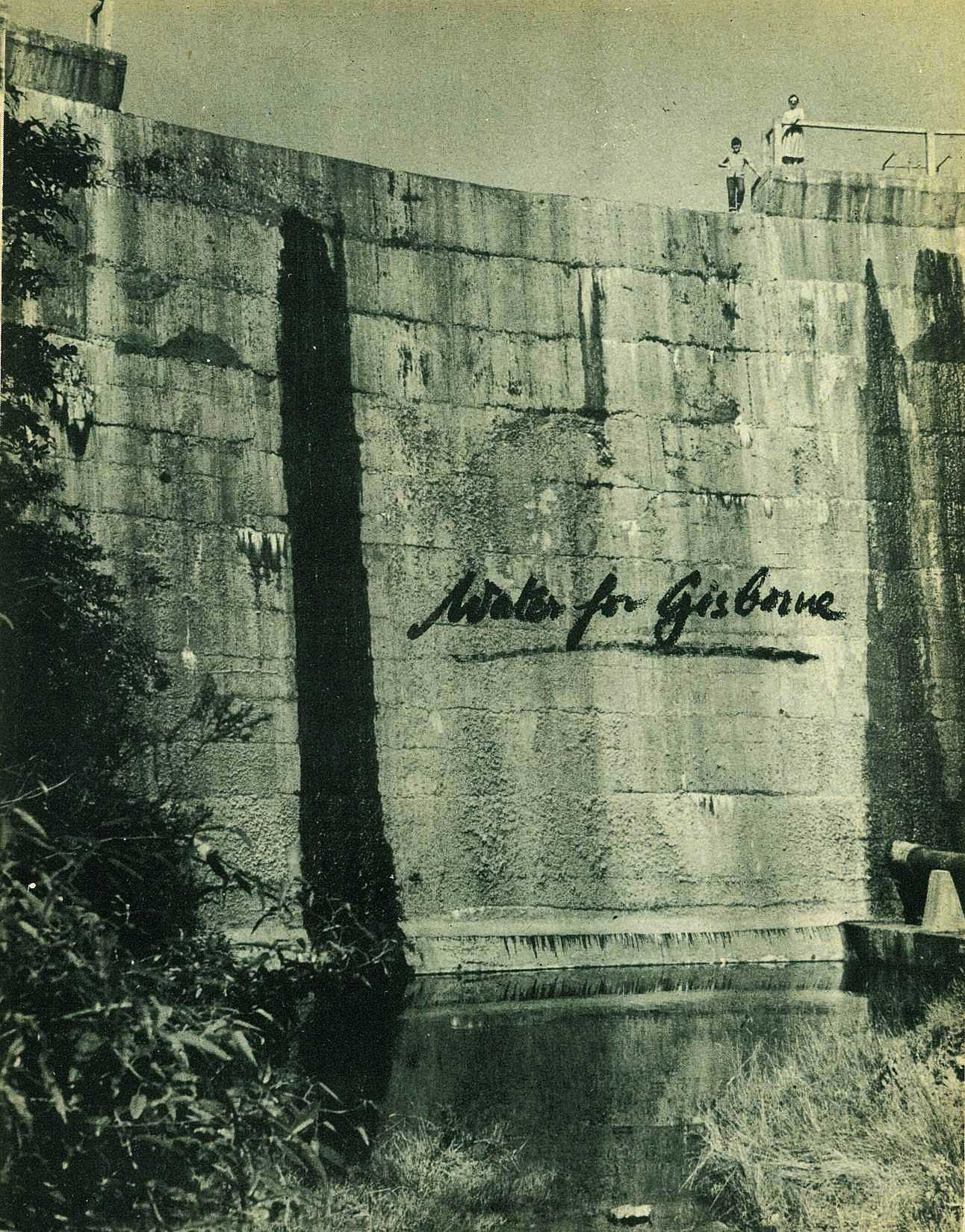
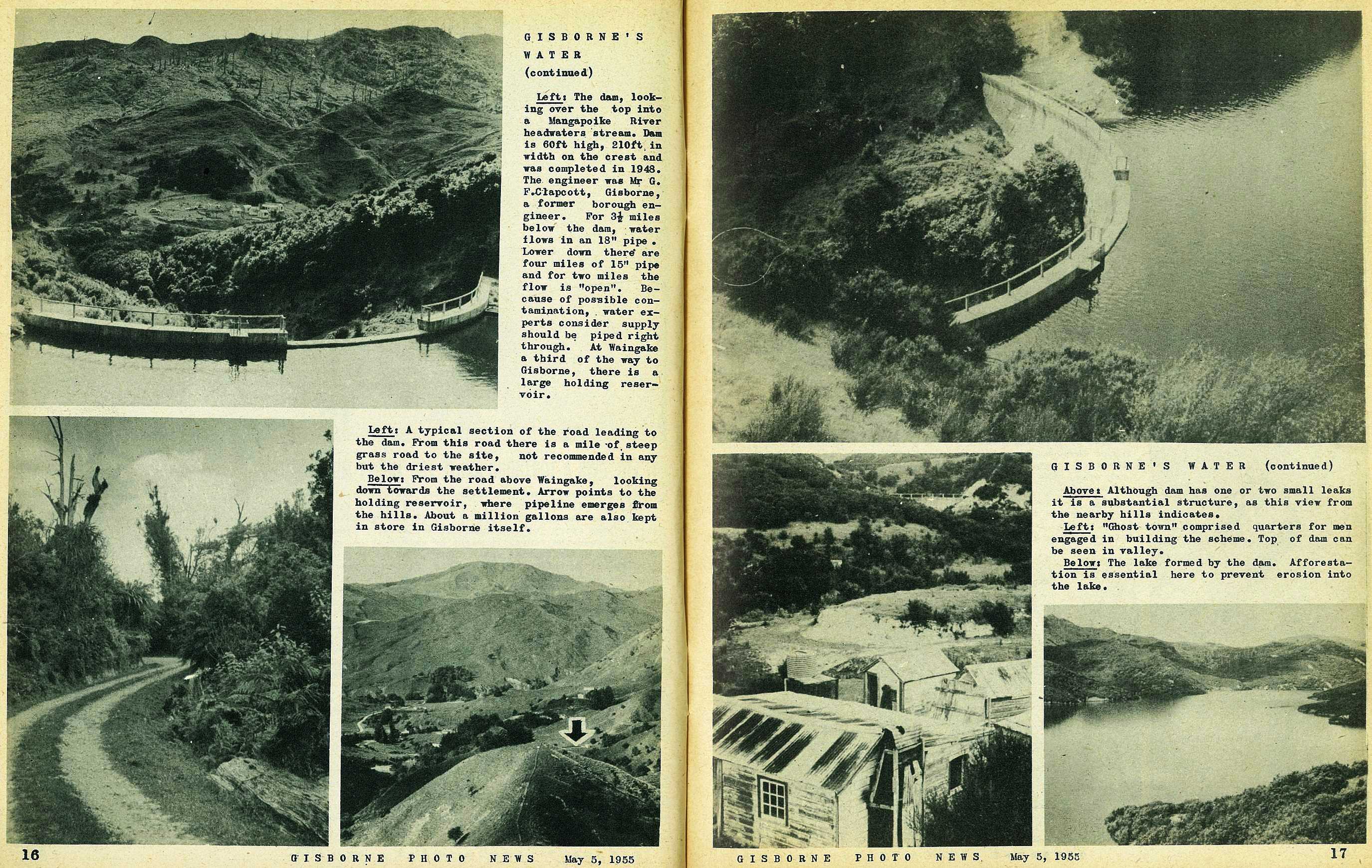
The dam, looking over the top into a Mangapoike River headwaters 'stream. Dam is 60ft high, 210ft in width on the crest and was completed in 1948. The engineer was Mr G. F. Clapcoott, Gisborne, a former borough engineer. For 3½ miles below the dam, water flows in an 18" pipe • Lower down there are four miles of 15" pipe and for two miles the flow is "open". Because of possible contamination, water experts consider supply should be piped right through. At Waingake a third of the way to Gisborne, there is a large holding reservoir.
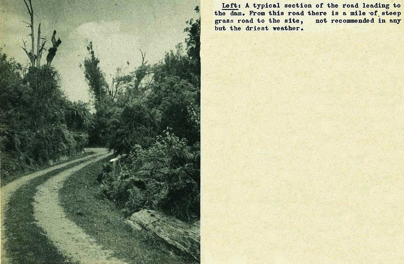
A typical section of the road leading to the dam. From this road there is a mile of, steep grass road to the site, not recommended in any but the driest weather.
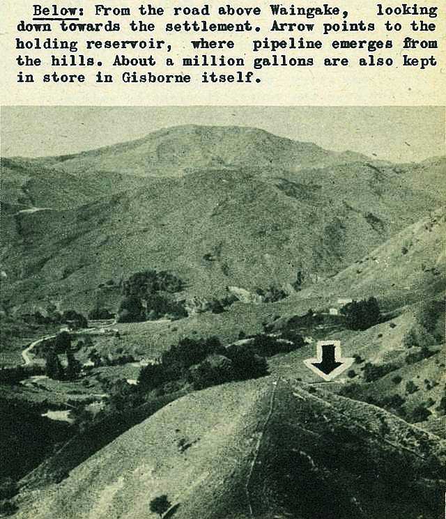
From the road above Waingake, looking down towards the settlement. Arrow points to the holding reservoir, where pipeline emerges from the hills. About a million gallons are also kept in store in Gisborne itself.
17
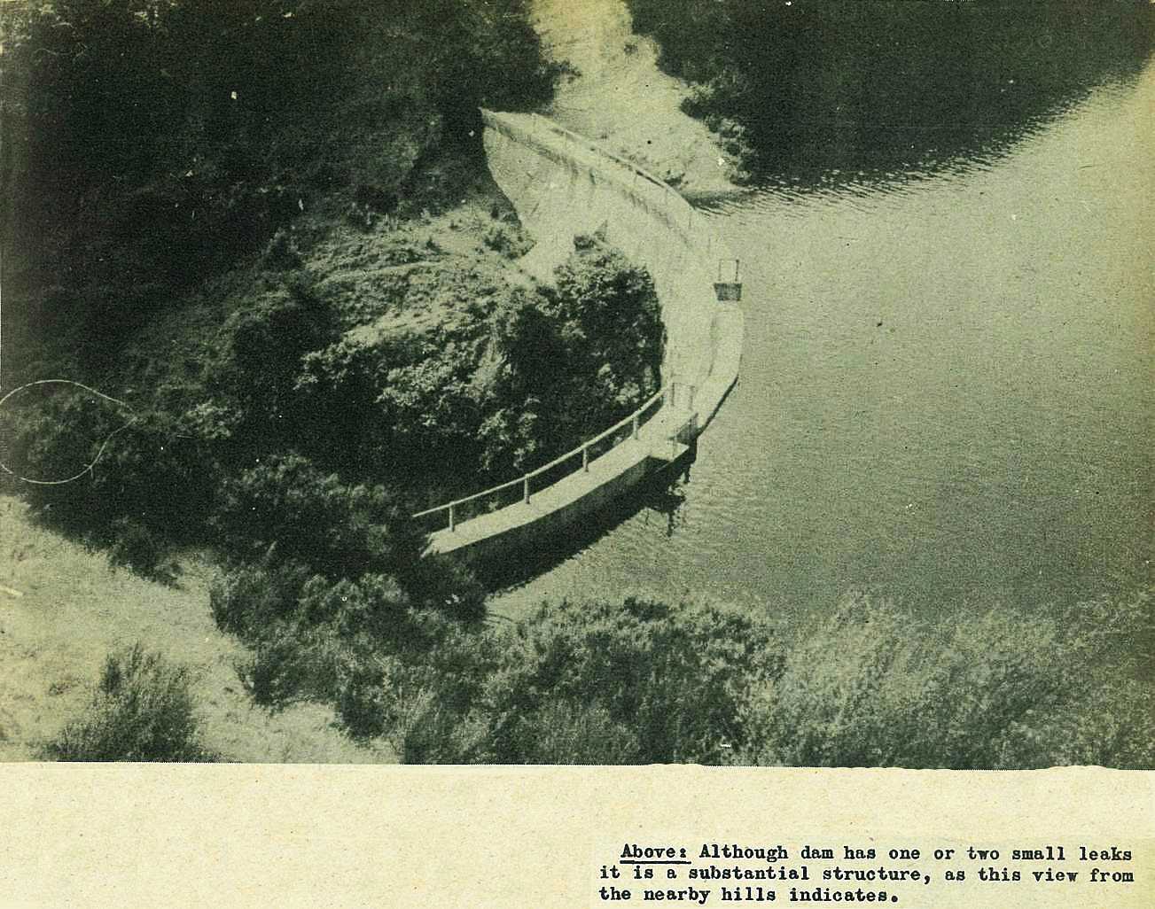
Although dam has one or two small leaks it is a substantial structure, as this view from the nearby hills indicates.
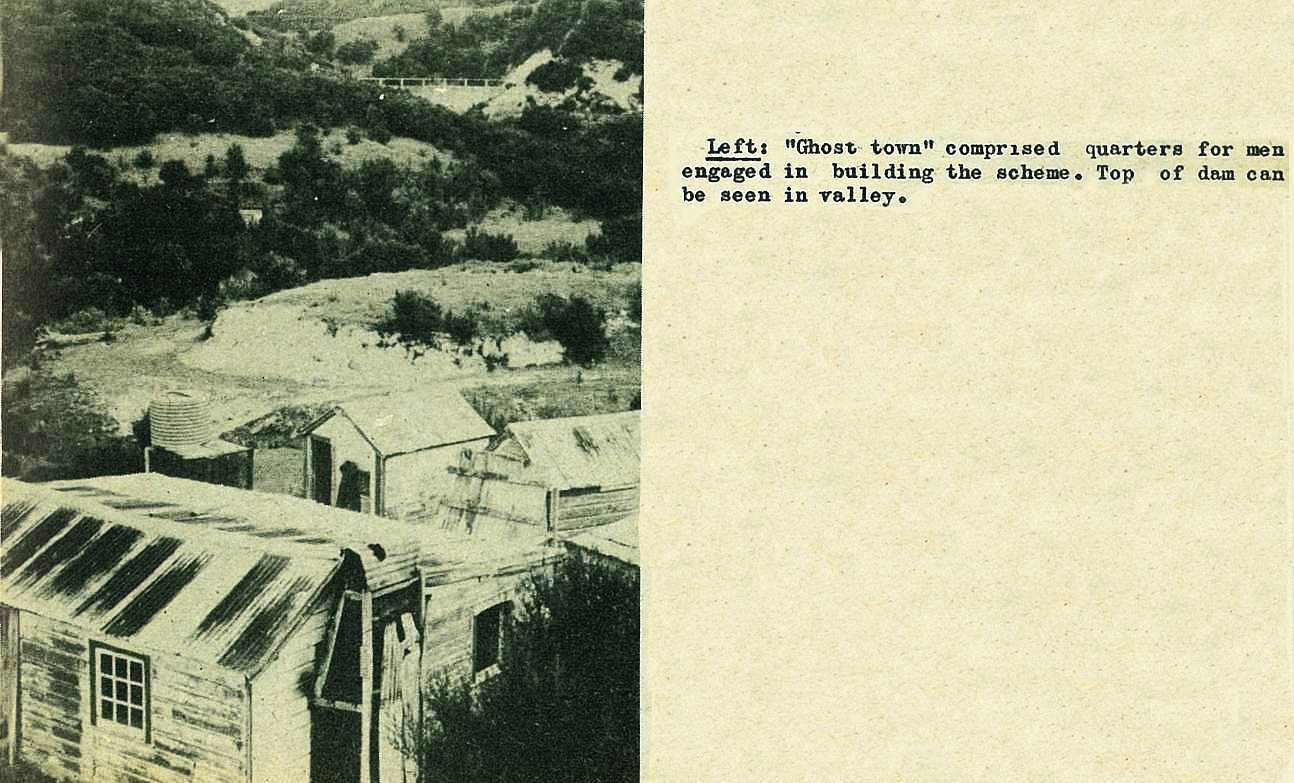
"Ghost town" comprised quarters for men engaged in building the scheme. Top of dam can be seen in valley.
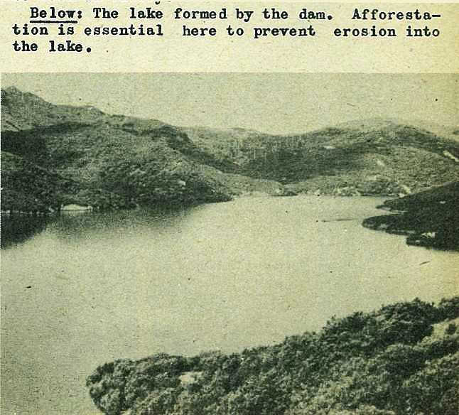
The lake formed by the dam. Afforestation is essential here to prevent erosion into the lake.
18
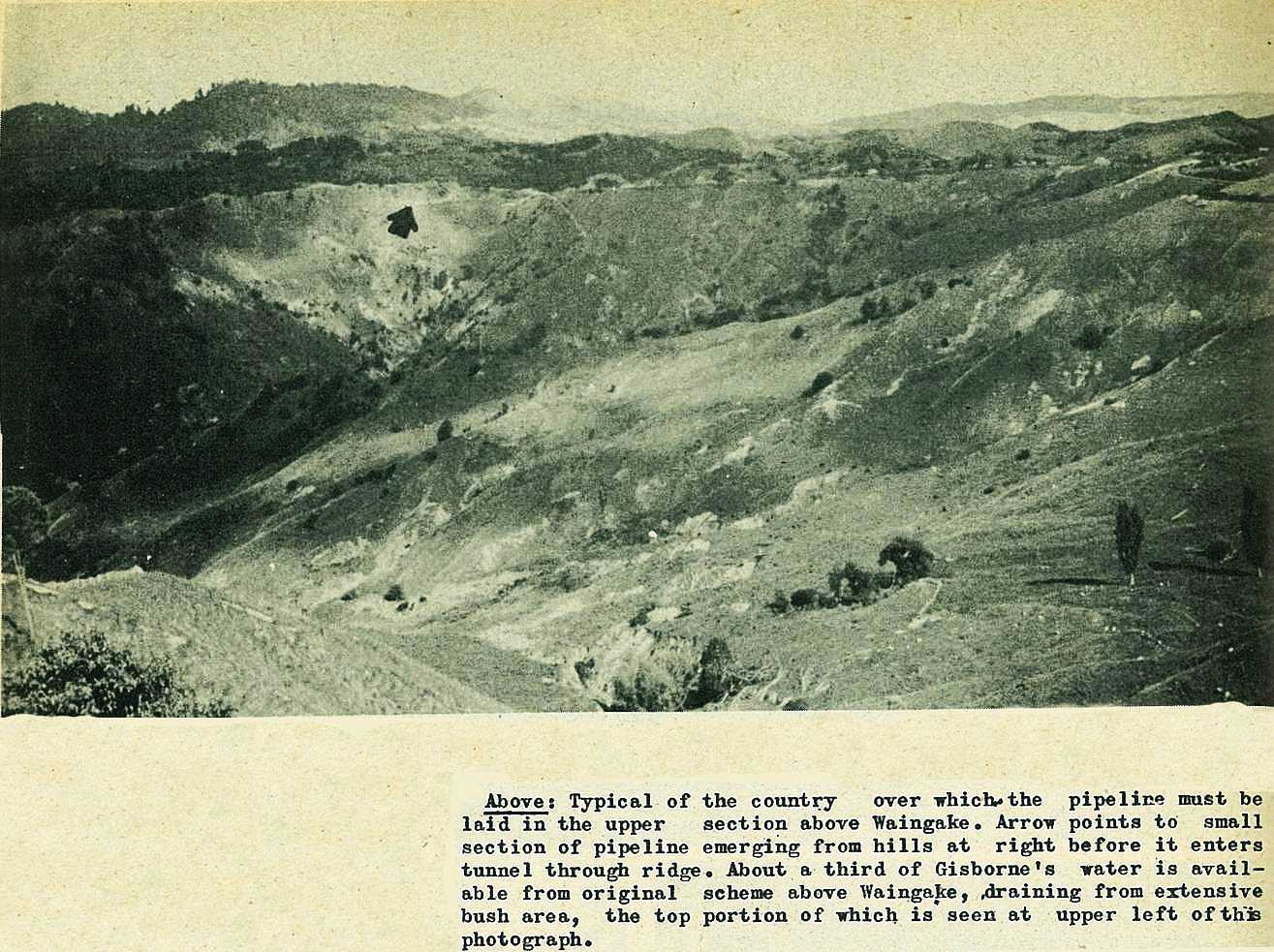
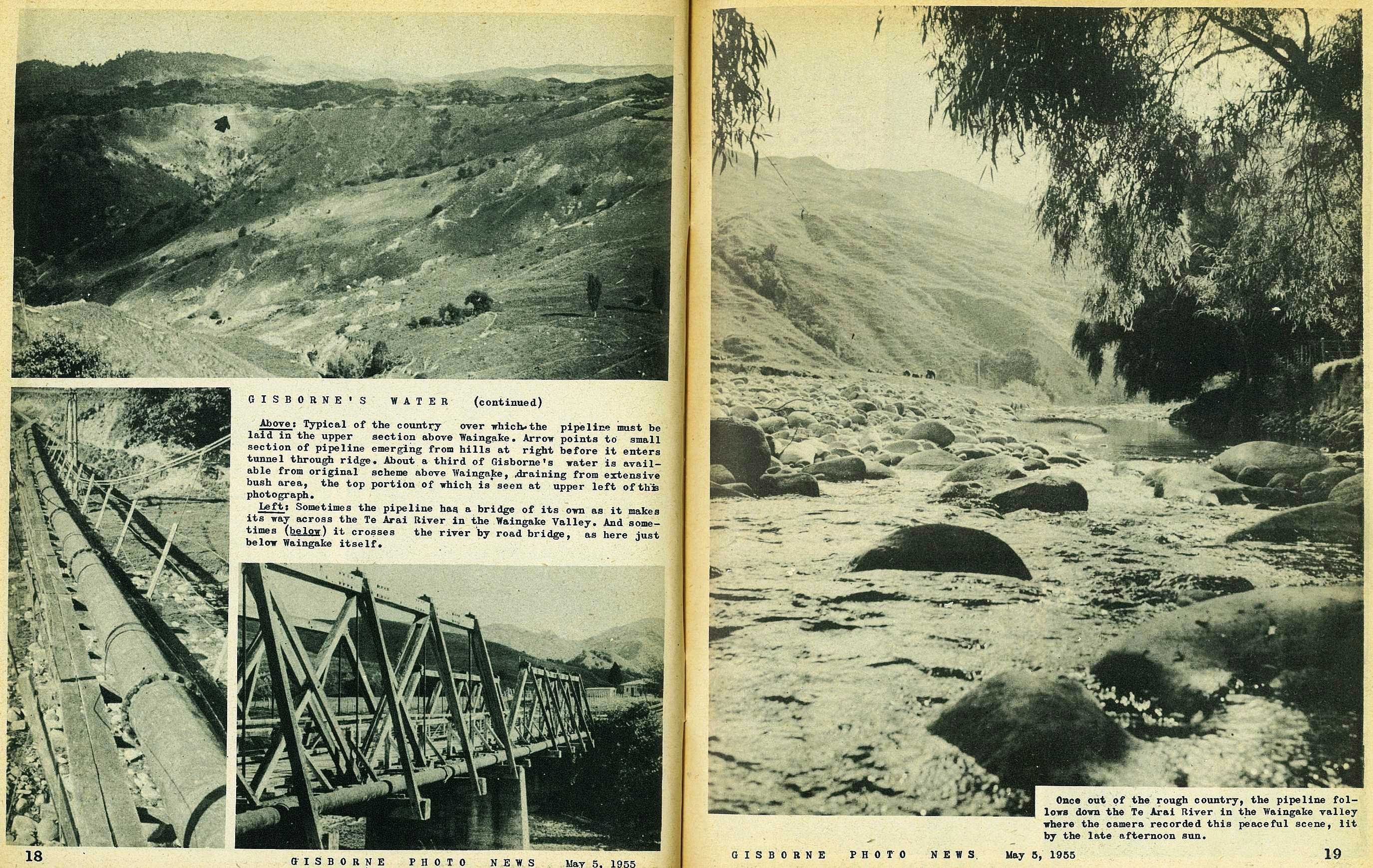
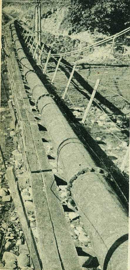
Typical of the country over which the pipeline must be laid in the upper section above Waingake. Arrow points to small section of pipeline emerging from hills at right before it enters tunnel through ridge. About a third of Gisborne's water is available from original scheme above Waingake, draining from extensive bush area, the top portion of which is seen at upper left of this photograph.
Sometimes the pipeline has. a bridge of its own as it makes its way across the Te Arai River in the Waingake Valley.
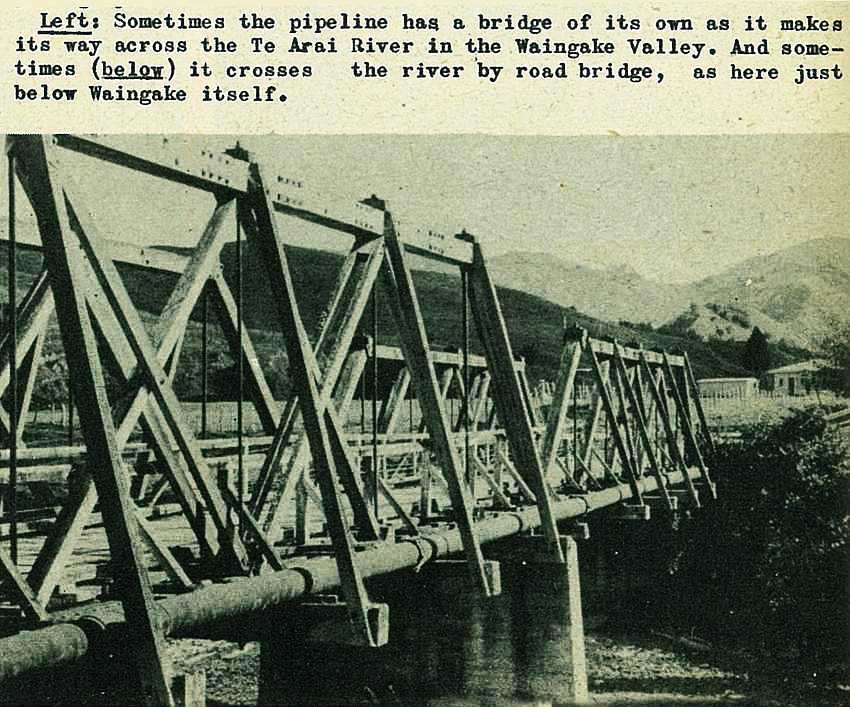
And sometimes it crosses the river by road bridge, as here just below Waingake itself.
19
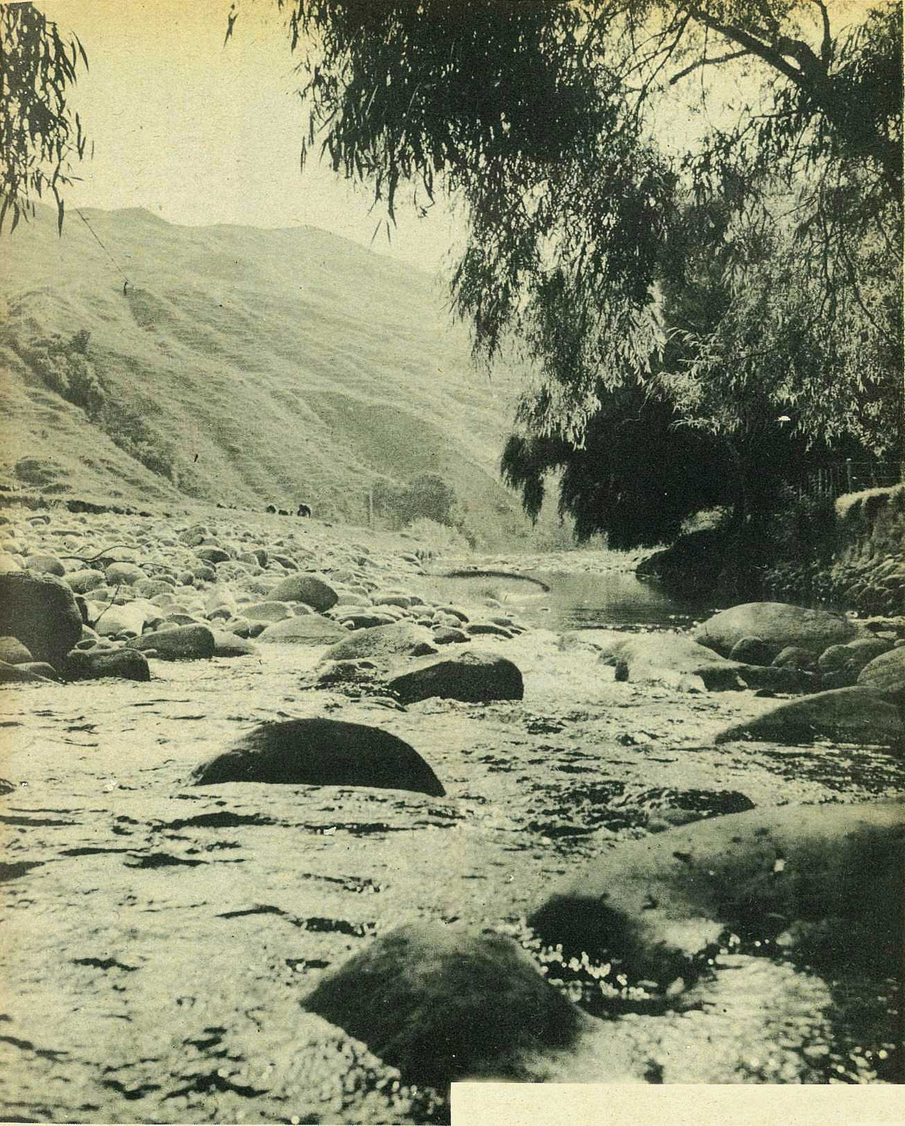
Once out of the rough country, the pipeline follows down the Te Arai River in the Waingake valley where the camera recorded this peaceful scene, lit by the late afternoon sun.

; void 0)
; void 0)
; void 0)
 lay 40 acres of water amid gently-sloping, lightly-wooded hills at an altitude of 1500 feet. Estimate of the lakes capacity: 240,000,000 gallons, enough to keep all Gisborne going for six months.\r\n\r\nGisborne Photo News - No 10 : May 5, 1955'); void 0)
 lay 40 acres of water amid gently-sloping, lightly-wooded hills at an altitude of 1500 feet. Estimate of the lakes capacity: 240,000,000 gallons, enough to keep all Gisborne going for six months.\r\n\r\nGisborne Photo News - No 10 : May 5, 1955'); void 0)
 lay 40 acres of water amid gently-sloping, lightly-wooded hills at an altitude of 1500 feet. Estimate of the lakes capacity: 240,000,000 gallons, enough to keep all Gisborne going for six months.\r\n\r\nGisborne Photo News - No 10 : May 5, 1955'); void 0)
; void 0)
; void 0)
; void 0)
; void 0)
; void 0)
; void 0)
; void 0)
; void 0)
; void 0)
; void 0)
; void 0)
; void 0)
; void 0)
; void 0)
; void 0)
; void 0)
; void 0)
; void 0)
; void 0)
; void 0)
; void 0)
; void 0)
; void 0)
; void 0)
; void 0)
; void 0)
; void 0)
; void 0)
; void 0)
; void 0)
; void 0)
; void 0)
; void 0)