21
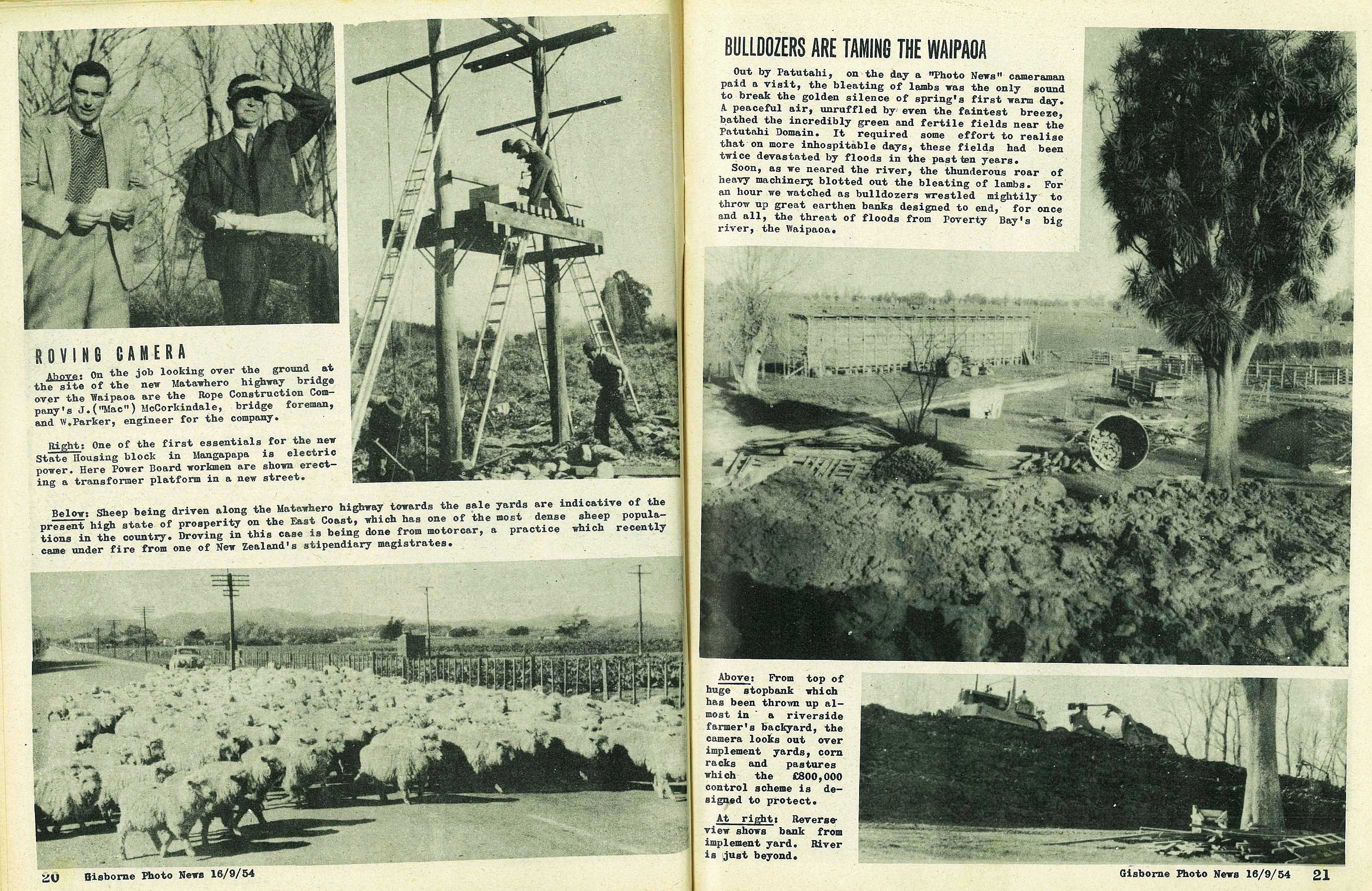
Bulldozers are Taming the Waipaoa
Out by Patutahi, on the day a "Photo News" cameraman paid a visit, the bleating of lambs was the only sound to break the golden silence of spring's first warm day. A peaceful air, unruffled by even the faintest breeze, bathed the incredibly green and fertile fields near the Patutahi Domain. It required some effort to realise that on more inhospitable days, these fields had been twice devastated by floods in the past ten years.
Soon, as we neared the river, the thunderous roar of heavy machinery blotted out the bleating of lambs. For an hour we watched as bulldozers wrestled mightily to throw up great earthen banks designed to end, for once and all, the threat of floods from Poverty Bay's big river, the waipaoa.
22
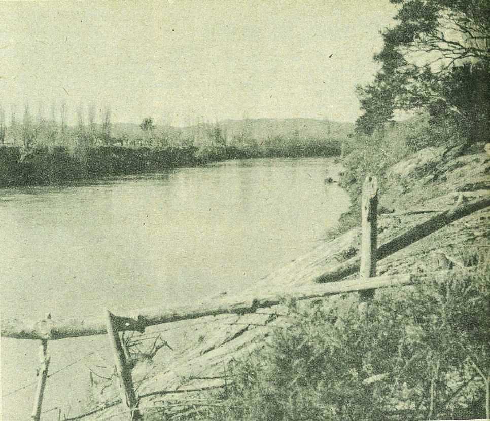
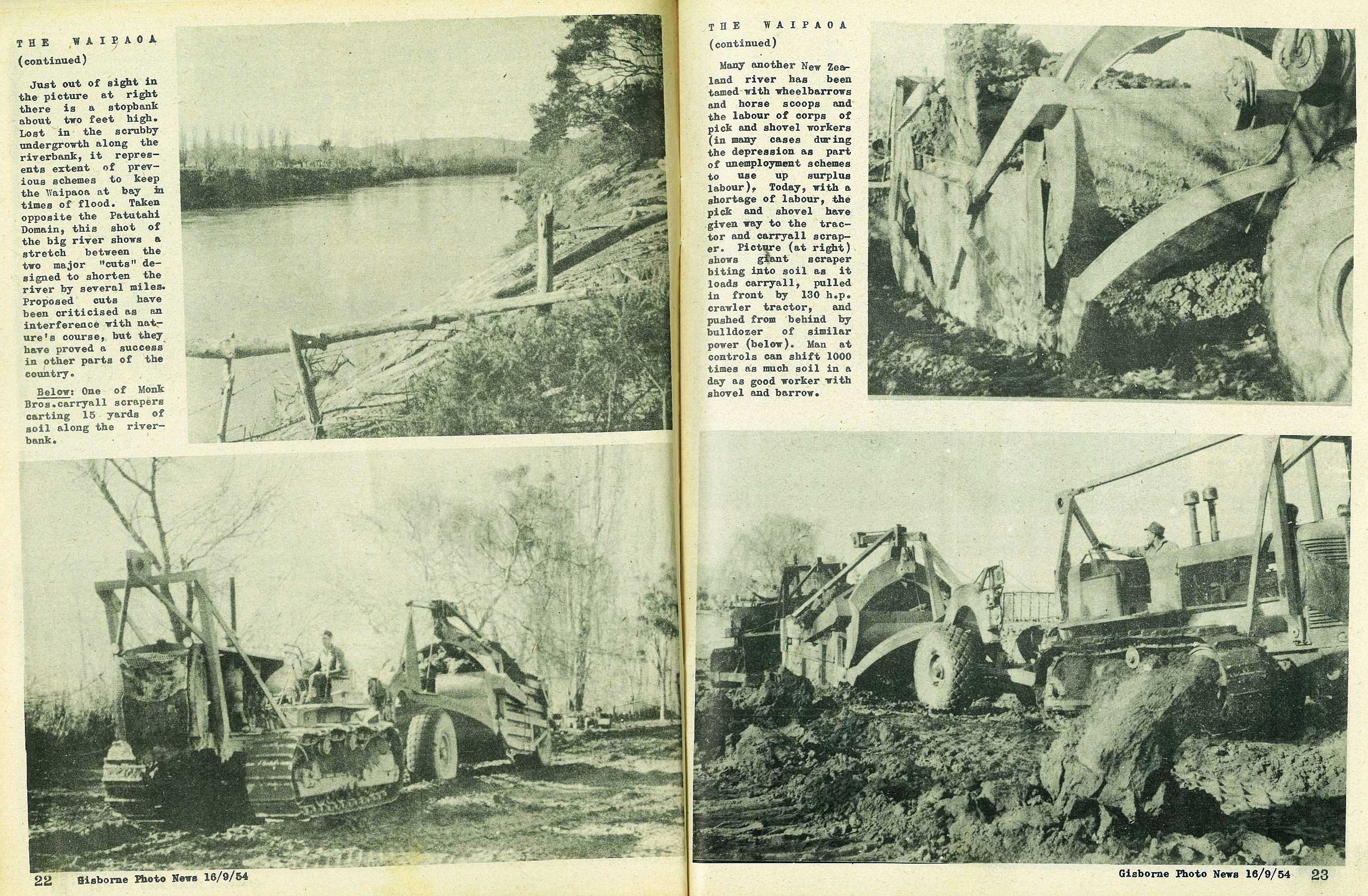
Just out of sight in the picture at right there is a stopbank about two feet high. Lost in the scrubby undergrowth along the riverbank, it represents extent of previous schemes to keep the Waipaoa at bay in times of flood. Taken opposite the Patutahi Domain, this shot of the big river shows a stretch between the two major "cuts" designed to shorten the river by several miles. Proposed cuts have been criticised as an interference with nature's course, but they have proved a success in other parts of the country.
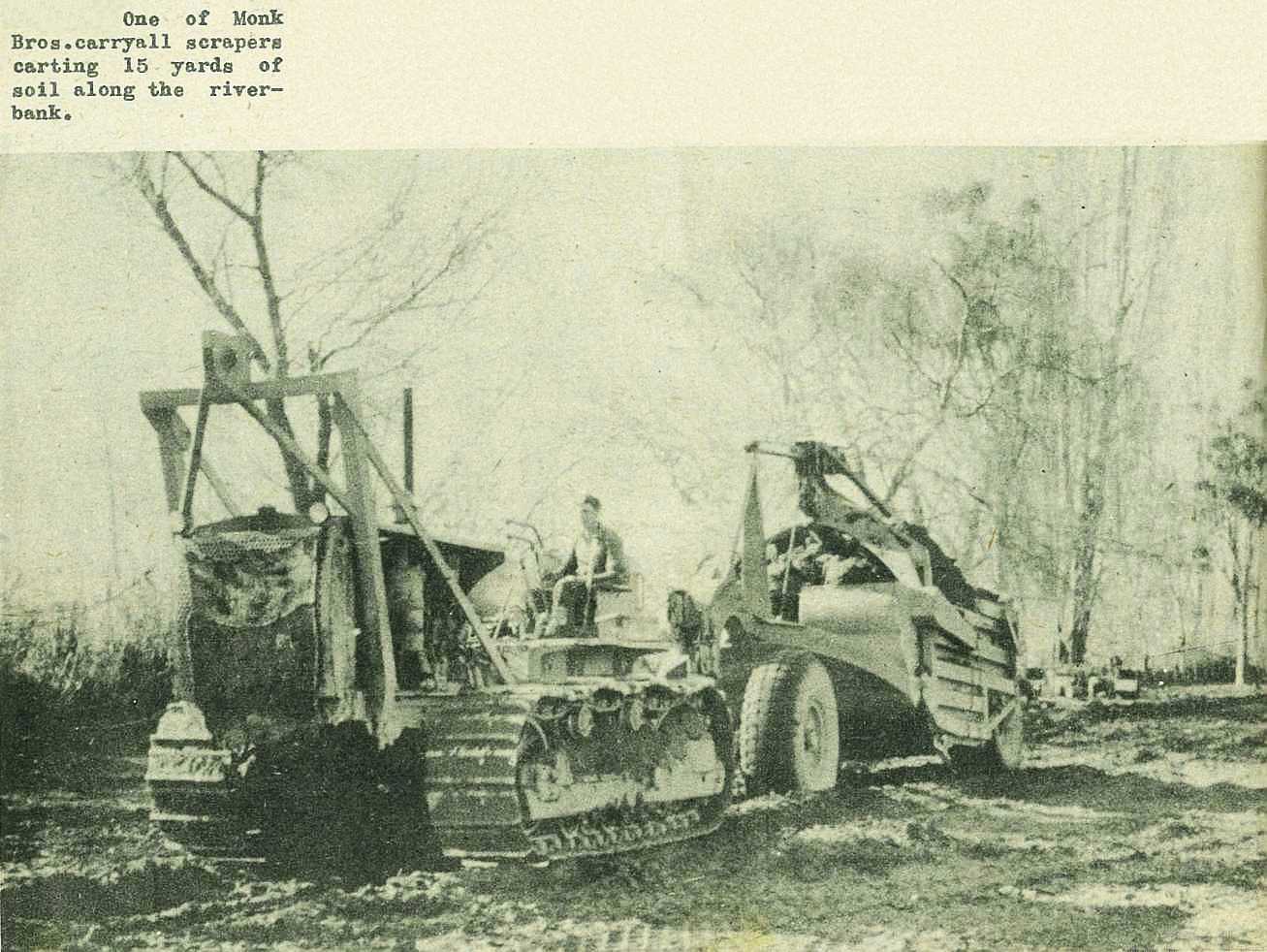
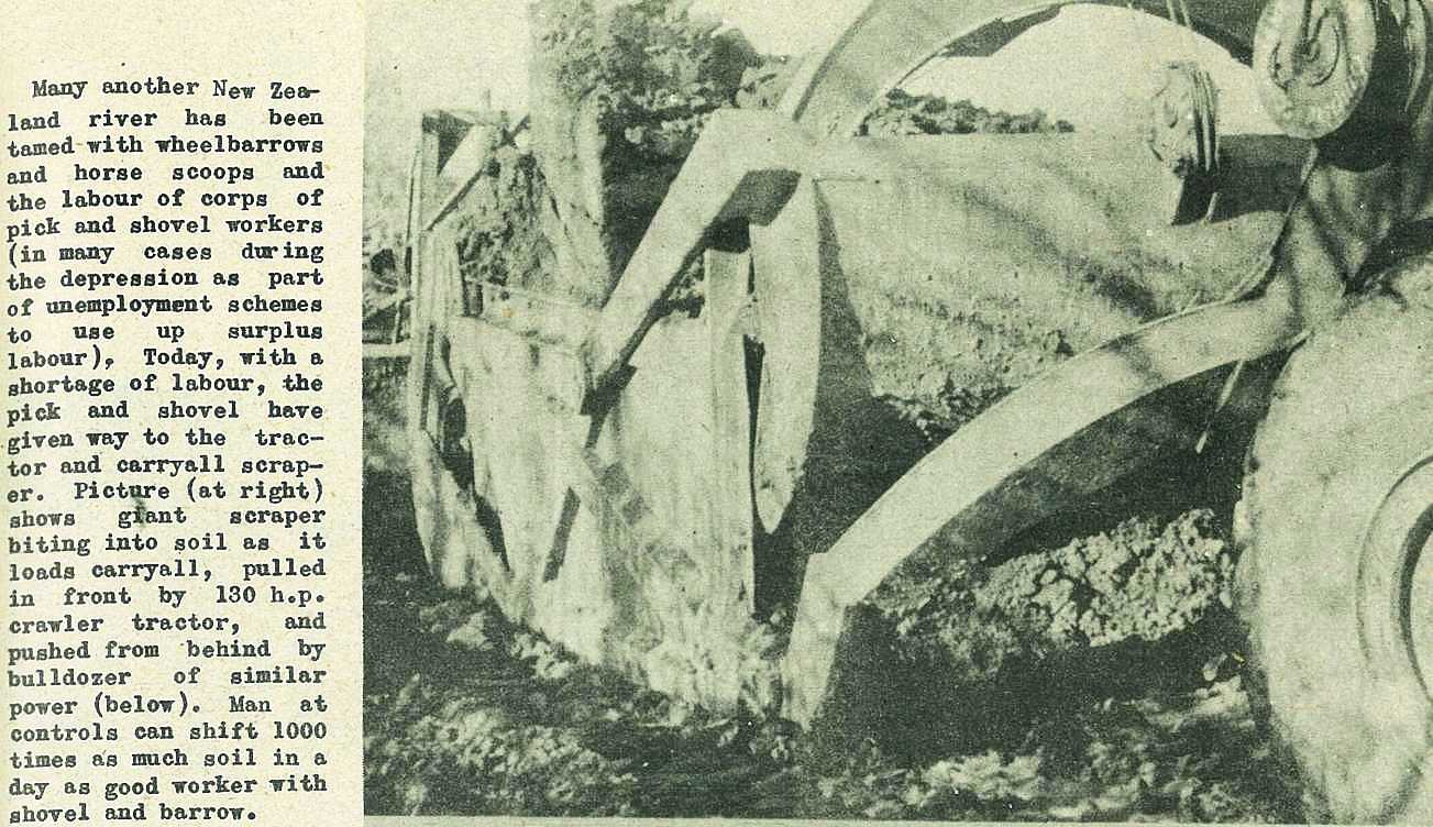
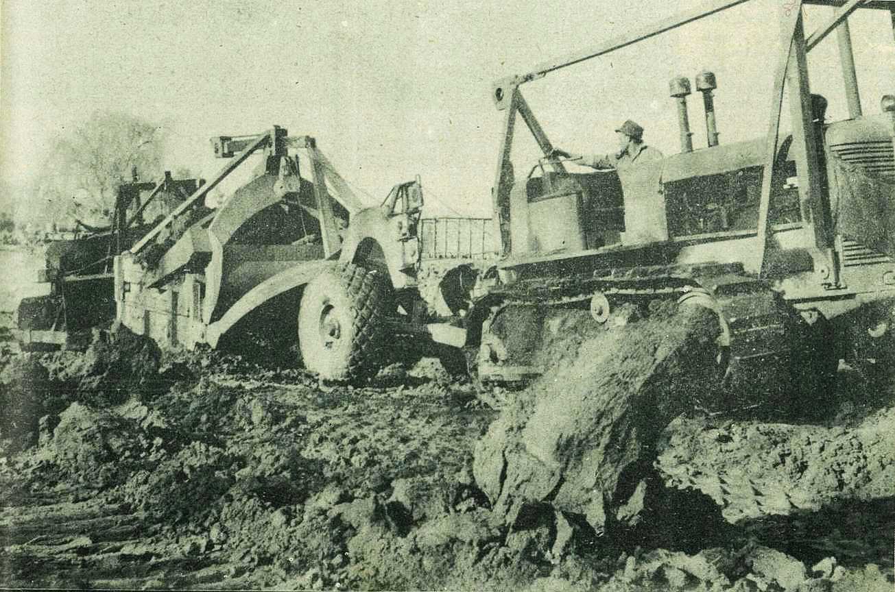
One of Monk Bros. carryall scrapers carting 15 yards of soil along the riverbank.
23
Many another New Zealand river has been tamed with wheelbarrows and horse scoops and the labour of corps of pick and shovel workers (in many cases during the depression as part of unemployment schemes to use up surplus labour), Today, with a shortage of labour, the pick and shovel have given way to the tractor and carryall scraper. Picture (at right) shows giant scraper biting into soil as it loads carryall, pulled in front by 130 h.p. crawler tractor, and pushed from behind by bulldozer of similar power (below). Man at controls can shift 1000 times as much soil in a day as good worker with shovel and barrow.
24
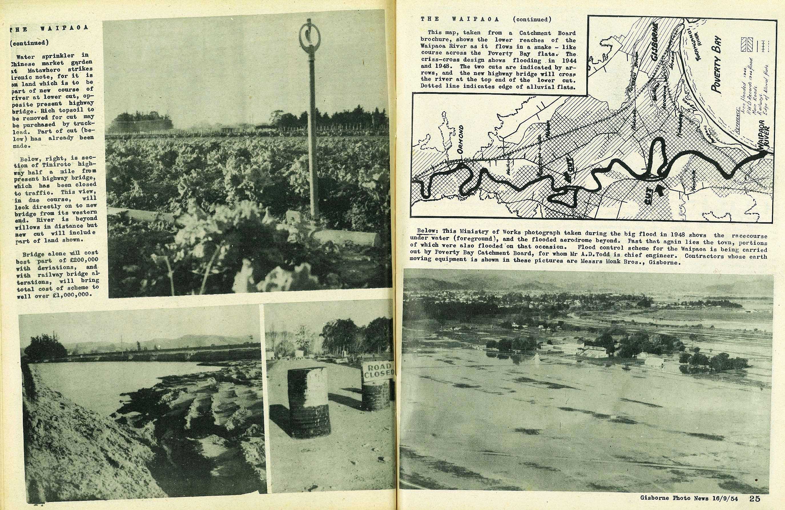
Water sprinkler in Chinese market garden it Matawhero strikes ironic note, for it is on land which is to be part of new coarse of river at lower cut, opposite present highway bridge. Rich topsoil to be removed for cut may be purchased by truckload. Fart of cut (below) has already been made.
Bridge alone will cost best part of £200,000 with deviations, and with railway bridge alterations, will bring total cost of scheme to well over £1,000,000.
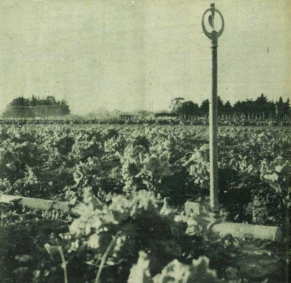
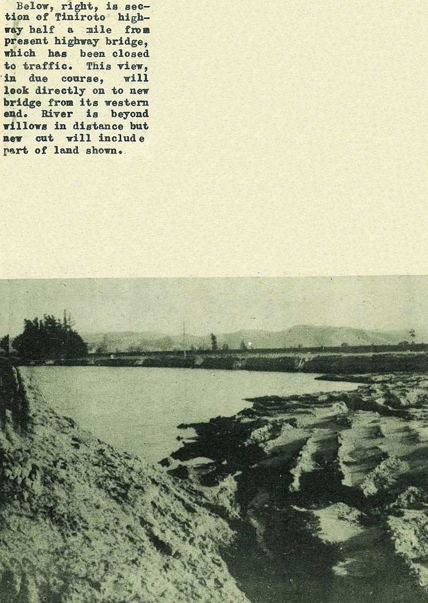
Is section of Tiniroto highway half a mile from present highway bridge, which has been closed to traffic. This view, in due course, will look directly on to new bridge from its western end. River is beyond willows in distance but new cut will include part of land shown.
25
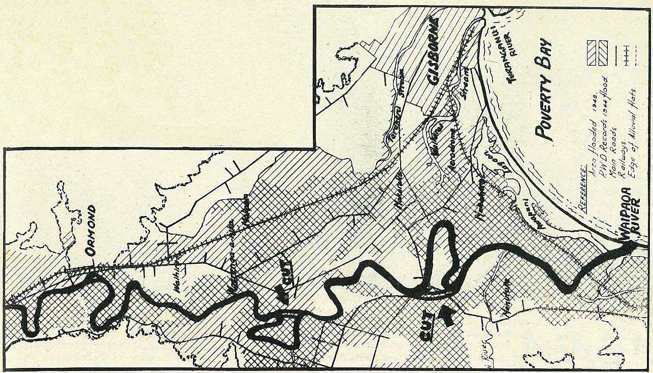
This map, taken from a Catchment Board brochure, shows the lower reaches of the Waipaoa River as it flows in a snake – like course across the Poverty Bay flats. The criss-cross design shows flooding in 1944 and 1948. The two cuts are indicated by arrows, and the new highway bridge will cross the river at the top end of the lower cut. Dotted line indicates edge of alluvial flats.
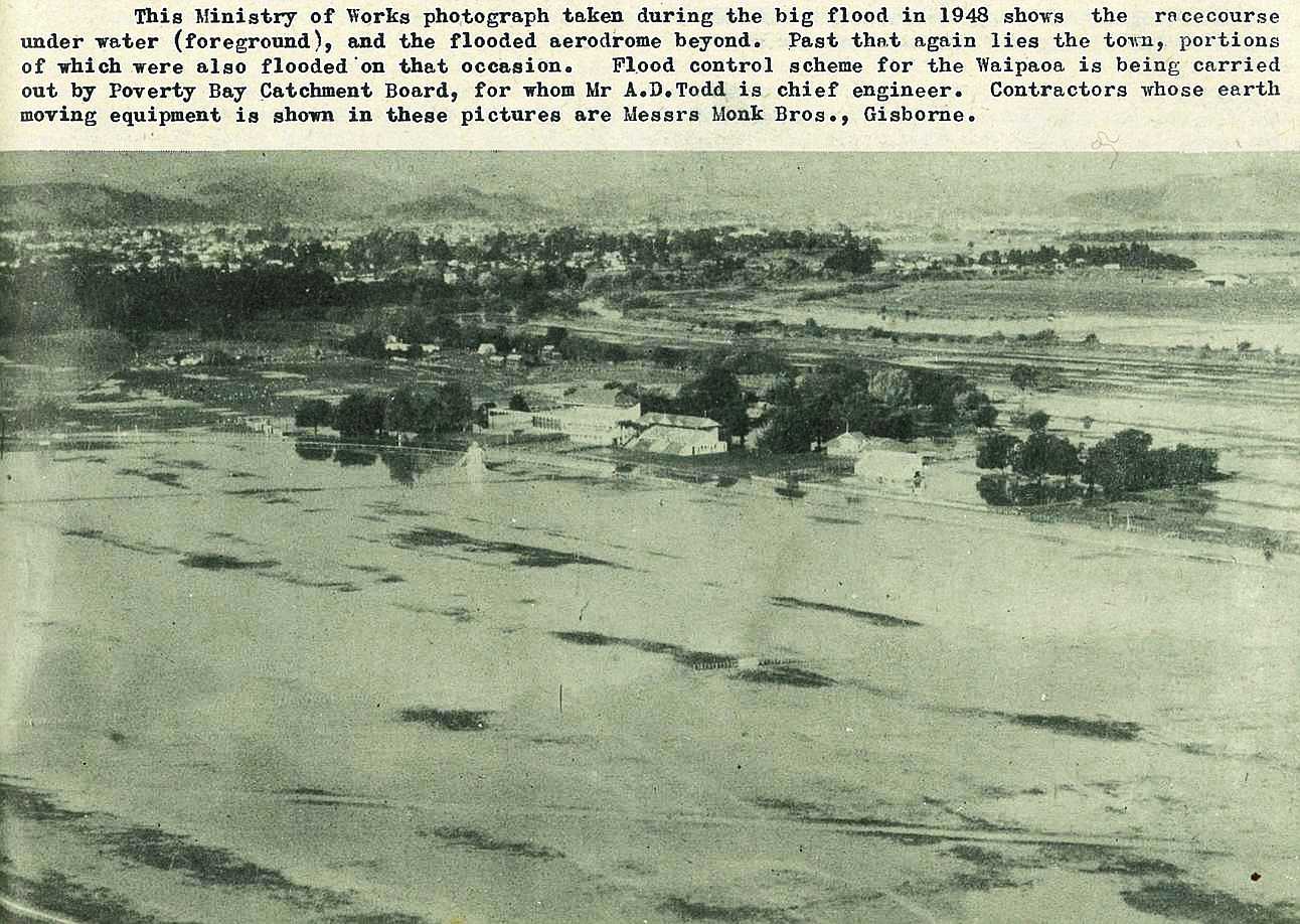
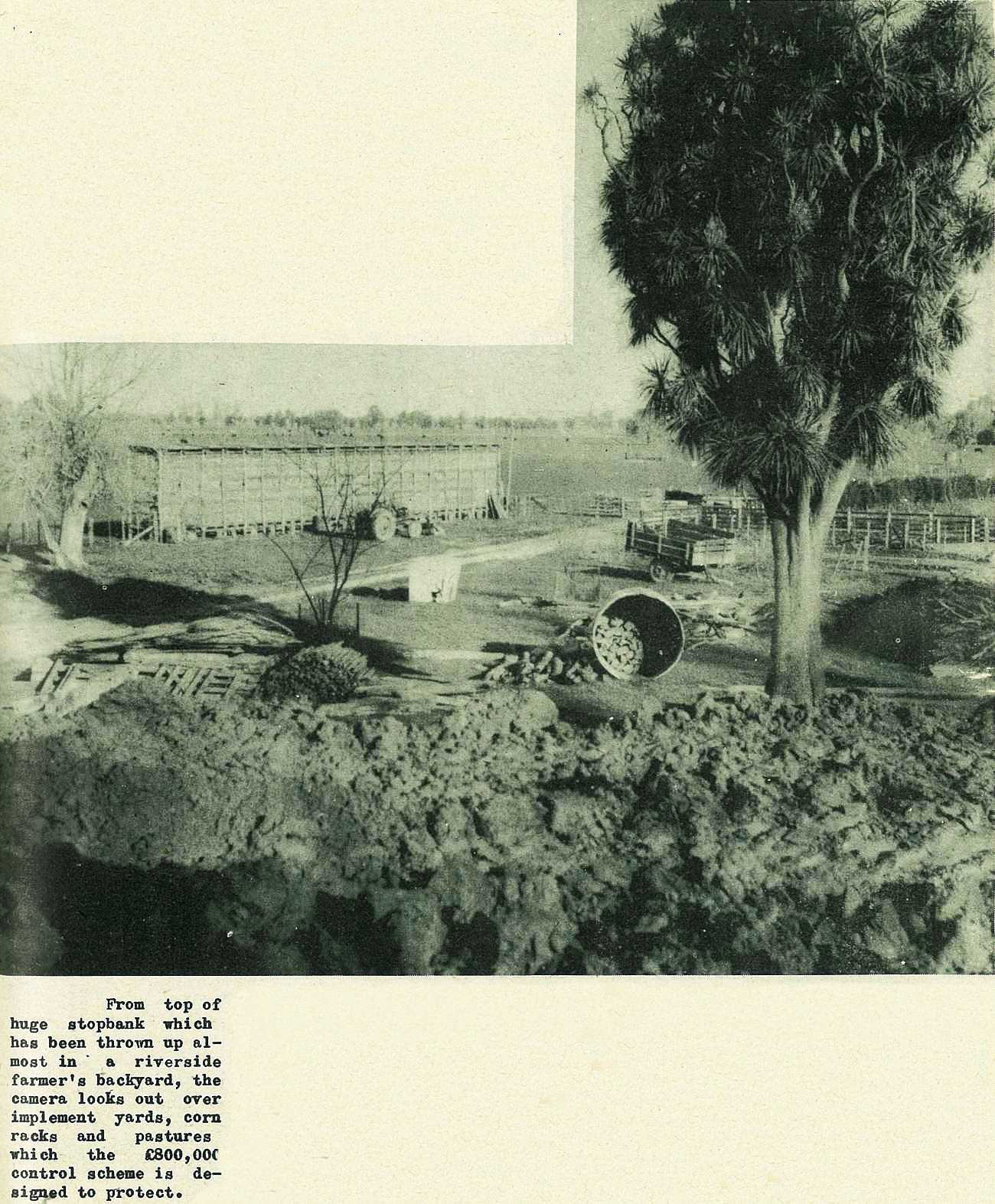
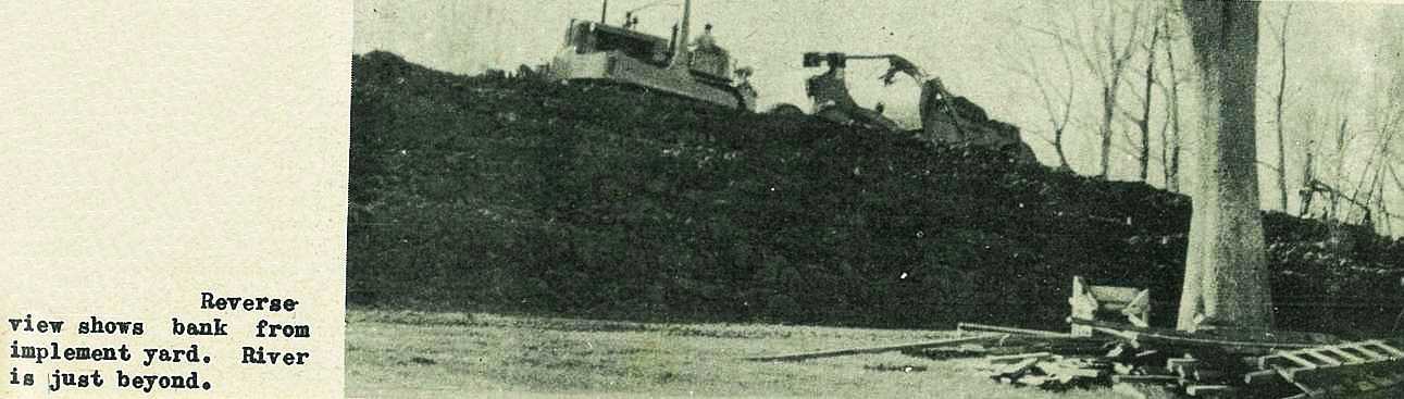
This Ministry of Works photograph taken during the big flood in 1948 shows the racecourse under water (foreground), and the flooded aerodrome beyond. Past that again lies the town, portions of which were also flooded on that occasion. Flood control scheme for the Waipaoa is being carried out by Poverty Bay Catchment Board, for whom Mr A. D. Todd is chief engineer. Contractors whose earth moving equipment is shown in these pictures are Messrs Monk Bros., Gisborne.

; void 0)
; void 0)
; void 0)
; void 0)
; void 0)
; void 0)
; void 0)
; void 0)
; void 0)
; void 0)
; void 0)
; void 0)
; void 0)
; void 0)
; void 0)
; void 0)
; void 0)
; void 0)
 has already been made.\r\n\r\nGisborne Photo News - No 4 : September 16, 1954'); void 0)
 has already been made.\r\n\r\nGisborne Photo News - No 4 : September 16, 1954'); void 0)
 has already been made.\r\n\r\nGisborne Photo News - No 4 : September 16, 1954'); void 0)
; void 0)
; void 0)
; void 0)
; void 0)
; void 0)
; void 0)
; void 0)
; void 0)
; void 0)
, and the flooded aerodrome beyond. Past that again lies the town, portions of which were also flooded on that occasion. Flood control scheme for the Waipaoa is being carried out by Poverty Bay Catchment Board, for whom Mr A. D. Todd is chief engineer. Contractors whose earth moving equipment is shown in these pictures are Messrs Monk Bros., Gisborne.\r\n\r\nGisborne Photo News - No 4 : September 16, 1954'); void 0)
, and the flooded aerodrome beyond. Past that again lies the town, portions of which were also flooded on that occasion. Flood control scheme for the Waipaoa is being carried out by Poverty Bay Catchment Board, for whom Mr A. D. Todd is chief engineer. Contractors whose earth moving equipment is shown in these pictures are Messrs Monk Bros., Gisborne.\r\n\r\nGisborne Photo News - No 4 : September 16, 1954'); void 0)
, and the flooded aerodrome beyond. Past that again lies the town, portions of which were also flooded on that occasion. Flood control scheme for the Waipaoa is being carried out by Poverty Bay Catchment Board, for whom Mr A. D. Todd is chief engineer. Contractors whose earth moving equipment is shown in these pictures are Messrs Monk Bros., Gisborne.\r\n\r\nGisborne Photo News - No 4 : September 16, 1954'); void 0)