34
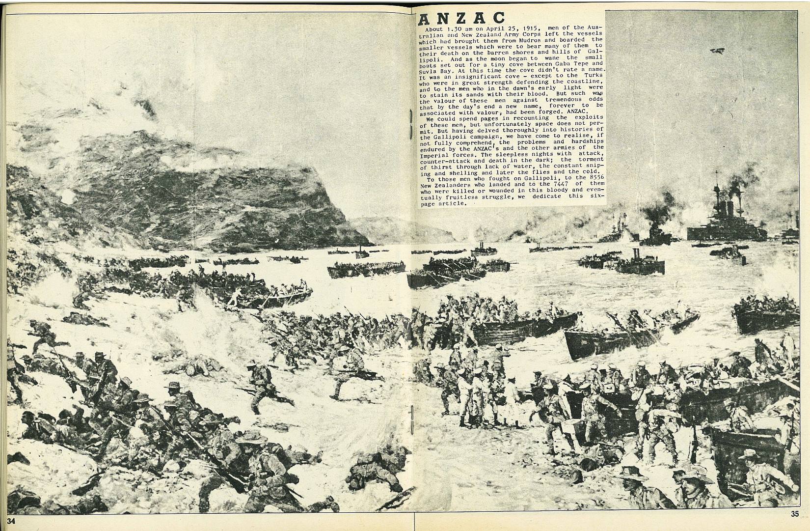
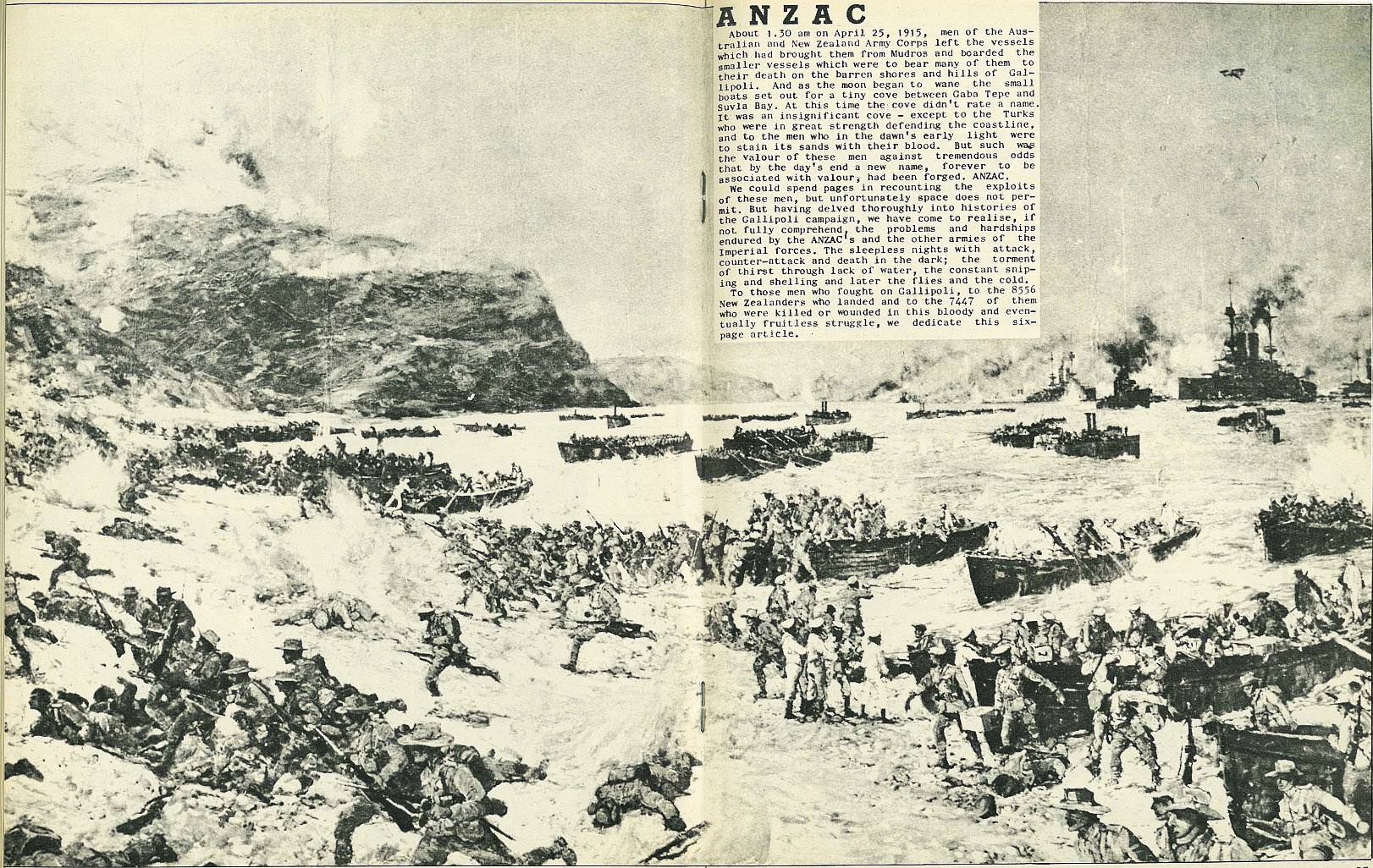
Anzac
About 1.30 am on April 25, 1915, men of the Australian and New Zealand Army Corps left the vessels which had brought them from Mudros and boarded the smaller vessels which were to bear many of them to their death on the barren shores and hills of Gallipoli. And as the moon began to wane the small boats set out for a tiny cove between Gaba Tepe and Suvla Bay. At this time the cove didn't rate a name. It was an insignificant cove - except to the Turks who were in great strength defending the coastline, and to the men who in the dawn's early light were to stain its sands with their blood. But such was the valour of these men against tremendous odds that by the day's end a new name, forever to be associated with valour, had been forged. Anzac.
We could spend pages in recounting the exploits of these men, but unfortunately space does not permit. But having delved thoroughly into histories of the Gallipoli campaign, we have come to realise, if not fully comprehend, the problems and hardships endured by the Anzac's and the other armies of the Imperial forces. The sleepless nights with attack, counter-attack and death in the dark; the torment of thirst through lack of water, the constant sniping and shelling and later the flies and the cold.
To those men who fought on Gallipoli, to the 8556 New Zealanders who landed and to the 7447 of them who were killed or wounded in this bloody and eventually fruitless struggle, we dedicate this six-page article.
35
36
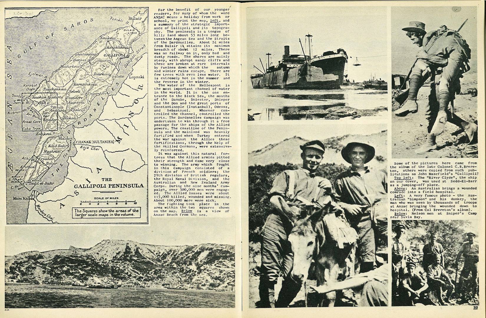
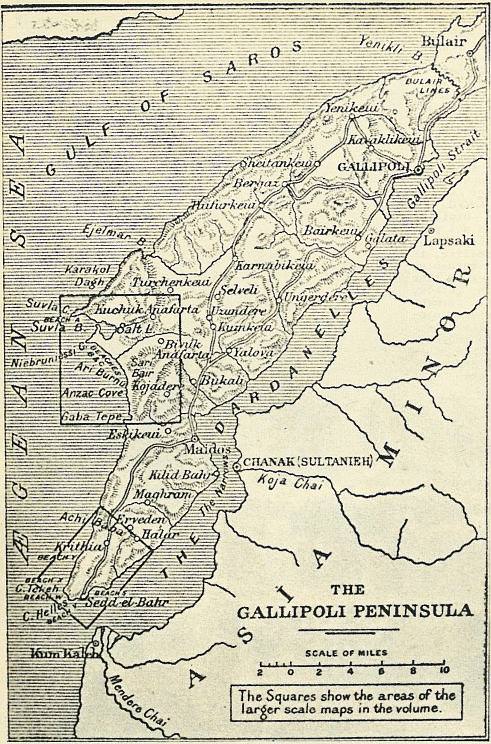
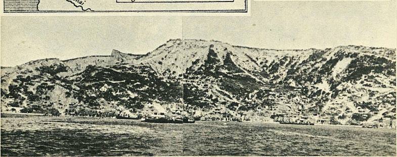
For the benefit of our younger readers, for many of whom the word Anzac means a holiday from work or school, we print the map, left, and a summary of the strategic importance of Gallipoli and its topography. The peninsula is a tongue of hilly land about 53 miles long between the Aegean Sea and the Straits of the Dardanelles. About 24 miles from Bulair it attains its maximum breadth of about 12 miles. There was no railway on it, only bad and dusty roads. The shores are mainly steep, with abrupt sandy cliffs and these are broken at rare intervals by ravines down which the autumn and winter rains escape. There are few trees with even less water. It is extremely hot in the summer and the reverse in the winter.
The water of the Hellespont is the most important channel of water in the world. It is the one entrance to the Black Sea, the mouths of the Danube, Dniester, Dnieper and the Don and the great ports of Constantinople (Instanbul), Odessa, and Sebastopol. Whoever controlled the channel, controlled the ports. The Dardanelles campaign was undertaken to win through it a free passage for the ships of the Allied powers. The coastline of the Peninsula and the mainland was heavily fortified and when Turkey entered the war against the Allies these fortifications, through the help of the skilled Germans, were extensively reinforced.
It was against this natural fortress that the Allied armies pitted their strength and came very close to winning. The army which fought in this campaign consisted of a division of French soldiers; the 29th division of British regulars, the Royal Naval Division, and the Australian and New Zealand Army Corps. During the nine months' campaign, over 300,000 men were engaged, The Allied losses were about 115,000 killed, wounded and missing, About 100,000 more were sick.

; void 0)
; void 0)
; void 0)
; void 0)
; void 0)
; void 0)
; void 0)
; void 0)
; void 0)