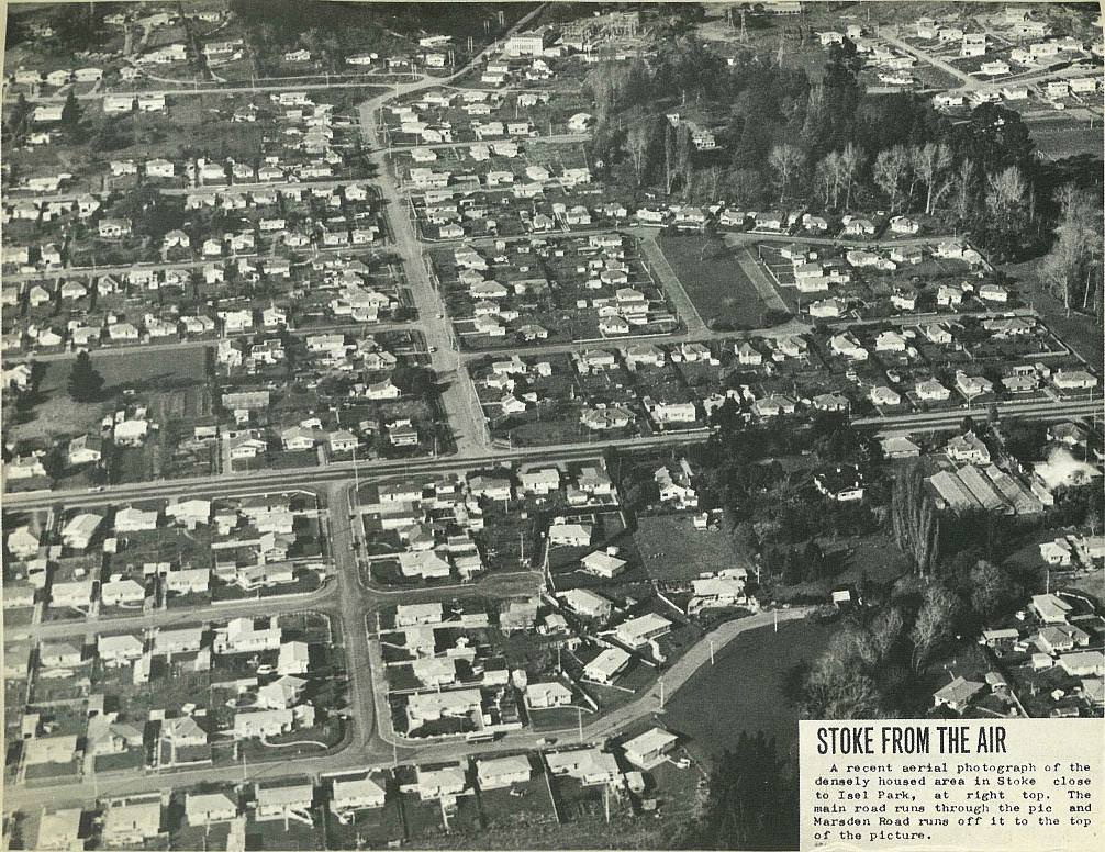
A recent aerial photograph of the densely housed area in Stoke close to lsel Park, at right top. The main road runs through the pic and Marsden Road runs off it to the top of the picture.
All images and text on this website are made available under the Creative Commons Attribution-NonCommercial-NoDerivs 3.0 New Zealand (http://creativecommons.org/licenses/by-nc-nd/3.0/nz/).

; void 0)
; void 0)
; void 0)
; void 0)
; void 0)
; void 0)