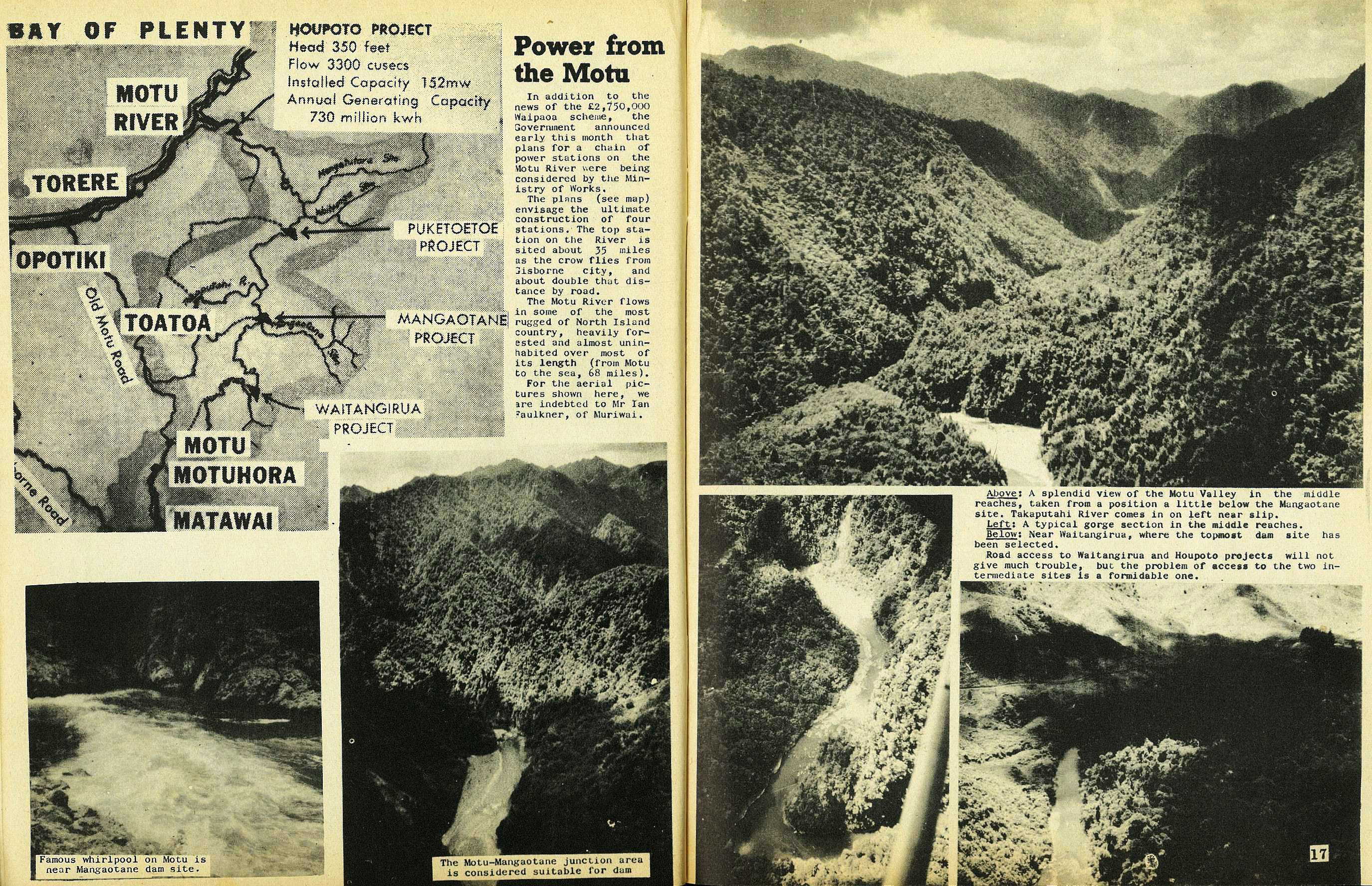
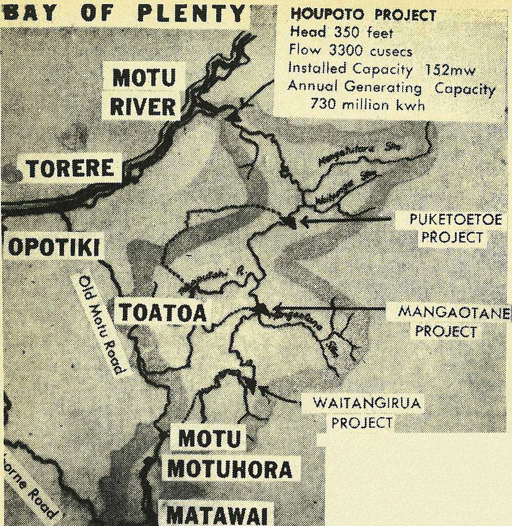
16
Power from the Motu
In addition to the news of the £2,750,000 Waipaoa scheme, the Government announced early this month that plans for a chain of power stations on the Motu River were being considered by the Ministry of Works.
The plans (see map) envisage the ultimate construction of four stations. The top station on the River is sited about 35 miles as the crow flies from Gisborne city, and about double that distance by road.
The Motu River flows in some of the most rugged of North Island country, heavily forested and almost uninhabited over most of its length (from Motu to the sea, 68 miles).
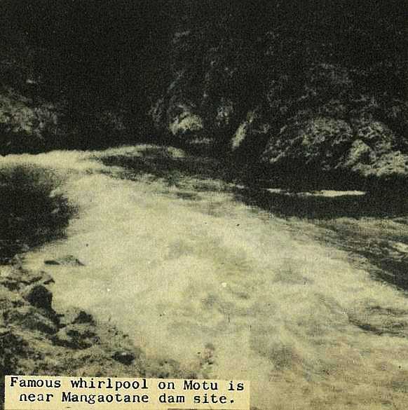
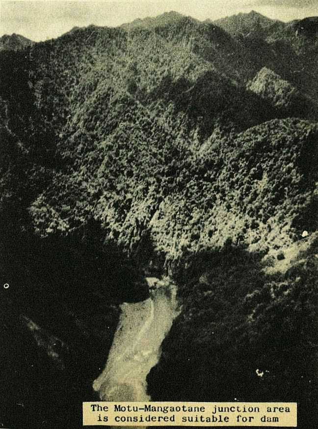
For the aerial pictures shown here, we are indebted to Mr Ian Faulkner, of Muriwai.
17
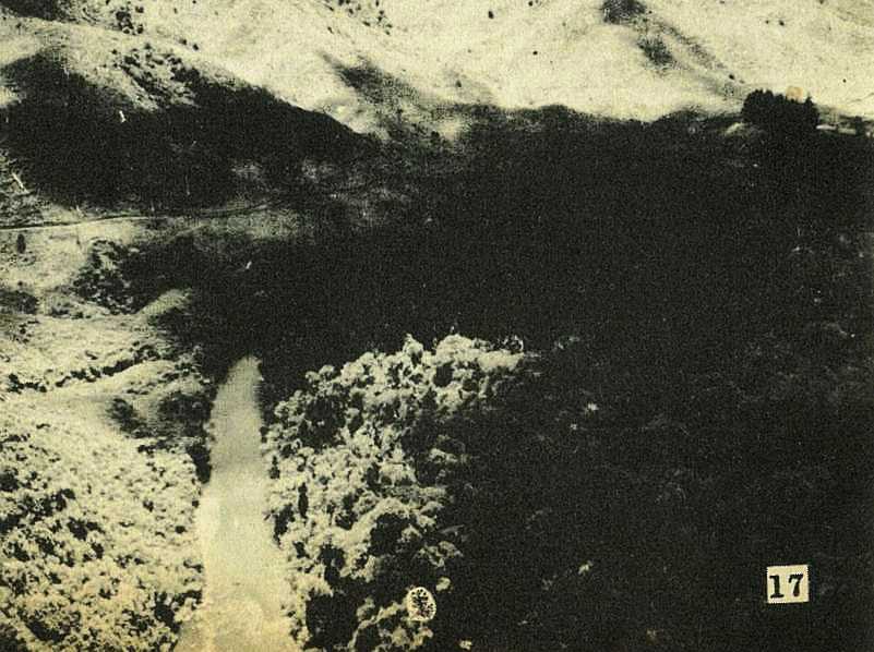
Road access to Waitangirua and Houpoto projects will not give much trouble, but the problem of access to the two intermediate sites is a formidable one.


18
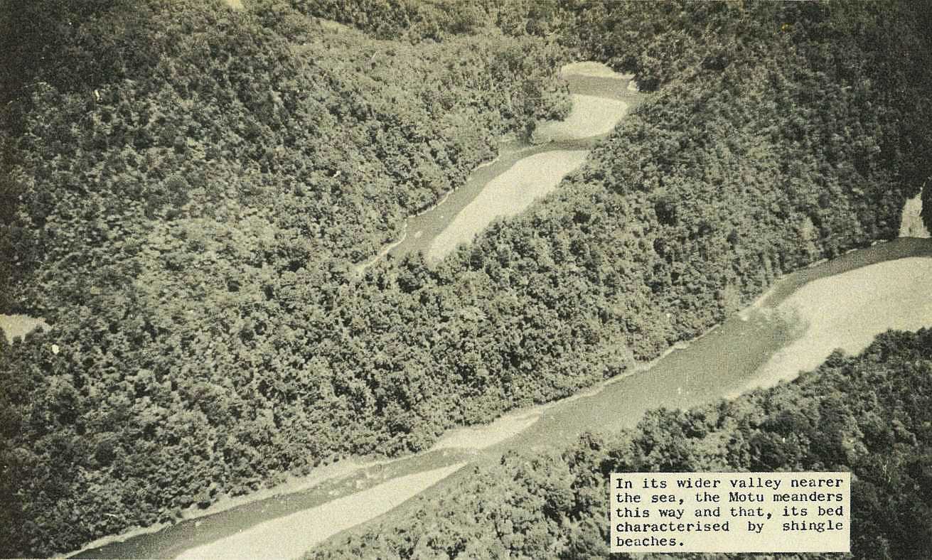
In its wider valley nearer the sea, the Motu meanders this way and that, its bed characterised by shingle beaches.
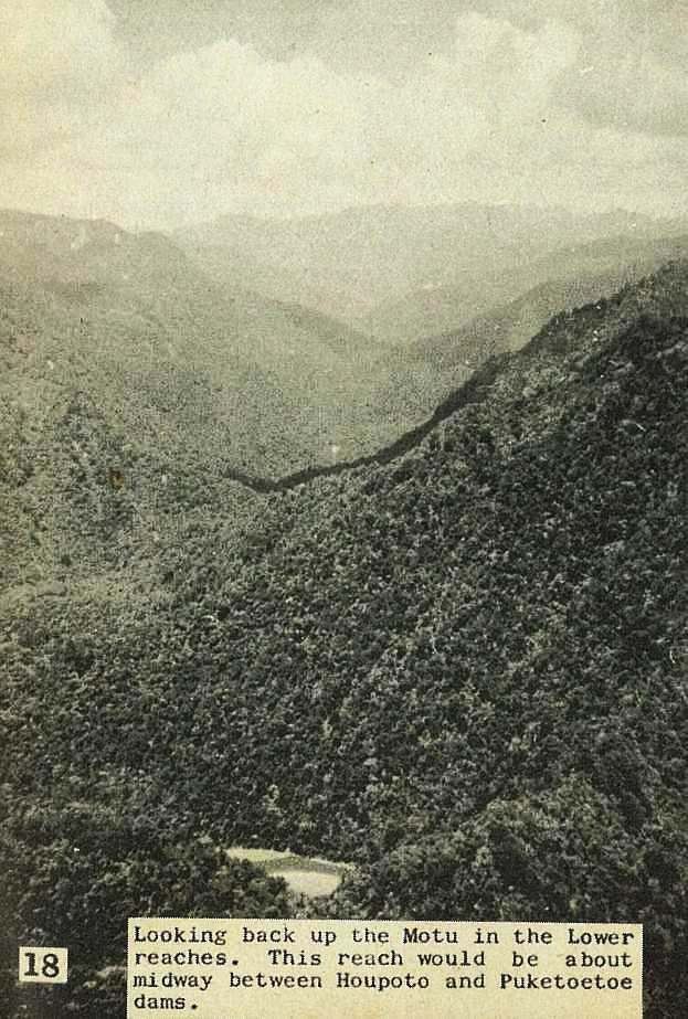
Looking back up the Motu in the Lower reaches. This reach would be about midway between Houpoto and Puketoetoe dams.
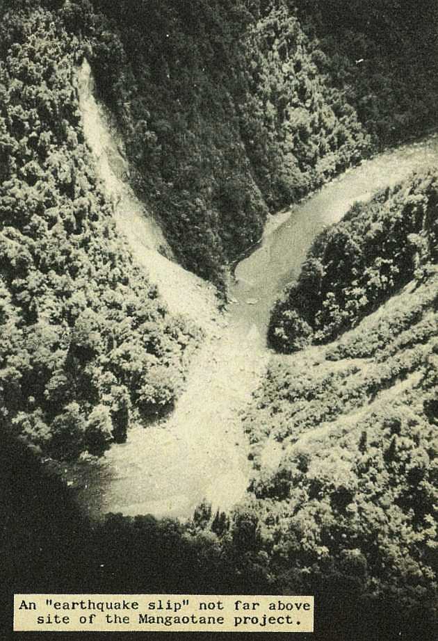
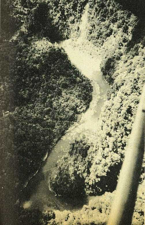
An "earthquake slip" not far above site of the Mangaotane project.

; void 0)
; void 0)
; void 0)
; void 0)
; void 0)
; void 0)
; void 0)
; void 0)
; void 0)
; void 0)
; void 0)
; void 0)
; void 0)
; void 0)
; void 0)
; void 0)
; void 0)
; void 0)
; void 0)
; void 0)
; void 0)
; void 0)
; void 0)
; void 0)
; void 0)
; void 0)
; void 0)