8
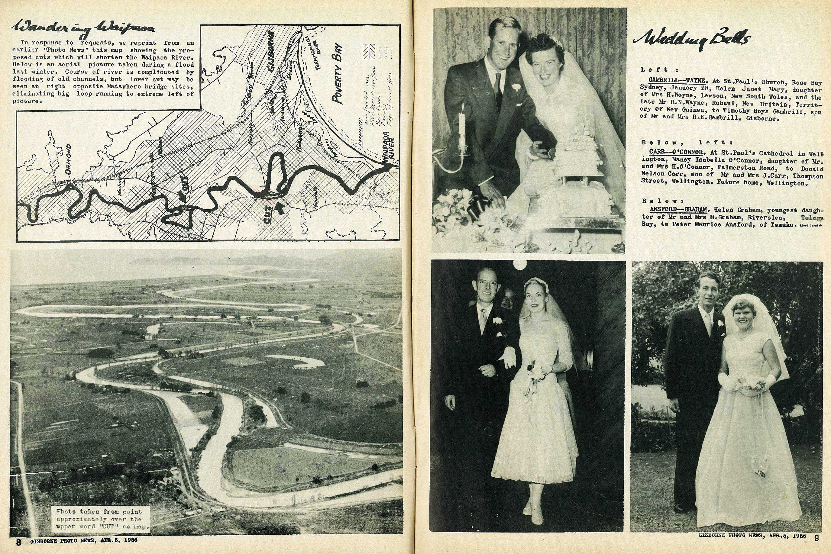
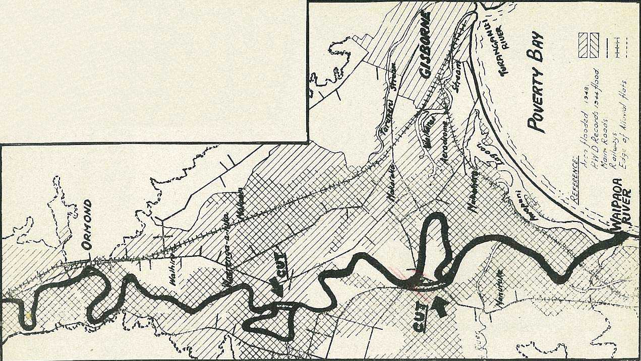
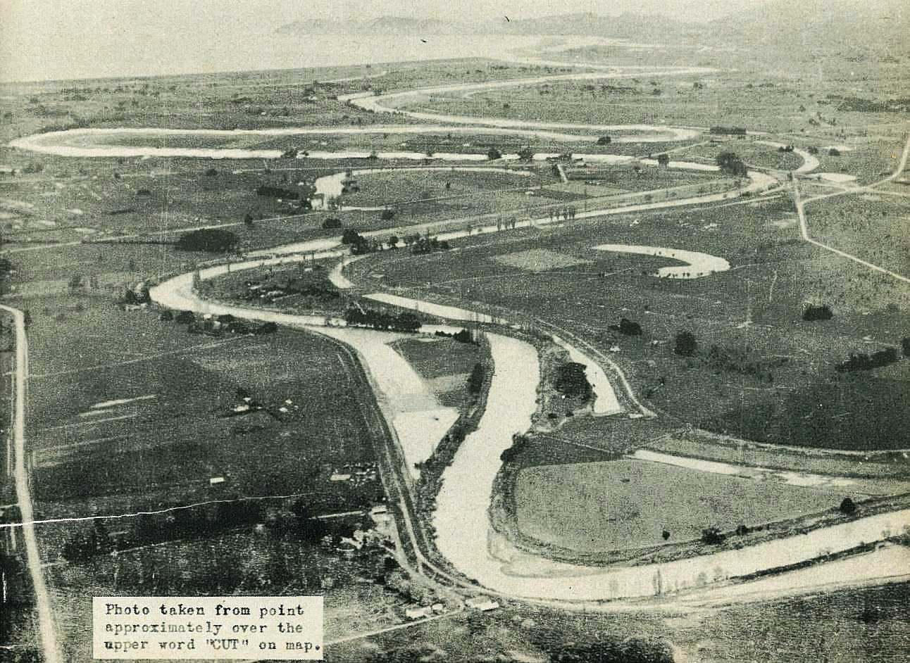
Wandering Waipaoa
In response to requests, we reprint from an earlier "Photo News" this map showing the proposed cuts which will shorten the Waipaoa River. Below is an aerial picture taken during a flood last winter. Course of river is complicated by flooding of old channels, but lower cut may be seen at right opposite Matawhero bridge sites, eliminating big loop running to extreme left of picture.

; void 0)
; void 0)
; void 0)
; void 0)
; void 0)
; void 0)