6
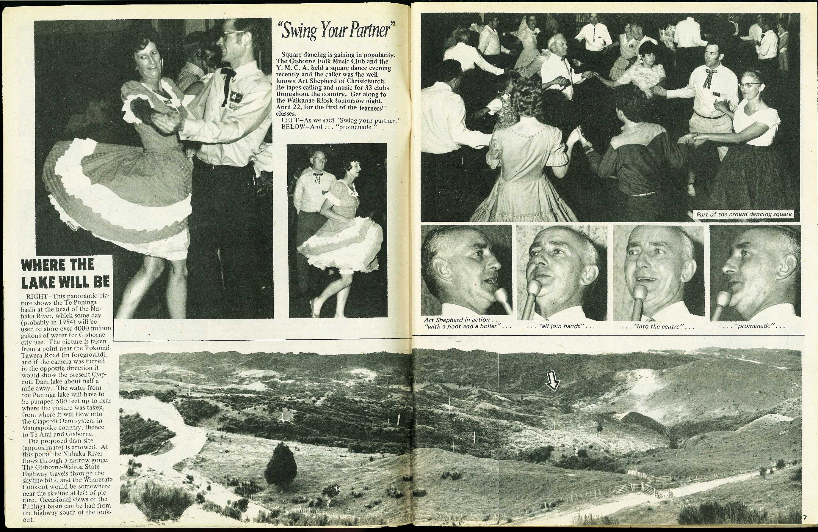
Where the Lake will Be
The proposed dam site (approximate) is arrowed. At this point the Nuhaka River flows through a narrow gorge. The Gisborne-Wairoa State Highway travels through the skyline hills, and the Wharerata Lookout would be somewhere near the skyline at left of picture. Occasional views of the Puninga basin can be had from the highway south of the lookout.
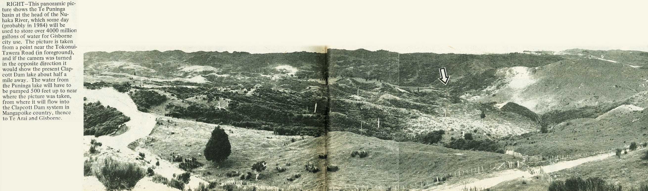
This panoramic picture shows the Te Puninga basin at the head of the Nuhaka River, which some day (probably in 1984) will be used to store over 4000 million gallons of water for Gisborne city use. The picture is taken from a point near the Tokonui-Tawera Road (in foreground), and if the camera was turned in the opposite direction it would show the present Clapcott Dam lake about half a mile away. The water from the Puninga lake will have to be pumped 500 feet up to near where the picture was taken, from where it will flow into the Clapcott Dam system in Mangapoike country, thence to Te Arai and Gisborne.
7


 will be used to store over 4000 million gallons of water for Gisborne city use. The picture is taken from a point near the Tokonui-Tawera Road (in foreground), and if the camera was turned in the opposite direction it would show the present Clapcott Dam lake about half a mile away. The water from the Puninga lake will have to be pumped 500 feet up to near where the picture was taken, from where it will flow into the Clapcott Dam system in Mangapoike country, thence to Te Arai and Gisborne.\r\n\r\nGisborne Photo News - No 202 : April 21, 1971'); void 0)
 will be used to store over 4000 million gallons of water for Gisborne city use. The picture is taken from a point near the Tokonui-Tawera Road (in foreground), and if the camera was turned in the opposite direction it would show the present Clapcott Dam lake about half a mile away. The water from the Puninga lake will have to be pumped 500 feet up to near where the picture was taken, from where it will flow into the Clapcott Dam system in Mangapoike country, thence to Te Arai and Gisborne.\r\n\r\nGisborne Photo News - No 202 : April 21, 1971'); void 0)
 will be used to store over 4000 million gallons of water for Gisborne city use. The picture is taken from a point near the Tokonui-Tawera Road (in foreground), and if the camera was turned in the opposite direction it would show the present Clapcott Dam lake about half a mile away. The water from the Puninga lake will have to be pumped 500 feet up to near where the picture was taken, from where it will flow into the Clapcott Dam system in Mangapoike country, thence to Te Arai and Gisborne.\r\n\r\nGisborne Photo News - No 202 : April 21, 1971'); void 0)
; void 0)
; void 0)
; void 0)
; void 0)
; void 0)
; void 0)
; void 0)
; void 0)
; void 0)
; void 0)
; void 0)
; void 0)
; void 0)
; void 0)
; void 0)