18
Threat to Gisborne Lies Far Back in the Hills
To most residents of Gisborne city and the Poverty Bay flats, talk about "erosion" and "crushed argillite areas" back in the hills lacks the urgent reality of a serious threat to their security. If the photographs in these pages do not impart this sense of reality, "Photo News" suggests that readers should take a Sunday run into the Tarndale Road country a few miles beyond Whatatutu to see for themselves what is so seriously concerning the Poverty Bay Catchment Board, the Minister of Lands and Agriculture, the Minister of Works, the Soil Conservation and Rivers Control Council, and many others.
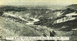
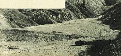
There, over an area of 14,000 acres of earthquake-shattered "crushed argillite" hill-country, millions of tons of rock and mud are eroding into the riverbeds, choking the waterways, and converting fertile river flats into arid wastes.
Expert opinion considers that a serious threat exists. The bluntest comment "Photo News" heard during a recent visit to the area came from the man behind the bar in the Whatatutu hotel. "If all that stuff gets down to the flats," he said, "you can write Gisborne off the map".
This was another way of saying that if the erosion is not checked, the whole length of the Waipaoa River could choke up with rock debris, wrecking the elaborate and costly stopbank system now designed to protect the city and the flats, and opening the whole area to the threat of extensive and uncontrolled flooding.
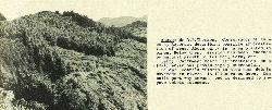
Looking down towards Gisborne from the Tarndale Road. Bush has been burnt off, hills are now eroding into valleys. Road here is at elevation of nearly 3000ft.
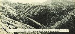
View in opposite direction from same spot shows Tarndale Station and stable hills still covered with bush. Station is about 50 miles from Gisborne.
19
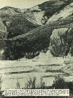
This picture shows a typical "trouble-spot" in a tributary of the Te Wereroa stream, which in turn is a tributary of the Waipaoa. Catchment Board has built a "coffer-dam" (just showing at right) to block flow of shingle in stream, and planted hillside to stop slipping. Minister of Lands (Mr Skinner) and Minister of Works (Mr Watt) were deeply impressed by scenes such as this when they visited the area last month. Note Tarndale Road high up at right.
20
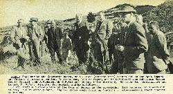
Engineer to the Catchment Board, Mr A. D. Todd (extreme left) points out on the spot important factors in erosion problem. In front row, left to right, are Mr D.W.W. Williams (chairman Waiapu County Council), Mr A. M. Moore, Mr C. F. Skinner (deputy Prime Minister, Minister for Agriculture and Lands), Mr H. Watt (Minister for Works), and Mr A. H. Reeves.
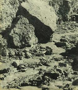
A close-up view of the type of debris in the riverbeds. Silt material will wash out to sea, but relatively hard, angular rocks would build up deposits in slower-moving lower reaches of rivers.
Since these pictures were taken the Prime Minister, Mr W. Nash, has inspected the area, after which he declared himself impressed with the urgent need for remedial measures.
Mr Skinner takes a good look at the problem
21
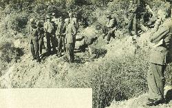
Mr A. P. Thomson, Conservator of Forests, Rotorua, describing possible afforestation of area. Above party is area planted in pines. Below them, erosion has been checked by natural growth of toi toi, fern, etc.
Catchment Board afforestation on a small scale has proved highly successful.
Board's efforts to slow down debris movement in rivers is illustrated here. Dam built part way across bed is designed to impede debris movement.


